Historic Columbia River Highway State Trail John Yeon – Cascade Locks, OR
Vicinity Location:
About 35 miles east of Portland, OR in the Columbia River Gorge National Scenic Area.
Directions:
From Portland, Oregon, take I-84 east for about 35 miles on I-84 East and take exit 35 towards Historic Hwy 30 and Anisworth/State Park.
Go about 0.1 mile and turn left towards NE Frontage Rd (follow signs for US-30).
In about 450 feet, turn right onto NE Frontage Rd. Don’t get back onto the freeway.
Drive about 2.1 miles and the trailhead is on the right at John B. Yeon State Park.
Trail:
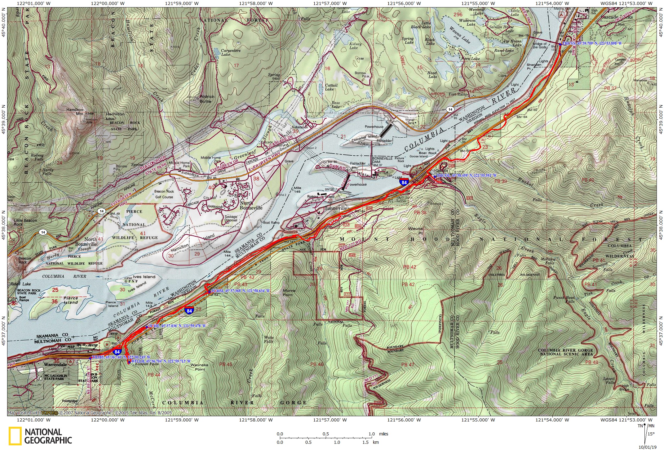
Historic Columbia River Highway State Trail – John B. Yeon to Cascade Locks – Bonneville Segment
Trail Maps:
Topo Map, Wind and rain forecast for Cascade Locks, Download Garmin .gpx file, Open Garmin .gpx file
Length and Elevation:
Distance is 16.4 miles roundtrip. Elevation at the trailhead is 130 feet. Highest elevation is 175 feet. Elevation gain is 150 feet and elevation loss is 150 feet.
Review: 3/26/2017
From John B. Yeon State Park Cross a couple of old highway bridges, going next to the westbound lanes of the highway for a bit.
Climb a couple of switchbacks and pass under the freeway.
You’ll soon pass Wahclella falls which is a short hike off the trail.
Return back along Trail #400 and rejoin the paved trail.
In the next .75 mile are two more junctions for Trail #400.
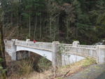
The first one is a bit after the old concrete highway bridge over McCord Creek.
Take this trail for an easy walk of just under .5 mile to Elowah Falls which is 213 feet tall and one of the prettiest falls in the Gorge. During high streamflows the bridge gets slick from the mist from the falls constantly drenching the wood bridge deck.
After a little over a mile pass back under the freeway and pass a junction for Trail 400 and Munra Point. Venture down Trail #400 the bridge over the creek and enjoy the sound of Moffett Creek and the views of the creek.
There are trees and brush along the trail so there isn’t a continuous river view. Now the trail is between the freeway and the Columbia River.
The next section of trail is next to the freeway and the sand, rocks, and other debris land on the trail from winter snowplowing operations. There is a slow climb to gain elevation to pass the Bonneville Dam but the ascents on this trail are never very steep.
Soon you’ll come to the trail to Wahclella falls and pass over Tanner Creek and then the trail passes under the freeway. Continue along the trail with views of Bonneville Dam and all the related structures.
From there generally go uphill passing the Tooth Rock Trailhead. Near Eagle Creek descend concrete stairs with the bike gutter.
At the north side of the bridge over Eagle Creek is a narrow stone overlook of Eagle Creek which is easily overlooked. Pause here to enjoy the view and if it is September or early October there will be salmon in the stream waiting to spawn.
Cross the bridge over Eagle Creek, cross the frontage road and look to the left to find the trail, which will parallel the freeway, heading east.
The hatchery has a self-guided tour from 7:30am to 4:30pm each day which starts at the driveway that faces the freeway.
Gently climbing up from Eagle Creek you soon come to Ruckle Creek where you can see you are on the actual route of the original highway as the bridge across Ruckel Creek and the stone guardrail which was built by the CCC program during the Great Depression. Also beneath the layer of pavement for the bike trail you can see the original pavement of the historic highway.
Continuing up the historic road grade you enter Sheridan State Park. Here there is a plaque that shows sections of the old historic highway that are still in use land have been destroyed during construction of the I-84 freeway. The sign says prior to restoration the old highway between Dodson and Cascade Locks was abandoned.
You’ll also notice as you climb up the hill that you enter enter into an area that was burned by the Eagle Creek fire of 2017. Here along the freeway the fire was not so intense and many of the trees have survived though their trunks were blackened by the fire.
At the end of this section at the Cascade Locks trailhead is a water fountain and the Cascade Locks trailhead parking area which would allow for a shuttle hike or bike.
Today many sections of the old highway have been connected and many of the old rock walls have been restored back to the way they once were. This is a great hike or bike trip and is great for kids. During high stream flows they will delight in seeing all the mist
Enjoy the photos!!
Gallery Pics
Switchback Steve