Bridal Veil Falls, OR
Vicinity Location:
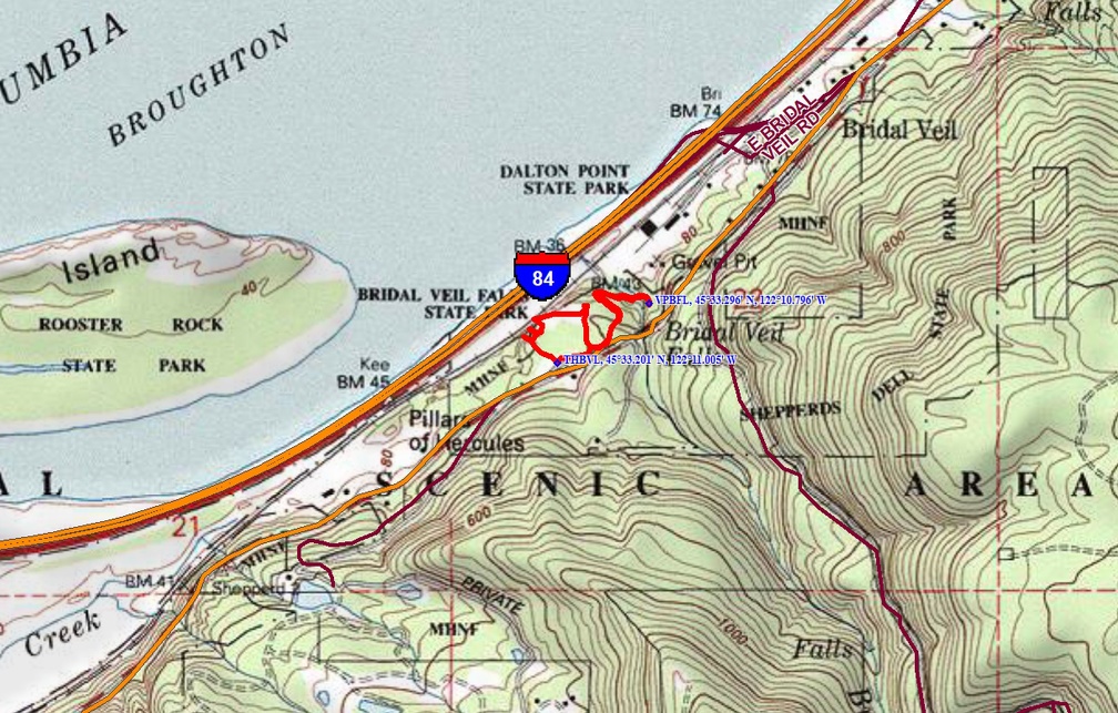
The trailhead is about 30 miles east of Portland, Oregon in the Columbia River Gorge National Scenic Area.
Directions:
From Portland, take I-84 east to the Historic Highway cutoff, Bridal Veil exit # 28. From the freeway, drive 0.5 miles and take the right branch of the road to a stop sign at Highway 30. Turn right and drive 0.6 miles to the parking lot on the right.
Travelling westbound on I-84 from the Bonneville Dam, take Ainsworth State Park exit # 35 and follow the Historic Columbia River Highway for 7.7 miles.
No permits are needed for parking.
Bathrooms available at the trailhead.
Length and Elevation:
Distance 1.0 miles, Elevation gain is 200 feet and loss is 200 feet. Lowest point on the trail is 70 feet and the highest point is 150 feet.
Trail:
Bridal Veil Trail
There is at least one geocache for this trail at: N 45° 33.280 W 122° 11.042 Info at Geocaching.com.
Trail Maps:
Topo Map, Download Garmin .gpx file, Open Garmin .gpx file
Review: October 1, 2019
Look for paved path that leads slightly downhill off through the grass from the west end of the parking lot by the big Bridal Veil Falls State Scenic Viewpoint sign. Take this and path through forest of maple, Douglas fir, and Oregon white oak. This path will leads to viewpoints over Columbia River Gorge. You may have seen these viewpoints at the top of the basalt Cliffs as you were driving out from Portland on I-84. The viewpoints have commanding views of the west end of the Gorge.
The path continues along the top of the basalt cliffs for about 0.2 miles then re-enters the forest. In about 300 feet, pass the bathrooms and after the bathrooms turn left on the paved trail to walk to the waterfall.
Go downhill and in a few hundred feet reach the end of the pavement near a small Viewpoint. From there the trail switchbacks down the hill passing a lovely hillside of Licorice Fern, then goes down about two dozen concrete stairs wending its way back towards Highway 30.
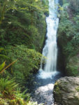
Dropping down a bit further, cross a wide, sturdy footbridge over the creek then climb about three dozen stairs to a viewpoint facing the falls.
This is one of the few waterfalls in the Gorge that is on the north side of Highway 30. When you are done admiring the cascading falls, return on the same trail to bathrooms, and from there walk to the parking lot.
This parking area, like most trails in the Columbia River Gorge, becomes full on weekends and sunny summer days so plan accordingly.
This trail is short and the cliffs are fenced off. There are steep dropoffs along the switchbacks, stairs, and overlook so be sure your children don’t get too close to the edge. Also, the stairs are a little narrow so pass others carefully so you don’t fall off the edge.
Enjoy the photos!!
Gallery Pics
Switchback Steve