Elk Meadows Snowshoe, OR
Vicinity Location:
About 50 miles east of Portland in the Mt. Hood National Forest.
Note: The switchbacks up to Elk Meadows cross an avalanche slope. The avalanche slope is several acres in size and should not be crossed in periods of high avalanche danger. Use your best judgement during moderate avalanche conditions but it is my recommendation that you search out other, safer, hikes when there is even moderate avalanche danger. Consult the National Weather Service or NWAC for conditions before you go.
Directions:
From Portland take I-84 East to the Wood Village, exit (16A). Head south and turn left onto NE Burnside Rd. Heading East, Burnside will merge into Highway 26. Follow Hwy 26 past Government Camp and exit on Highway 35 to Hood River. Follow Hwy 35 for 6.6 miles, drive under the highway overpass for Mt. Hood Meadows. Drive about 1.2 miles past the overpass and turn left into the Mt. Hood Meadows parking area, for a total of 7.7 miles from the Highway 26 and 35 junction. Drive .7 mile and turn right into the parking area for the Nordic Center.
A Snow Park permit is required during the snow season. A Northwest Forest Permit is needed for the Newton Creek trailhead in the summer months.
An outhouse is available at the parking lot during the winter season.
You can see avalanche forecasts here: Northwest Avalanche Center
National Weather Service Snow Level forecast: Northern Oregon Cascades
Length and Elevation:
5.5 Miles roundtrip, Trailhead elevation is 4,530 feet. Lowest elevation is 4,530 feet. Highest elevation is 5,310 feet. Elevation gain is 1,315 and loss is 1,315 feet.
Trail:
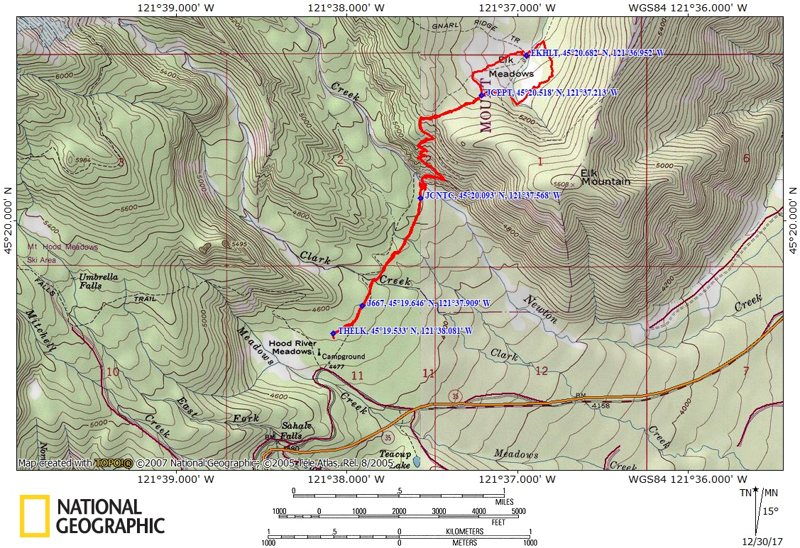
Sahalie Falls Trail #667C, Elk Meadows Trail #645, Elk Meadows Perimeter Trail #645A, Elk Meadow Shelter Access Trail and connections to several trails.
There are no geocaches along this trail.
Trail Maps:
Topo Map, Download Garmin .gpx file, Open Garmin .gpx file
Review: 12/27/2017
Start on the west end of the Nordic Center trailer and snowshoe to the northeast towards the snowshoe sign. Look for the blue diamonds nailed to the trees, showing the trail. The forest is fairly open and soon joins the Sahalie Falls Trail. The route is easy to follow and the forest is mostly level with a couple of shallow ravines and small streams on the way to Clark Creek. About .25 mile is the junction for Umbrella Falls Trail. Continue heading generally northeast a little more than .1 mile to Clark Creek. You’ll pass the junction of the Elk Meadows Trail and the Elk Meadows Ski Trail. Continue straight and stay on the Elk Meadows Trail. In just a couple hundred feet you’ll come to the Clark Creek crossing.
At Clark Creek the log bridge over the creek may have too much show to cross. You may have to look for a snow bridges just upstream of the log bridge. Continue along the route, generally heading northeast towards Newton Creek.
Winter brings deep snows and can create a 10 foot deep snow canyon at Newton Creek. The snow canyon is too wide to jump across and too deep to climb down and back up again in most places. To cross Newton Creek, go downstream about .15 mile where there is a downed log that could be suitable for a log crossing. You would have to butt-scoot across the log because a single log is to narrow of a snow bridge.
You may be able to find rocks covered by ice and snow that will allow you to step across the creek but I found a shallow place in the stream and waded across with my snowshoes on. At the crossing, it was easy to step a couple of times in the stream and clamber up to the top of the snowbank on the far side. Your boots and snowshoes don’t get enough water on them for very much snow to stick to your snowshoes and boots.
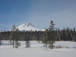
After crossing the stream there are open spots for a rest break with are excellent views of Mt. Hood. To continue to Elk Meadows route-find to a place directly across Newton Creek from where you came out of the forest. There should be a noticeable opening in the trees and brush. When you find the break in the trees, the trail goes left, upstream, about 150 feet at a gentle grade and then makes a sharp switchback going moderately steeply up the hillside. There are several more switchbacks to find to get to the top of the bluff. The trail becomes less steep then drops gently down, passes a trail junctions for the Gnarl Ridge Trail and the Bluegrass Ridge Trail on the way to the junction to Elk Meadows.
Turn left and follow the Elk Meadows Perimeter Trail until you can see the meadows about 200 feet to your right. Find an easy spot to go through the forest and head out across the meadows. After going about .4 mile you should be able to see shelter nestled in the trees at the edge of one of the meadows. The shelter is a fine place for lunch and has a great view of Mt. Hood.
From the shelter head north to the small stream that drains the meadow. Follow along the bank and go over the broken bridge then into the woods to find the trail junction. Turn right and route-find back to the junction. Head back down the switchbacks to Newton Creek. Find a crossing to your liking and snowshoe back to the parking lot.,
If you decide to go, take a snow shovel so you can clean off the ramp and the giant step on the other side. If you want to ascend the switchbacks up to Elk Meadow, you will need to create 20 or 30 waypoints because you can’t tell where the snow-buried trail is as it climbs up to Elk Meadows.
Don’t forget to keep separate tracks for skis and snowshoes. Don’t be a person who snowshoes over x-country tracks instead of staying out of the track.
This trail is safe for small children, as long as they are under adult supervision. Snowshoeing through the forest creates a unique set of hazards such as sharp upward-pointed sticks just under the snow, steep-sided tree wells, and empty voids covered by a thin layer of snow. The snow canyon at Newton Creek is also a unique hazard because if you get too close, the snow lip could break off and you could slide down to the bottom with no way to get out.
Enjoy the photos!!
Gallery Pics
Switchback Steve