Emmons Moraine Trail, WA
Vicinity Location:
About 60 miles southeast of Seattle, WA in Mt. Rainier National Park.
Directions:
From Seattle: Follow I-5 South for 25 miles and take exit 142A to merge onto WA Highway 18 East toward North Bend/Auburn. Drive 4.4 miles and take the Auburn Way/WA Highway 164 East exit toward Enumclaw for 0.2 mile.
Make a slight right at 6th St SE then turn left at Auburn Way S/C St SE/WA Highway 164.
Continue to follow WA Highway 164 for 14.7 miles then turn left at Roosevelt Ave E/WA Highway 410.
Continue to follow WA Highway 410 for 37.3 miles.
Make a slight right at Sunrise Park Rd and follow it for 15.0 miles.
From Portland: Take I-5 North towards Seattle and drive for about 75 miles.
Take exit 68 for US-12 East. At the top of the off ramp, turn right onto US-12 and travel about 71.8 miles. This takes you past Morton and through Packwood.
Make a slight left onto WA Highway 123, driving for 16.1 miles. This road is seasonally closed. Continue straight onto WA Highway 410 for 3.5 miles.
Make a sharp left onto Sunrise Park Rd and follow the road for 15 miles to the Sunrise Visitors Center.
The road to Sunrise is usually only open from July through September.
There are bathrooms and water at the trailhead.
Pets are not allowed on the trails in National Parks.
A permit is needed to enter the National Park.
Trail:
Glacier Basin Trail and Emmons Moraine Trail.
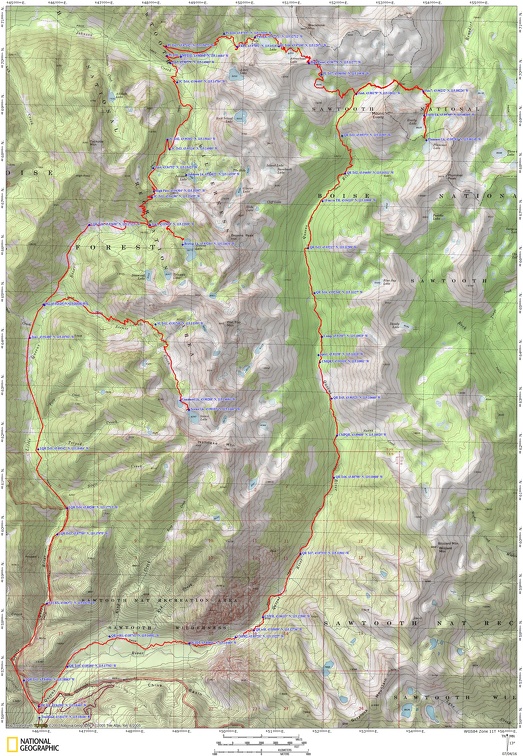
Trail Maps:
Topo Map, National Park Map, Download Garmin .gpx file
Length and Elevation:
3.8 miles round trip to turn around point. Elevation at the trailhead at 4,330 feet, 5,970 feet at Glacier Basin Camp and 6,700 feet at turn-around point. Highest point is at 6,700 feet. Lowest elevation is 4,330 feet.
One way elevation gain of 1,700 feet and loss of 60 feet to Glacier Basin. Gain of 2,400 and loss of 60 feet to the turn-around point.
Review: September 8, 2012.
The trailhead for Glacier Basin Trail is easy to find, once you get to White River and park in the large parking lot. Just continue heading towards Mt. Rainier and you’ll see the well-signed trail nestled between the sloping mountainside to the right and the swift-running White River.
From the trailhead, the first part of the trail is almost level, heading through the forest and going gently uphill.
After about .5 mile, the trail becomes steeper and you break out of the trees for about 100 feet above the rive bed. Soon after that, you hit the first switchback heading higher along the valley.
This first part of the trail has been completely rebuilt over the last few years and you can see the hard work of the many volunteers that worked to reopen this trail after it was washed out by floods in 1996-1997. Looking at the rockwork, you can see the care they took in designing and building the trail.
The trail takes another switchback just before reaching a mostly-hidden waterfall. Though you can’t see it, the sounds are delightful as you wander up and get better views of Mt. Rainer.
Since this first part of the trail is mainly in the forest, there aren’t very many wildflowers. Wildflowers appear only where trickles of water along the trail provide nourishment for them.
The forest along the lower sections of this trail has a very thin layer of topsoil, so the soil dries quickly and doesn’t support flowers.
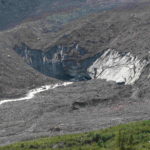
After traveling about 1.1 miles, there is a junction for the Emmons Moraine Trail to the left. This trail also has an overlook to a turquoise meltwater lake about .2 mile along the Emmons Moraine Trail. It is a worthwhile side trip to the viewpoint.
The trail continues through the forest on an abandoned road and passes some old copper mining equipment in a couple of spots. During the summers of 1897 and 1898, prospectors discovered signs of copper ore deposits on the east flank of Mount Rainier, between the Emmons and Inter glaciers, in a place called Glacier Basin. In 1906, mining was begun, but no copper ore of commercial value was found and the mining was abandoned.
At 2.6 miles from the trailhead is the junction for the Burroughs Mountain Trail.
Traveling about another .7 mile, you come to Glacier Basin Camp. Just before camp is a sign for the toilet. This trail loops around the entire camp, passing by the toilet, and rejoins the main trail at the other end of Glacier Basin Camp.
Continuing on, you pass through the camp with several campsites. Just past the camp is a small lake off to the right. This lake is the water source for campers and hikers.
Walking a bit farther, pass the end of trail maintenance sign. From here there are a couple of user trails. One goes to the left and crosses the creek. This continues up to the ridge on the far side of the valley and hikers on this trail eventually reach Camp Shurman. Note that reaching Camp Shurman requires glacier travel and special equipment and rescue techniques are needed.
Continuing straight ahead, climb along one of the branches of the White River, coming out of the trees. Climb fairly steeply at times along the roaring creek. This section can get slippery in damp weather because of the clay content of the soil.
Just before you reach the high basin, cross a small creek that tumbles down the hill. There are wildflowers that bloom all summer long along the creek. Follow the creek to where it springs out of the ground. Look carefully and you should be able to find a safe place to get a drink. Watch out for any marmot dens that could pollute the water.
Continue a little farther and come into the small basin. The trail soon fades away. Pick a place to take a break, enjoy the view, and have a well deserved snack.
Looking down the valley, you can see where you started the hike far below you in the distance.
This is a fairly easy trail for children up to Glacier Basin Camp. After the camp, the trail travels a narrow ridge about 30 feet above the creek. If you want to avoid the ridge, you can pick your way through a little ravine. Children will enjoy playing in the snow patches and streams in the high basin.
Enjoy the Photos!
Gallery Pics
Switchback Steve