Frog Lake Buttes, OR
Vicinity Location: The trailhead is about 53 miles southeast of Portland, Oregon in the Mt. Hood National Forest.
Directions: From Portland take I-84 East to the Wood Village, exit (16A). Head south and turn left onto NE Burnside Rd. Heading East, Burnside will merge into Highway 26. Follow Hwy 26 for 45.4 miles, about 6.9 miles past Government Camp and turn left into Frog Lake Sno-Park. This provides access to Frog Lake and the Pacific Crest Trail.
In winter, it is required to carry chains or have traction devices.
The parking lot is a very popular location and is shared with snowmobiles.
There are pit toilets at the trailhead.
A current Sno-Park permit is required to be displayed between November 1 and April 30. Oregon permits cost $4 a day, $9 for three days or $25 for the season. The permits can be bought on-line, in Government Camp other outdoor stores or DMV offices.
You can see avalanche forecasts here: Northwest Avalanche Center
National Weather Service Snow Level forecast: Northern Oregon Cascades
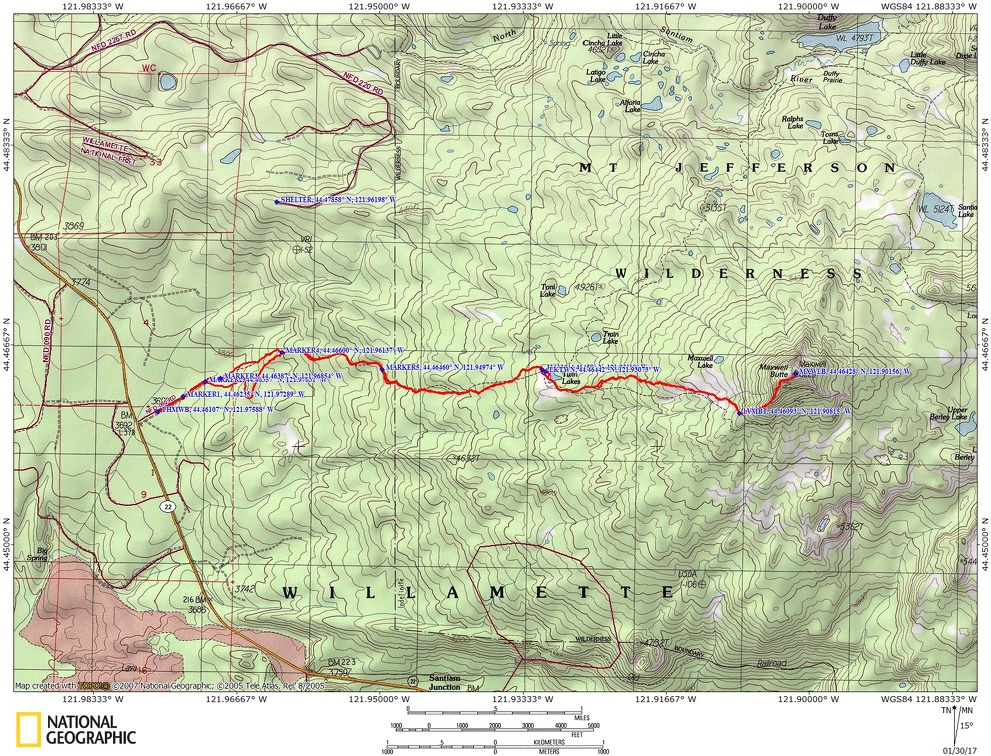
Trail Maps:
Topo Map, Download Garmin .gpx file
Length and Elevation:
8 miles roundtrip. Elevation at the trailhead is 3,900 feet. Total gain is 3,900 feet and loss is 3,900 feet. Highest elevation is 5,270 feet and the lowest elevation is 3,900 feet. Elevation change to the top of the butte is 2,650 feet elevation gain and 1,320 elevation loss.
Review: 1/23/2017
After to 2.1 miles pass a trail Junction sign for Frog Lake Trail 484 and Twin Lakes Trail 495 also upper Twin Lake and Barlow. Take the trail to the right which goes down to Twin Lakes Trail 495. From The Junction it is just a short walk down to one of the Twin Lakes. The trail so far has been very pleasant through a beautiful old second-growth Forest with tall, straight trunks. Most the trees through here on Hemlock. The trail climbs a bit then down to Lower Twin Lake.
Walk a few hundred feet along the edge of lake and looking up to the shore around Twin Lake. Walk to the sign for Frog Lake Butte and from there walk straight away from the lake and we went gently climbing for a few hundred feet then gently dropping. Look for brown spray painted blazes on the trees to help spot the trail. We reached the butte after travelling 4.75 miles.
The views are so beautiful up on the butte. If you go past the repeater tower another tenth of a mile there’s a very nice Viewpoint of Mount Hood. From other viewpoints on top of the butte you can see distant things such as Smith Rock, Gray Butte and other distant landmarks in eastern Oregon.
From there we came back down the road which was easy to follow. Just go downhill and you will run into the road. It’s used by quite a number of snowmobiles and so you will no problem following the road back down to the parking lot.
Hiking down there are some nice viewpoints off to the east of the snow covered ridges and on a clear day you can see Mount Jefferson. As we continued down the road we could see Frog Lake and Highway 26 off to the left across the valley. When we got down to the bottom of the hill, the road T-s off. We continued straight across into the forest and directed ourselves towards the parking lot.
The trail to Frog Lakes is little used and you may be breaking trail most of the way up to the Buttes. Following the snowmobile trails down the snow-covered Forest Service road will be a steady downhill walk.
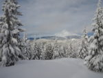
Enjoy the photos!!
Gallery Pics
Switchback Steve