Garfield Peak, OR
Vicinity Location:
The trailhead is 96 miles southeast of Eugene, OR in Crater Lake National Park.
Directions:
Drive on East Rim Road to the main parking area on the rim of Crater Lake and walk a short distance to Crater Lake Lodge.
A National Park entry permit is required to park enter the park in both summer and winter. Entrance fees to the park for 2019 are $25 per vehicle and $20 per motorcycle. An annual park pass is $50.
Pets are not allowed on this trail.
There are bathrooms at the lodge.
Trail:
Garfield Peak Trail
There are no geocaches along this trail.
Length and Elevation:
Total distance is 3.6 miles roundtrip. Trailhead elevation is 7,082 feet. Highest point is 8,054 feet. Lowest point is 6,982 feet.
Total elevation change is 1,355 feet up and 1,355 feet down.
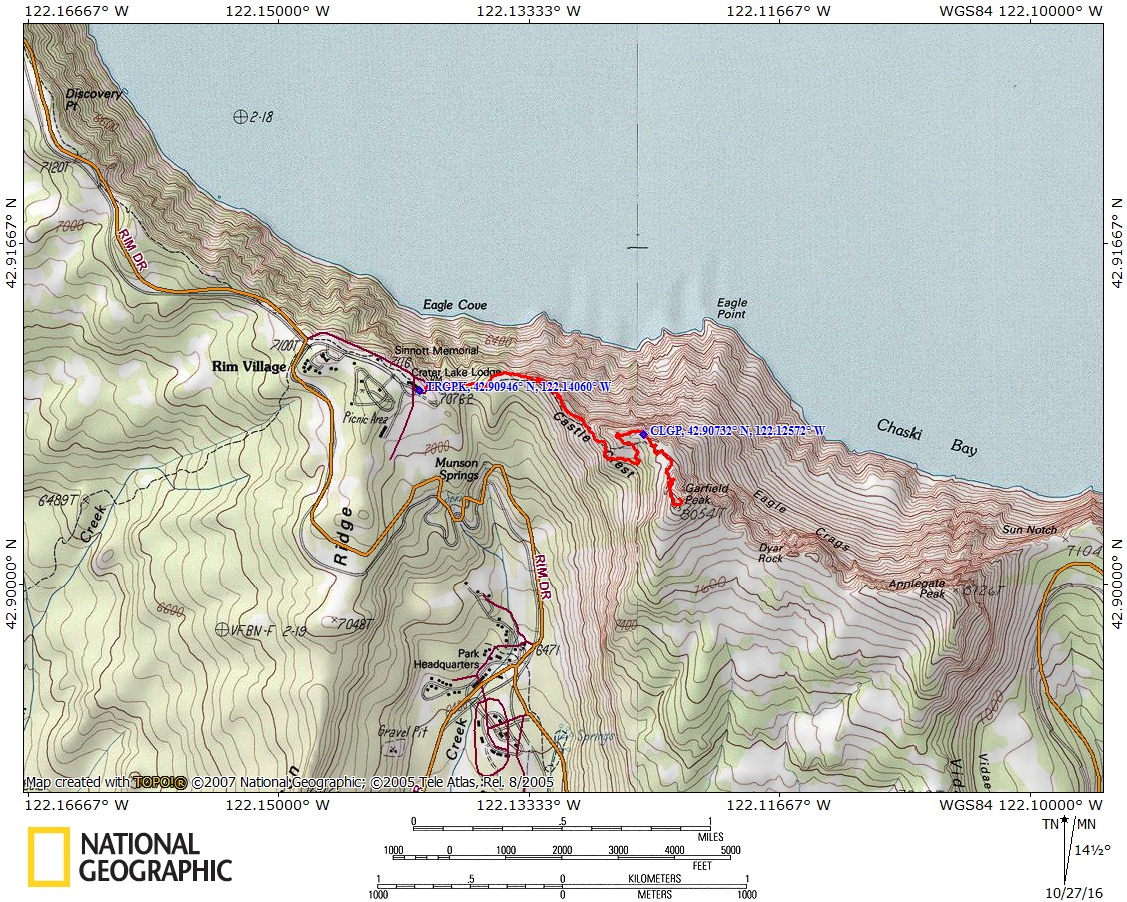
Trail Maps:
Topo Map, Download Garmin .gpx file
Review: July 27, 2012
Walk past Crater Lake Lodge and follow the paved pathway along the lake rim. The way soon turns into to a wide trail across meadows where lupine, orange paintbrush, and other wildflowers bloom in the summer.
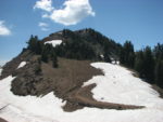
The trail starts climbing switchbacks and the views get better as you gain altitude. At this elevation, only the 5-needle whitebark pines, grasses, and wildflowers survive. Some of the trees are have wonderful knarls where the bark has been stripped off by winter storms. The branches of the whitebark pines are very flexible to shed snow and bend in the winter hurricane force winds.
As you near the peak you’ll probably see snow patches across portions of the trail until August and sometimes the final .4 mile is closed until late July.
When you reach the peak’s summit the cobalt blue of Crater Lake is spread out below you. Take in the spectacular panoramic view. Mt. Scoot rises in the east behind Phantom Ship’s rugged little island. To the south you can see the distant flatlands of Klamath Lake and the tip of Mt. Shasta and the cone of Mt. McLoughlin on the right. You might see or hear marmots and mouse-like pikas whistling and you might even see them on the rocks just north of the summit.
Pick your way back down the dusty trail past the weathered trees and volcanic rocks and through the meadow to return to the lodge.
Enjoy the photos
Link to Photos
Switchback Steve