John Muir Trail
Maps of our route – link
Here is the journal for our 17 days and 215 miles of backpacking:
August 2, 2008 – Day 0 – Arrival at Yosemite. Today we woke before 6 a.m. to catch the YARTS bus from Mammoth Lakes RV Park to Yosemite Valley. We wanted to eat something for breakfast besides the really junky food we bought yesterday, so we went to McDonalds for normal junk food. I had a sweetbread thing with a sausage patty and a side order of a disc of hash browns. While we were eating at the bus stop, we met a man named Vincent and his girlfriend. Vincent loves to talk about hiking and the trips he has been on in and around Yosemite. He talks so much his girlfriend told him she was tired of him talking and schussed him a couple of times to boot.
On the bus Vincent was recounting his hikes around Yosemite and naming the different peaks for us. He told us of several out-of-the-way hikes that we would love to do someday. I tried to write down all of Vincent’s tips for future plans.
The bus driver told us the Telegraph Fire hadn’t pushed smoke into the park for the past two days and sure enough, the sky was a brilliant blue, except for haze on the western horizon. The bus made a special stop at May Lake trailhead because someone in a hiking party had a heart attack this morning and had to be airlifted to a hospital. The bus dropped off one of the hiking partners of the heart attack victim. The man we dropped off had no idea whether his friend was dead or alive. I thought about a friend of mine who got a twisted colon just a week after a 50 mile backpacking trip we took together some years ago.
The rest of the trip to Yosemite Valley was uneventful and we stopped by Tuolumne Meadows for a couple of minutes before continuing on. We arrived in Yosemite Valley about 11:30 a.m. and we went directly to the Wilderness Permit area. We got lucky and we were able to change our permit to leave on 8/3 instead of 8/4.
After changing our permit and reviewing the rules, we bummed around for the afternoon. We got some snacks and went sightseeing using the free shuttle buses. I waded into the Merced River to get a good picture of Half Dome while Drew waited for me on the shore. After that, we were wandering around and saw a buck in a meadow. We walked along the road watching it and took pictures of the buck eating fallen apples in one of the parking lots. Later, as we walked to the backpacker’s camp, we saw a bear being chased away by the rangers in Lower Pines Campground.
There were still sites available and we put our gear in the bear box at the site. I wanted to check out the area, so we walked from the backpacker campsite, west along a trail running along the base of the cliffs, climbed a seasonal streambed, and took pictures of the smooth granite walls. The air was filled with the smell from Bay Laurel bushes. The bushes were everywhere on the Yosemite Falls side of the valley. We met two climbers who told us about Devil’s Bathtub, which was a little more to the west, so we went looking for it. We went past the bend in the granite wall and climbed up to where the rubble meets the wall, then walked back east, but we couldn’t find it. Drew did find a dead, dried out bat. We posed the bat on a rock and took some pictures of it. We were careful not to touch the bat for fear of rabies. We could hear bats further up the cliff, so it must have fallen from much higher up the wall.
We ate some dinner at the wall and made our way back down the slope, batting at mosquitoes, then went to see the sun set on Half Dome. On the way back to camp, we saw a doe and two fawns in a meadow, but we couldn’t get a good picture of them in the dim of the evening. We came back to camp and freshened up for tomorrow’s gain of 3,000 feet (914 meters) to the Half Dome junction and then another 2,000 feet (610 meters) gain to the top of Half Dome. Finally, there is a gain of about 200 feet (61 meters) from the junction to where we plan to camp. The elevation gain plus the high elevation, and the high temperature, getting to around 85 degrees (30° C), will make for a hard day of backpacking.
August 3, 2008 – Day 1 – Steps of granite, trail of wonders
Right after I got settled into my hammock, three hikers decided to bed down next to me. They weren’t noisy for long and later I heard some snoring, but they quieted down after someone dumped about 20 glass bottles into the trash.
We got up at 6 a.m. and Drew told me that during the night a bear or two came into the other side of camp. Drew said there were people yelling and pots banging, but I never heard the commotion either time. We had breakfast, got our gear together, and broke camp at 7 a.m. We thought we could buy anything we forgot when we got to Tuolumne Meadows.
We walked to the Happy Isles trailhead because there weren’t many shuttle buses running yet. We only saw one bus as we walked along a creek to the trailhead. The trail starts ascending and soon gets pretty steep. It goes above a stream and crosses on a bridge with a beautifully framed view of Half Dome in the middle of the bridge. There is one last bathroom with flush toilets after the bridge, but it was closed due to the Telegraph Fire.
Soon you encounter stairs of granite that climb and twist up a slope of granite. Vernal Falls comes into view and it is a glorious waterfall, dropping over an overhanging precipice to the streambed below. More granite stairs and a rock arch eventually bring you to the top of the falls. Just above the falls is a huge pool of emerald water, inviting you to swim in, but it is forbidden. From the pool, the ever-climbing trail ascends to spectacular views of Nevada Falls.
At Nevada Falls we took a break and two Park Rangers stopped by and checked our permit. They also made sure we knew where to camp, as well as talked about how to store our food, along with anything that smells, in our bear can.
After filtering water we continued up the trail. I felt a little intimidated thinking about the length of the trail, the elevation and elevation gain, and wondering if we would have any bear problems. The trail to Half Dome is mostly in the trees but the sun was hot in the sunny clearings. A packhorse train of about six horses went past us and on up the trail. We were surprised they didn’t make a great cloud of dust as they passed by. Of course we had a few times of smelling horse poop and then passing a pile of it in the trail.
We got to the junction for Half Dome about 12:30 p.m., had lunch, and stashed our packs and Bearikades™ in the woods. The first part of the trail to Half Dome is pretty easy, but as you get closer, the trail gets steeper. The trail passes some really nice views of Half Dome then the stairs of granite begin to climb towards Half Dome. These are tough stairs to climb because the rise is 12 to 18 inches (30 to 45 cm) on some of them. After a couple of hundred stairs you walk over a granite rise and see the cables to the top of Half Dome. The climb up the cables starts out steep and gets steeper. There were lots of work gloves at the bottom that cold be borrowed to keep your hands from getting blisters and a sign warning to keep off if thunderstorms are possible. Those long cables must be quite the lightning rod. There was a pretty good crowd ahead of me and people go up incrementally because everyone tends to rest on the wood cross-boards.
I think the Telegraph Fire is causing a lot of people to delay going to Yosemite. I have heard the lines up Half Dome can fill the cable walkway and stretch a couple of hundred feet (61 meters) to wait to climb the cables. Eventually I made it to the top and wandered over to look at the vertical face. The summit actually overhangs into nothingness! It was a beautifully clear day and I could see for miles in every direction. Eventually I went back down, which was much easier, though some people had trouble and became afraid of falling on the steep parts. You can almost rappel down! I went back down the granite stairs looking around for Drew, but I couldn’t find him so after about 30 minutes, I went back up to the top of Half Dome to find him. I quickly reconnoitered the area as it was getting late, but I couldn’t find Drew. I went back down the cables, this time I discovered you could face forward, hold the cables, and slide down the rock from board to board. There were very few people this late in the afternoon and I made it down the cables in about seven minutes. I found Drew waiting at the bottom of the granite stairs and we went back to our backpacks and bear cans. We were about out of water but we planned to camp near a stream about a mile away (1.6 kilometers) so we knew we could make it to water. We put our packs back together and headed for our first night’s camp. Drew’s calves were really hurting him so we went to where Sunrise Creek crosses the trail and looked for a spot. On the way to camp we met a man who was carrying his tent down the trail. The carpenter ants were really bothering him so he was relocating to a new spot.
After walking around, doing about a mile of searching, Drew found a great campsite away from the crowds and near the stream. We found some bear scat nearby and a place where a bear had been turning over old logs looking for food. We hoped the bear wasn’t in the neighborhood, had a nice campfire, cooked our meals, and washed up. We went to bed expecting bears but we never heard anything other than a deer and some owls.
August 4, 2008 – Day 2 – Ramparts of Granite
Monday dawned clear and blue again. I haven’t had to use my rain fly yet and the bugs have been pretty easy to handle. We broke camp at 7:45 a.m. and headed down the slope to the trail from our campsite. The forest changes from heavy tree cover into an open Lodgepole Pine forest with nice views to the south. We had one last view of Half Dome as we gained elevation. The section of the trail from the first Cloud’s Rest junction is pretty unremarkable. There was only one small stream between Sunrise Creek and Sunrise Camp. We passed a trail crew working on stairs up to Sunrise Camp. Some of the crew had been out there for almost two months.
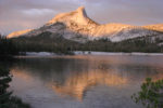
It was a pleasure pass through the nice level meadow instead of gaining elevation, but soon we started climbing again towards Cathedral Pass. Just before Cathedral Pass, there are amazing vistas of granite spires. From the pass, the trail drops down to Cathedral Lake with more great views of Echo Peaks and Cathedral Peak, with Cathedral Lake in the foreground.
We cross-countried to Lower Cathedral Lake and had to change course when we encountered glacially smoothed granite slopes above the lake. One slip on that steep rampart of granite and you would slide and tumble all the way down to the lake. We found a gentle, wooded path to the lake then found a campsite in the trees near the west end of the lake. The granite seems to go on forever at around the lake. Some of the granite is almost as smooth as a countertop. We set up camp with views of the lake and watched with apprehension as clouds started sliding across the sky and piling up against the mountains in ever increasing numbers.
We had two deer in camp and we spotted other deer nearby. It was a hard hike today because of the really crummy sections of the trail at Cathedral Pass and backpacking between 7,000 and 9,500 feet (2,130 – 2,895 meters) all day. Drew’s calves are really tender but he is hanging in there.
August 5, 2008 – Day 3 – Cowbell in the wilderness
Night passed with a couple of sprinkles, but the ground was bone dry when we got up. Drew had a tough night with heartburn and sore muscles but was still pumped about the trip. We had breakfast, packed up, and left about 7:30 a.m. It was a quick trip down the switchbacks in the trail and we filled water bottles at a spring coming right out of the ground beside the trail. The spring is the beginning of Cathedral Creek and has a strong flow so we didn’t worry about filtering water. This section of the trail appears to get a lot of use but is pretty well maintained.
Once you reach the first flat area, there are still ups and downs before you reach Tuolumne Meadows. Once you reach the meadows, the trails are not well signed for the JMT. We walked the road east until we found the trail that crosses the Tuolumne Meadows. We followed the signs for Soda Springs until we crossed the river, then we headed towards Lembert Dome, which is easy to see from a distance. We walked past Lembert Dome and stopped at the Wilderness Registration and asked for directions to the store. We found out we needed to backtrack about ½ mile (800 meters) west. Now we know that to get to the store, grill, and Post Office, you have to cross the highway bridge where the road to the parking meets the main road.
We got to the grill and found out breakfast goes until 11:35 a.m. and then lunch starts. We wanted burgers so we waited a few minutes and each ordered the Combo for $7.50 and enjoyed our food immensely. We talked with several backpackers over lunch. We met Andrew and Linda from Sweden and other people hiking the JMT. We watched as Andrew and Linda covered their heels in moleskin to cover their big blisters. We hit the trail with the fast food heavy in our stomachs. The trail again passes a couple of confusing junctions and we followed the widest trail. My GPS confirmed we were on the JMT. I had loaded waypoints that were just after most of the trail junctions so that we could confirm we were traveling on the JMT. The sandy trail passed through a fairly open forest and crossed streams a couple of times, finally settling on the west side of Lyell Creek. The stream is beautiful as it winds through the meadows. I saw several fish in the stream and people fishing told me that fishing was good. We passed an area with lots of tree trunks pointing into the meadow. These are skeletons of trees that couldn’t bend to the will of avalanches. We passed Ireland Creek and it was barely a trickle. Later we got rained on a bit and the rain made a beautiful scene as the raindrops gently fell into the river and made circles on the placid stream. The rain quickly ended and I waded across the cool, inviting stream for some pictures of the mountains and Donohue Peak with the stream in the foreground. I caught up with Drew and we remarked at how level the trail was now and how steep it would be tomorrow. We found a good campsite near the head of the valley. Little did we know that a cigar smoker would camp next to our campsite. Luckily the stink didn’t come our way much. Before dinner I walked into the meadow and across the stream. I found another nice campsite but it had more mosquitoes than ours. I also got pictures of a doe in the meadow. I walked on and I took pictures of some ptarmigans that spooked when I was about to step on them.
When I got back to camp, we made a campfire and boiled noodles for dinner. Those noodles really hit the spot after the day on the trail. After dinner about 15 horses from a horse camp came to graze in the meadow. One horse had a big cowbell on it that echoed across the valley. We put out our campfire and went to bed, hearing cowbell noise most of the night.
August 6, 2008 – Day 4 – One day but two passes
We heard a few sprinkles of rain during the night but again the ground was dry and dusty when we woke at 6:45 a.m. The horses were rounded up and the only wildlife we saw was a deer when we were getting ready to go. We continued being careful with our food, fearing the bears would get our food and cut our trip short. We take only the food we immediately need from the bear can, then lock the bear can right back up.
We chose our camp so we would climb Donohue Pass in the morning. The climb goes up through the pine forest and granite strewn slopes. The climb gets steeper and eventually reaches a hanging valley with some campsites. The trail crosses the outlet of an alpine lake and climbs up granite stairs through fractured rock. At the top of Donohue Pass is a small lake and views into Rush Creek Valley. We met a group of Boy Scouts on a 50 mile (80 kilometer) backpacking trip, taking a break at the lake. The trail descends fairly steeply after the pass and the tread alternates between sand, stone, or granite. There are great views of the Ritter Range as the trail drops quickly in elevation.
We met a group of people who told us their bear story. One of the women had gotten an apple and put it in her tent. In less than five minutes a big black bear came into camp, ripped the tent open with one slash of his claw, and got the apple. They chased away the bear but her tent was ruined.
We stopped for lunch along Rush Creek and soaked our feet and put moleskin on our hotspots and blisters. We hiked up to Island Pass, which also has great views of the mountain peaks and slopes. We continued down past the beautiful 1,000 Island Lake. We wanted to filter water at the lake, but the strong winds had stirred up too much crud in the water for our liking. The next 2 ½ miles (4 kilometers) to Garnet Lake felt really hard and drained us. The trail really seems to go up and down a lot to pass Emerald Lake and Ruby Lake along the way. When we got to Garnet Lake, we took the user trail along the shore. This proved a poor choice because it is so rugged. We finally found a good campsite but it was really windy. We were wiped out and went to bed shortly after dinner. Thankfully the wind tends to die down at night and slept well once the our tarps stopped flapping.
August 7, 2008 – Day 5 – Burgers and beers!
Today looked like another beautiful day for backpacking. We watched the sun come down Banner Peak and Mt. Ritter. The nights have been between 40° and 50° (5° to 10° C) but I know it will get colder as we camp higher. We didn’t mind leaving our camp because the wind was rising again. The trail immediately starts climbing out of Garnet Lake and it is a hard climb for early in the morning. After a gain of about 400 feet (122 meters), the trail drops down to Shadow Lake, a very pretty lake.
From Shadow Lake, the trail relentlessly switchbacks up about 1,000 feet (305 Meters) to Rosalie Lake and then up again to Gladys Lake and then down, down, down past Trinity Lakes. I was going to wait for Drew at the outlet stream to Trinity Lakes, but it was all dry and I walked right past it. I kept walking past Johnston Meadows and walked until I got to water, which is where the JMT crosses Minaret Creek. I saw one of the people who started at Happy Isles the same day we did. I was surprised to see Tom at the river crossing. He was waiting for his wife, Paula, to catch up. The rest of his party had gone on to Red’s Meadow to get a campsite. While I waited for Drew, Tom and I talked and Tom told me his bear story. Tom and his group have been hiking about the same speed as us. We saw them our first day out, and passed them a couple of times on the trail. On their first night on the trail they camped about ½ mile (8,000 meters) farther along the trail than where we camped. We camped near the first Cloud’s Rest Trail junction, the one near Half Dome. They were using Ursacks™ to store their food. They heard a bear around their food and Tom went out in just his underwear and a flashlight to check on the situation. He threw rocks and sticks to chase the bear off. Tom moved the food and made sure to tie the bags correctly. They went to bed only to be awakened by a deer squealing as it was being chased by a bear. The deer ran right through their camp and right through Tom’s tent. The deer ripped the tent netting and kicked Tom in the shoulder. Luckily the bear veered off. Later that night they heard the bear after the food again. The bear made crashing and crunching noises for what seemed like an hour. Then all was quiet again. The next morning the knots on the bear bags were still tied but the cords were chewed into pieces and the bags were shredded. Of course the food was all chewed up and even the toothbrushes were chewed up. Tom kept the bags as a souvenir and they were planning to resupply at Red’s Meadow. Paula arrived and they both left for Red’s Meadow.
Stephanie, a solo backpacker, arrived with her dog Puck. We talked about different hikes while Stephanie dipped water from the creek. She is careful to backpack on lesser-used trails and stay upstream of horses. She commented that the horses had ruined all the water crossings on the trail she was on. She warned us of lots of bugs farther down the trail and she traded me some insect repellent for an extra dinner I had. She was hoping Puck would like the dinner because he usually quits eating after three days on the trail.
Drew arrived and Stephanie told us how to get to the backpacker’s camp and to order the special dinner before 3 p.m. I saw we would be too late for the dinner, but we heard the double cheeseburgers are great. We hiked past Devil’s Postpile and a bunch of tourists. The trail stopped at a road and we didn’t know which way to go. We went right and found a little trail through the bushes that went into the campground. After some helpful directions, we finally found the backpacker’s site and it was full. We saw Tom and Paula and they let us share their site. This was the first night I couldn’t find trees to set up my hammock tent. I got it set up on the ground like a bivy and Drew and I went to the store and grill, which is about ½ mile (8,000 meters) away. Drew got some snacks and some ibuprofen for his sore legs and we went for dinner. Most of the tables were reserved, but there was room at the counter and we scored a table as a family was just leaving as we stood in the restaurant. We had our burgers and I had two beers with my dinner.
We got back to camp and I wanted to go to the top of Devil’s Postpile so Drew and I walked the trail back the way we had come into Red’s Meadow. We took the junction that led to the top of Devil’s Postpile. The top is really cool because it was scraped smooth in the last ice age and the basalt looks like giant cobblestones. We took some pictures of the basalt sections and got back to camp just before dark.
We thought a hot shower would feel great after being out on the trail so we got in line for the free hot showers. The bathhouse gets water from a hot spring and people come from other campgrounds to use the showers. We had to wait about 30 minutes for a shower to open up. By then it was dark and there were no lights inside but I had brought my headlamp for light. We got our hot, hot showers and dried off at Tom, Paula, Jack, and Ron’s campfire. We were both tired and felt ready for bed. The campground quieted down and I slept soundly.
August 8, 2008 – Day 6 – Feeling stronger at altitude
Drew said he tossed and turned all night and got hardly any sleep. We wanted to gain elevation before the heat of the day so we ate in camp, packed, and went to the store for extra ibuprofen. The store and restaurant are open 7 a.m. to 7 p.m. Drew found what he was looking for and we phoned home to check in and tell people about our change in camps. We were ahead of schedule and had decided to change camps to even out the daily mileage better than our original plan. We got directions to get back on the JMT and walked over to the stables. We walked through the stable area and went left at the first junction, towards Red Cones. The road turns into the JMT and drops a little, then begins to climb through a burned area. There are lots of thorny, spiky bushes in the burned area so I was glad I had my leggings on. We hiked through the burned area for about 45 minutes before entering forest cover. We climbed for nearly four hours and then passed a nice campsite at Crater Creek. We took a snack break at the creek crossing and I washed my stinky socks, using my wash bag, away from the creek. The trail after the creek is a walk through pumice soil and a mostly open forest. We crossed Deer Creek, which has level campsites but no view. Granite bedrock returns and the trail climbs to the junction of Duck Lake. We looked up at the mountains to where Duck Lake must have been and were glad of our choice to camp at Purple Lake.
We began our climb to Purple Lake and again the wind blew harder as we gained altitude. The trail to Purple Lake was rocky but had great view of Cascade Valley and Mt. Abbot. We got to the lake and the wind was blowing hard with gusts to 30 miles (48 Kilometers) per hour and the few clouds in the sky were flying north. We heard there were a couple of nice campsites on the south side of Purple Lake and found the sites we were told about. After we set up camp we went exploring on the north side of Purple Lake and found nicer campsites but with more mosquitoes. Thankfully the wind mostly died away at nightfall so we could sleep and not hear our tents and rainflys flapping. We feel we’re acclimating to the higher elevations and we’re not so tired at night anymore.
August 9, 2008 – Day 7 – Barbeque spurs us on!
I can’t believe I slept through my alarm even though it is right on my wrist! Drew was up and around and had already retrieved the bear canisters. Once again, there was no bear activity that we could see. We checked our campfire to make sure it was cold and I sprinkled a little extra water on it to be absolutely sure it was out.
In Yosemite two rangers told us we had to pack out our toilet paper so I decided to try natural vegetation. There aren’t many leaves on the JMT but there is some fine grass that works pretty well. I have been folding little bunches of it in half and using it to wipe. Lupines are my favorite natural toilet paper so far. Today I got some grass near the lake that felt like sawgrass when I went to use it, so I put it down and went for the fine-textured grass.
Back to camp and we were all packed but I couldn’t find my GPS. Drew waited as I pulled everything out of my pack and of course my GPS was at the bottom. I don’t much like this pack with one giant pouch and the sleeve extension. It is *****bersome for me to get to anything except the few items I can put in the two outside pouches.
We broke camp around 7:45 a.m. and started the daily climb, this time up to Virginia Lake. The trail was pretty rocky from packhorse use. The trail climbed then dropped down to Virginia Lake. It is a really nice lake where the land gently slopes to meadows on the north side of the lake and there is a large pond next to the lake on the south side of the lake.
When we first crossed the meadow on the north side of the lake, we heard a marmot giving alarm. We saw it and a few other marmots near the lake. We stopped for some marmot pictures and after about 20 minutes, the lead marmot pretty much ignored us. Then a younger marmot came up on the rock with the lead marmot and they groomed each other for a few moments. Then the lead marmot went off to browse. We got up, got our packs, and moved on, leaving the marmots to their meadow. Just after crossing the major inlet stream, we saw a pika with a mouthful of leaves. It wanted to cross the trail and froze for a few moments. Then it darted a few feet, froze, then darted again, until it was out of sight. We continued around the lake intending to filter water, but the trail started climbing above the rocky lakeshore. We finally found a good spot to drop down to the lake, but it turned out to just be a large pond. We had to walk past the pond, then down to the lake to get our water. We had earlier discovered that Drew’s water filter was broken on the inside, so we started filtering using my water filter. We enjoyed the lakeshore views as we filtered our water and heard some other backpackers going along the trail.
The trail climbs steadily from the lake and then it drops down to Tully’s Hole using dusty switchbacks. Along Fish Creek we could barley see the trail because it was so overgrown with willow bushes. From there we began a long climb on gravel, rocks, and granite slabs up to beautiful Squaw Lake, where we had lunch. We had heard that Vermillion Valley Resort had a barbeque on Saturday Nights in the summer. We thought we could make the 4:45 ferry and have a barbeque dinner if we pushed ourselves. We tromped over Silver Pass, admiring the views, then down the easy switchbacks to Silver Pass Lake. From there we dropped down steep, nasty little switchbacks and across blasted granite slabs into Pocket Meadow. Pocket Meadow is a very pretty stroll that all too soon became steep switchbacks. We got to Edison Lake Ferry junction around 3:30 and thought we had plenty of time to catch the ferry. I thought the trail would be a fairly constant grade, but granite slabs kept appearing and the trail climbed over each one of them. At last we reached the sign for the ferry and knew the landing had been moved ½ mile (8000 meters) farther southwest due to the low water. We walked along the beach but the dock was really at least ¾ mile (1.2 kilometers) farther. I guess they moved the dock and didn’t change the sign. At last we saw the United States flag that marked the dock and saw a boat coming. We found out the ferry for the year is a five-passenger boat, so we had to wait for the next trip, which took about 20 minutes for the boat to return. The boat dropped us off near the dam, then we took a car shuttle the last mile or so to the resort because the lake is being drawn down for irrigation.
We finally reached the lodge tired, hungry, and with a few new blisters from hurrying all afternoon. We got settled in and met some of the backpackers going south, like our trip. We met David from Berlin Germany, Ross from San Francisco, Rudy from San Diego, and Colin and Ken are from Great Britain. We were all there to get our food drops, which we had mailed earlier. The resort is basically camping spots, cabins, horses, general store, and restaurant. We went to the restaurant, ordered our barbeque dinner, and had a beer on the house because we are JMT hikers. Rudy regaled us with several stories throughout the night, including the time he was sleeping in the open and an ant crawled into his ear and died. It took Rudy three days to get the ant out and now Rudy sleeps in a bivy bag.
For David and Ross, this is their first backpacking trip and they are very excited to get going. David had big blisters on each heel and is now using plenty of moleskin, hoping they will heal. Drew and I looked around the resort and decided to leave the next day along with this group instead of staying a full day at the resort.
August 10, 2008 – Day 8 – Hiking Companions
The dawn brought another beautiful day and we went to the restaurant for breakfast about 7:10 a.m. Rudy sat with us and told us he was on no set schedule. He had bought a sleeping bag and other supplies from a backpacker who blew out his back on the trip and had to leave at Vermillion Valley.
After breakfast I helped get our box out of the metal cargo container and I was happy to see it was in great shape. I had fears that it would get chewed on by something while it was in storage. We pulled out our supplies and I found that my crackers were moldy but thankfully the hiker’s barrels had many pounds of leftover food. Drew and I shared a bag of Wheat Thins™ he found and I also found some chocolate mix, a freeze-dried breakfast of scrambled eggs, and some extra sunscreen.
As we prepared to leave, I heard that Rudy had left on an earlier ferry and the others were planning to walk using the Bear Ridge Trail, which is actually shorter than taking the ferry back to the dock, rejoining the JMT and then taking the JMT south. We had decided to meet back up at Rosemarie Meadows, 2,400 feet (730 meters) and 11 ½ miles (18.5 kilometers) of walking for Drew and I. I hoped going back on the same trail to the JMT would seem faster, but it didn’t; it felt just as far with our again heavy packs. Drew’s and my pack each now weigh about 39 pounds (17.7 kilograms), but that was nothing compared to David’s 60 pound (27 kilogram) pack.
We saw Rudy leaving as we got to Mono Creek and stopped to filter water. Drew soaked his hat and shirt, I soaked all that I was wearing to keep cool on the climb. All too soon we were regaining all the altitude that we had lost the day before. The trail was good, but it was still a long, hot, climb. The trail finally flattened out, then dropped, then climbed, then went up and over granite slabs.
We were a couple of miles from the meadow when we walked through a soggy area with clouds of hungry mosquitoes, which followed us down the trail no matter how fast we walked; biting us at every chance. Finally we stopped and put on repellent, which drove them away. We reached the meadows about 7 p.m. and found the rest of the group, except for Rudy, who was behind us on the trail. We got all set up and talked around the campfire while we cooked dinner over the campfire. We talked about the two missing members of Ken and Colin’s group. There were supposed to be four in their party but one of the men got a serious cut on his leg on a cruise and couldn’t go. The other guy made it as far as Tuolumne Meadows where the blisters on his feet got so bad that he couldn’t go on. Colin heard he couldn’t walk for three days and had returned to the United Kingdom.
August 11, 2008 – Day 9 – Hot, hot day
We had camped just below 10,000 feet (3048 meters) because campfires are prohibited above that level and we wanted to save our stove fuel whenever possible. The day dawned clear and about 35° (1.6° C), our coldest night yet. Ken and Colin broke camp about 7:30 a.m. and Drew and I left about 8:15 a.m. David woke up with his eye swollen and sore and Ross’ knee was hurting him a lot. Ross is a thin guy and I found out his pack weighs nearly 60 pounds (27 kilograms). He said that the majority of his preparation for the trip was cycling. Ross and David were going to take it easy on the trail and catch up with us later.
We started our daily climb past Marie Lake and made it across Seldon Pass well before noon. We switchbacked down to Heart Lake for a rest and took in the beautiful vistas and watched some fish swimming in the lake. It seems that almost every lake and stream has small fish that can be seen swimming about. From there we dropped down to Sallie Keyes Lakes and walked along the beautiful shoreline. From there we started dropping down to Senger Creek, which was still flowing and is the last good water before the junction to Muir Trail Ranch. We arrived at the beginning of the many switchbacks leading down into the valley of the South Fork of the San Joaquin River. Livestock use the trail a lot and it has large stretches of loose, rounded rocks down the switchbacks. The upper 2/3 of the trail has a southern exposure and the sun cooked the hillside, sapping our strength and wishing for some clouds. We met several groups going up and felt sorry for them because it was such a hot day. Finally we got some tree cover and after the cutoff trail there were a couple of tiny streams. We couldn’t filter from them because they were too small so we moved on. I needed a break so we found a nice spot off the trail, but it had big carpenter ants crawling around, and soon on us. Big carpenter ants are really common on the trail and sometimes they bite. We moved on but soon we were out of water. We looked at the map and saw we cold backtrack towards the Muir Trail Ranch and filter water. We only had to walk about seven minutes to reach the wide, cool San Joaquin River. We slaked our thirst and took our extra water back to our packs. We headed towards Piute Creek and it must have been 95° (35° C) in the shade. We were roasting as we hiked uphill with our packs on. The trees were scattered along the trail and I stopped in their shade several times.
After the first cutoff to Muir Trail Ranch, the trail had gotten much nicer to walk on, but after the second cutoff for the ranch, the trail got much worse with loose river rocks covering the trail. Today’s switchbacks down the hillside and this section are two of the worst trail segments we have traveled so far.
We finally crossed the bridge over Piute Creek and entered King’s Canyon National Park about 3:30 p.m. We were really tired from the day’s trip. We continue being extra careful with our food and we found out bears are hunted in the Inyo National Forest, but not in the National Park. This means there is a greater chance of bears being in the National Park.
David arrived about 4 p.m. and his eye didn’t look swollen but he said it still hurt and itched. Ross never showed up but David had hiked with him on the trail and he was talking about exiting at Muir Trail Ranch. We hoped he would be okay and assumed he went out at the Muir Trail Ranch. We hadn’t seen Rudy again so we assumed he also went out at Muir Trail Ranch.
We soaked our feet in Piute Creek, made dinner, and went to sleep with the sounds of Piute Creek rushing by.
August 12, 2008 – Day 10 – Passing the halfway point of our trip
We awoke to another clear, beautiful morning for backpacking. We found our food canisters untouched and I got my oatmeal out. Last night was the first time my knees ever ached in the night. I hope that doesn’t happen on the next big downhill day. We broke camp and said goodbye to David, Colin, and Ken. I hope Ken does okay because his new Raichle boots had bad stitching on the toe piece and the stitching on the sides of the toe box had entirely ripped out on both boots.
We reached Evolution Valley and crossed the creek about 10 a.m. In August it is an easy wade, barely knee deep. Drew tried crossing with his boots on and almost made it across but took one misstep and got water in one of his boots. We continued through the valley and the streams coming down the mountainsides must have been dried up because I thought Tuolumne Meadows was just as pretty. I did like the way the river flowed over the granite slabs of bedrock through Evolution Valley. All too soon we began the climb to Evolution Lake. It is a gain of about 900 feet (275 meters). We reached the lake and decided to push on to Sapphire Lake because it makes less gain for the next day and we heard there were campsites available. We walked past Evolution Lake, which is in a beautiful setting. A good portion of the trail around the lake is on fist-sized broken granite rocks. We reached Sapphire Lake about 3:30 p.m. and found a spot that was a little protected from the gusty winds. There really aren’t any trees at this lake. We set up camp and David showed up about an hour later. We found a spot for him and when we moved some rocks around we found places where someone had take a dump and others had stuffed their used toilet paper into the rocks. That is so disgusting and against park rules. When you’re above 10,000 feet (3048 meters) you have to pack out your toilet paper. How inconsiderate to take a dump and cover it with some rocks! Plus, I think it was less than 100 feet (30 meters) to the lake from where the people went to the bathroom.
We cooked our dinners and talked over dinner. This camp has its share of mosquitoes but they left us along once the sun went behind the mountains. The landscape around the lake is very stark from all the glacial action and elevation. The mountains around the lake are much more rugged than at Evolution Lake. I was hoping the wind would die down soon because my rainfly was really flapping. The days have been very windy every time we got above 10,000 feet (3048 meters).
Today was a big elevation gain day. We went through Evolution Valley and on to Evolution Lake. There were some great waterfalls next to the trail but they weren’t huge. I guess there aren’t many tall waterfalls on the JMT because all the granite and glacial action.
August 13, 2008 – Day 11 – Views of Mordor
It was surprisingly warm during the night, about 40° (5° C) in the morning. This was only the second time that I needed to set up my hammock tent as a bivy. There was a slight wind blowing downslope and hardly any mosquitoes. We heated water for breakfast, ate, and cleaned up camp. I had to use the bathroom and I found a sandy, gravelly place a few hundred feet up the hill. I used a few rocks for the initial wipe, and then I only used three squares of toilet paper, which I put in my blue plastic waste bag. We hit the trail about 8 a.m. and climbed pretty steadily. We crossed the outlet of Wanda Lake, another easy stream crossing. After a bit, the trail gets rockier and starts ascending via switchbacks up to Muir Pass. The views get better and better as you climb higher. We reached Muir pass and hut about 10 a.m. and took a break in the hut. The hut is for shelter from lightning storms and not for overnight camping. We descended down the switchbacks on the other side of the pass. The switchbacks are sandy at first but soon become rockier, then fractured rock. We crossed a small snowfield and took snow to put in our hats and up our sleeves to keep us cool because we were still above the trees. Sometimes the stream was near the trail; sometimes it was the trail, and other times the stream disappeared briefly into the rocks. We met one backpacker who aptly said the trail reminded him of Mordor.
The trail drops down into the valley below and we stopped for lunch in a small meadow with a shallow stream and great views of the mountains. The trail continues downward and we strayed off the trail twice. Each time it was because of user trails to find crossings when the water runs higher. The trail reaches the floor of Le Conte Canyon and levels out. The first meadow you pass is Big Pete Meadow, which has stunning Langille Peak for a backdrop. The next meadow is Little Pete Meadow. In the sprint and summer, meadows mean hungry mosquitoes!
Soon you pass by the side-trail to the Le Conte Canyon ranger station. When you see the junction for the Bishop Pass Trail, you’ve already passed the ranger station. Once you walk over the truss bridge over the Dusty Branch, the trail deteriorates and narrows. After a few miles we passed Grouse Meadows and we continued a bit father to the Middle Fork Trail junction. We found a great campsite near the waterfall and set up camp. There were few bugs and we enjoyed sitting around the campfire talking and listening to the river.
August 14, 2008 – Day 12 – Forest fire in the valley
Another perfect morning and there was no bear activity during the night. We filtered water, had breakfast, and broke camp for a big elevation day of about 4100 feet (1250 meters) of gain. We started up the trail about 7:45 a.m. and were soon climbing up the valley. The trail leveled out as it crossed the edge of a meadow and forest stream with the trees taken out by avalanches. Then the trail goes through a burned area with plenty of widow-makers waiting to fall in the next storm. The trail goes up and down a bit through muddy sections and little streams. In one of the grassy areas intermixed with trees, I plucked a sprig of wild mint, which was in bloom and inhaled the fresh, minty aroma. Soon the trail begins aggressively climbing. The next 1500 feet (457 meters) of elevation gain is called the Golden Staircase, and it is a long climb. Part of the trail is shaded in the morning by the rock cliff above and the shadow is very welcome. We paused several times to catch our breath and savor the view. The edges of the trail had clusters of pennyroyal and their minty smells wafted through the air as we brushed against them or crushed them with our trekking poles as we passed by.
The switchbacks climb unforgivingly upward with a few parts of the trail being almost level. After getting to about 10,500 feet (3200 meters) there is a huge hanging valley containing Palisade Lake. We were out of water and took advantage of the meadow along Palisade Lake to filter water and be amazed at the Palisade Peaks. From there the trail climbs above the lake and continues to climb towards Mather Pass. The switchbacks are very rocky and pretty steep. You can’t see the trail far ahead because there is so much rock rubble on the slope. Eventually we could see where the pass was, as well as portions of the trail far below. We paused at the pass to rest, take photos, and congratulate ourselves for reaching the pass.
The switchbacks down the other side are just as steep as the ones coming up, but they are sandy at first. All too soon the trail turns to broken rock that needs to be carefully negotiated to avoid a bruised foot or turned ankle. The trail becomes sandy and rocky as you descend via what seems to be a glacial lateral moraine. There are several little tarn lakes and we stopped at one to filter water. Trees reappeared as we dropped in elevation and we crossed a few streams as we continued to drop in elevation along the South Fork Kings River. The trail has basketball-sized rocks embedded in the trail which we had to be careful not to trip over. Pretty soon we crossed the South fork of the Kings River stepping on rocks in the stream. We got back on the trail by walking upstream about 20 feet (6 meters) from the rock crossing. We soon found a level site to camp, but we couldn’t have a campfire because we were just above 10,000 feet (3048 meters).
We walked around and I found a spring that had swamp onions (Allium validum) growing around it. I harvested some for dinner and went back to camp. We think there is a forest fire to the southwest because we saw a lot of haze. After returning, I found the smoke was from the Tehipite Fire, which has been burning since July 14th. We also heard one clap of thunder during the evening, but the skies cleared of smoke and clouds as twilight approached.
August 15 – Day 13 – Crossing a suspension bridge
We passed another uneventful and quiet night. The sky cleared and the full moon shone through the trees. The moon seems extra bright at 10,000 feet (3048 meters) in the wilderness. We pitched camp and started backpacking about 7:30 a.m. These early morning climbs are getting a bit tiresome but it is the best way to beat the heat and avoid getting caught in a thunderstorm on the exposed trails where they go through the passes. We climbed steadily up to a bench where we had great views all around the valley. We passed Lake Margorie and began climbing again. Soon the trail switchbacked through the scattered trees then passed through jumbles of rocks. We reached Pinchot Pass about 9:30 a.m. and paused for photos. I saw some Tibetan Prayer flags up on the right and climbed up for a better look. I rejoined the group and put on more sunscreen while Drew and David started down the steep switchbacks. The trail passed many pretty little lakes. Just past the last switchback the trail passed through a narrow channel between two rocks, I tripped, and fell headlong. Lucky for me the ground wasn’t really rocky and I landed mostly on my shoulder and my pack because I twisted my body as I went down. Of course David heard my cry of surprise and alarm as I fell. David and asked if I was hurt. I banged my knee and skinned it a little, but I was otherwise all right. I got up and walked more slowly down the trail. The trail drops down fairly steeply into a river valley of Woods Creek. There are several sets of shin-high to knee-high stairs to go down. We passed a small lake where we took a break and filtered water then we continued down the canyon. This part of the trail has stairs that go down, then up, then down repeatedly until you finally get past all the granite slabs. The trail passes above a nice waterfall and it is interesting to see the stream sliding down the slick granite bedrock. We stopped to take our pictures as we crossed the suspension bridge over Woods Creek. There is also an outhouse now at Woods Creek and we passed it on the way in without seeing the trail to it. We arrived at camp about 2:30 p.m. and found a nice campsite near the creek. I was looking for other campsites and cut my foot on a sharp stick. The wound didn’t quite cut all the way through the skin so I hope it isn’t very sore tomorrow. The camping areas really filled up as the afternoon wore on. We have backpackers all around us, even in the poorer looking sites. We made a campfire and cooked dinner over it. Talk turned to foods that we haven’t had for a couple of weeks and how we wished we could eat some of them.
The afternoon got very cloudy, but they were high clouds and dissipated at sunset. The weather seems to be getting cloudier each afternoon, which makes me worry about thunderstorms, but so far the clouds always break up in the evening. We got to sleep with the sound of Woods Creek splashing in the background. This part of trail has been the best-maintained section so far.
August 16, 2008 – Day 14 – Glen Pass
I feel so lucky to have wakened to another blue-sky day. We started on the trail almost at the normal time and we weren’t in a hurry because the mileage is fairly short. We started climbing right away and gained about 1,500 feet (457 meters) to Dollar Lake. The climb continued up to the Rae Lakes Basin with beautiful Rae Lakes. The trail gains and loses elevation as you navigate past Rae Lakes. We had great views of Mt. Cotter, Mt. Clarence King, and the Painted Lady as we walked along the lakes.
We stopped to filter water where the first lake flows into the second lake. We wanted to be sure we had enough water to climb Glen Pass. We filled up on water and followed the trail as switchbacked up the side of the mountain and entered an amphitheater ringed by rugged mountains. This part of the trail construction is amazing. It seems impossible that someone conceived this approach and constructed it, but the trail is here just the same. I think this section is much more impressive than the Golden Staircase. We reached the pass about 11:30 a.m. and the vistas were the best so far. Tall mountain peaks stood in ranks to the north as far as you could see. Deep valleys were to the west and south and lakes and snowfields were far below us. We left the pass and dropped rapidly down, then started traversing and dropping down towards Charlotte Lake. I stopped to take pictures of Charlotte Dome in the distance. It reminded me of Half Dome, now over 100 miles (160 kilometers) away.
Just past the Charlotte Lake trail junction, there are several trail junctions in a short distance so we had to be careful to stay on the JMT. After crossing a pumice plain, the trail climbed a bit, then switchbacked down to a small stream that is the outlet to Bullfrog Lake. We camped just a little past the creek near a metal bear box. We chose the campsite farthest away from the stream and meadow to avoid mosquitoes. We found plenty of wood and got a campfire started and cooked dinner. David was so hungry he cooked a second dinner, hoping to get more food at Crabtree Meadows. We made tea using strawberry leaves and pine needles. It was quite good and we had seconds.
Drew treated his blisters. He said walking on the trail is very painful when the ground is level. He is wondering if the volume of the toebox is too small for his feet.
We stayed up talking about food and good movies.
August 17, 2008 – Day 15 – Forester Pass, the highest pass on the John Muir Trail
Wow, Sunday is here again so soon. Our trip is almost over. We have just one more pass to climb and then Mt. Whitney. David has been sleeping on a space blanket each night and it has been working out for him very well. There are a few mosquitoes in the early evening and then they go away soon after dark. The ants haven’t been a problem for him and we’re seeing a lot fewer ants on the southern end of the trail. I’m not sure if the climate or the altitude is the reason for there being fewer ants on this half of the trail. We started another campfire and made ready to go. David and Drew bandaged their blisters and I checked to make sure the sportstape was still on my foot covering my wound. I took my plastic laundry bag to the creek and got a gallon or so of water and poured it on the fire. I wanted to make extra sure the fire was “dead” out.
We left about 7:40 a.m. and started climbing past Vidette Peak. The trail climbed pretty steadily, though at times the trail is pretty level. Of course the trail goes up and down as we navigated past pillows of granite. Then the trail really starts to climb as we left the trees behind. We passed several lakes and could see people way above on a ridge. We were up on that ridge soon enough. The trail climbed sometimes steeply across a huge slope of scree, and then switchbacked up the final few hundred feet (100 meters) to the pass. I made it to the to about 12:10 p.m. and joined Drew and David. We stopped for lunch and pictures at the Forester Pass.
The trail going down the other side of the pass is an amazing job of construction and the trail is not for the faint of heart. You can see where sections of the trail were blasted out of the mountain face, rock retaining walls were built to support the trail, and 100 feet (30 meters) cliffs are common for the first several switchbacks. The trail continued to drop steeply down to a rocky ridge, which it followed for some time. Looking back, it is soon hard to imagine that you took a trail over the pass. It looks like an amphitheater with no way out. After a few miles the trees reappear and you cross Tyndall Creek, where we stopped to get water. From there we branched off to the ranger cabin to look for extra food, but no one was there and there wasn’t any extra food.
From there it was a steep climb up to the JMT and our camp for the night. We’re above 10,000 feet (3048 meters) so no campfires are allowed. We cooked our dinner and Drew and I walked up the hillside while David read. We found a trashcan sized quartz rock and lots of smaller pieces of pure quartz. We wondered how there can be all this granite, then pure quartz. The mosquitoes were bothering us when we got back to camp, so I went to my hammock, Drew went to his tent, and David crawled into his sleeping bag. I was thinking that it might get pretty cold because it was already feeling cool and there weren’t any clouds in the sky.
August 18 – Day 16 – Guitar Lake
We woke up to a light frost. Drew and David said they heard something rattling the metal bear box during the night. If it was a bear, it didn’t come over to the tents because they laid awake listening for a while. David said his eye was still hurting him but he was sure he could finish the trip. The cold motivated us to move fast to stay warm and we didn’t want to linger around camp, so we got started about 7:20 a.m. David told us that he had his cathole dug and was ready to use it when he discovered he was very close to the trail. He jumped behind a tree until a pair of backpackers passed by on the trail, which was about 30 feet (10 meters) from his temporary hiding place.
The trail climbed around the base of Tawney Point and just before we got to a small lake on the right, we ditched our packs and walked to the top of a mound for our first good view of Mt. Whitney. We saw where some other backpackers went to the top of Tawney Point to view Mt. Whitney but we were content with the mound we hiked up to. From the base of Tawney Point, the trail dropped down to Wallace Creek, then up to Crabtree Meadow. Many of the creeks we passed were dry and we were running out of water. We found a creek that wasn’t dried up and we stopped to filter water because we were out of water. Drew’s foot was really making him suffer with every step so we talked about how to bandage up his toes. David used some Lidocaine and I cut off a piece of foam from my sit pad to cushion his two smallest toes. He wrapped up his little toes in pairs, put his boots back on, and we set off. As we walked into Crabtree Meadow, I asked Drew how his foot felt and he said his feet felt much better. We stopped at a barrel and picked up our WAG (Waste Activated Gel) bags for our Mt. Whitney summit trip. There used to be an outhouse on Mt. Whitney, but it has been removed and people have to carry out all of their own waste.
We took the side-trail to the ranger station hoping to get a little extra food but the ranger wasn’t there and we couldn’t find a hiker food box. We sat in the shade and had lunch at Crabtree Meadow, then we started hiking up the trail again. The trail climbed gently but steadily then the trail became steeper. I was pleased to see the trail had been recently maintained so it was reasonably wide and most of the loose rocks had been removed. There were plenty of granite stairs to climb up to reach Timberline Lake. From there, each time the trail crested, I thought the flat spot ahead was Guitar Lake, but it wasn’t. Finally the trail dropped down to Guitar Lake and I found Drew and David sitting a rock waiting for me to finally arrive. We scouted around the neck of the lake for campsites and found a good site, which was a little, protected, up in the rocks.
The weather was clear except for a few fair-weather cirrus clouds. I was very happy to see the *****ulus clouds from the afternoon were gone. We talked about what time to leave for the summit and decided that getting up at 4 a.m. and leaving about 5:30 a.m. would get us to the summit before it got too crowded with people coming up from the Whitney Portal side. There are few trees at Guitar Lake and no bugs here so David and I are both sleeping out. I sure hope the wind dies down after dark.
August 19, 2008 – Day 17 – Mt. Whitney
We slept fitfully because of the cold weather and thinking about our last day. We set our alarms for 4 a.m. but got up a little earlier. I heated up my granola bar in some water for breakfast, but my stove sputtered out before the water got very hot. I shook the can and there was still fuel in it. I don’t understand why a fuel canister would still have fuel in it at 11,000 feet (3353 meters) but not put out enough fuel for a flame.
The full moon almost gave us enough light to avoid tripping on the rocks as we went down to filter water four our summit trek. There was frost on the grass at the lake and we knew it would get colder as dawn approached and we trekked higher. We left Guitar Lake about 6:12 a.m. and used our flashlights to avoid rocks in the trail. We didn’t want to be the 3 out of the 3,000 people climbing Mt. Whitney who fell on the trail.
All was silence as we walked on in the dark except for the sounds of our trekking poles stabbing into the gravel and rocks in synchronization to the crunching of our boots and the rhythm of our breathing as we went up the trail. We made good progress up the trail, but I tired quickly at the altitude when I tried to catch up to David and Drew.
Last night I had calculated the bearing to Mt. Whitney from Guitar Lake was about 68° from True North, but you can’t see the summit of Mt. Whitney from the lake. As we got higher, Guitar Lake vanished from view as the trail snakes up the mountainside. The trail enters an amphitheater and you can’t imagine what route the trail takes to leave the valley. The trail climbs a set of switchbacks and I paused to wonder why it looks like the switchbacks to the east are steeper than the switchbacks to the west.
I was surprised to see Guitar Lake come back into view as the trail climbed up the side of Mt. Whitney. Now I see the shoulder of Mt. Whitney can be seen from Guitar Lake.
We reached the junction for the Mt. Whitney Trail about 8:15 a.m. The construction of the trail for the last mile up to the junction is incredible. You can’t help but wonder how this trail could have been built.
There isn’t a lot of room beside the trail to leave packs for the trip to the summit, so the packs are lined up along the rock wall at the trail junction and in a pile on the other side of the trail. The wind was blowing hard and cold and I was wearing most all of my clothes. We waited at the junction while David went off to use his WAG bag before the trip to the top. Drew and I had been able to go before we left camp so we’ll have our WAG bags as a souvenir if we’re lucky.
The trail to the summit is blasted from the mountain and retaining walls were built to support the trail. There are a couple of saddle crossings where the slopes drop thousands of feet to either side of the trail. As the summit comes into view, the flat roofline of a building near the top can be seen if you look closely at the summit. After about 1-¼ miles (2 kilometers) we reached the final slope to the top. It was pretty easy to walk up the rest of the way and we reached the summit about 8:30 a.m. and we wandered all around the summit. The top has stupendous views in all directions and it was a perfectly clear day.
We soon saw a resident marmot that looked better fed than us. It wasn’t shy about sneaking into any food left unattended. The marmot posed while we took all the pictures of it that we wanted to take. We saw some people making cell phone calls from the summit. Some calls got through, though other didn’t. We met one couple at the top that had started from the Whitney Portal side at 10:30 the night before and they were hiking back down the same day.
We stayed at the top for about an hour and went back down to the junction to get our packs back on. We thought the trail would drop from the junction but it climbs again to Trails Crest at 13,000 feet (3962 meters). From there the trail goes down hundreds of switchbacks to the valley far, far below. We stopped for lunch where the trail crosses a stream on a rock pile that bridges the creek. We wanted to rest our quads from the constant descent and not injure ourselves on the last day.
The trail passed Outpost Camp and there were several single campsites in the area. Most people who backpack up from the Whitney Portal side have to camp partway to the summit because the elevation gain is too great for one day.
As we descended down the switchbacks, a road far down in the valley came into view. It was hard to believe our trip was coming to an end and we would soon be back among cars, motors, tourists, and fast food.
After talking about our trip to the summit and seeing some of the sickly looking people making it to the top, Drew and I decided we wouldn’t want to backpack south to north. David is thinking about backpacking the JMT in a couple of years, going south to north using multiple resupply points.
We finished the trail just before 3 p.m. and stepped across the end of the trail together. We met a Forest Service employee who agreed to take our pictures at the trailhead, and we were done!
What a finish! Seventeen days backpacking for us. David started on August 1st, but he recuperated for a day at Tuolumne from his half-dollar sized blisters on his heels and he stayed in Vermillion Valley for a day for his resupply. We learned a lot about long-distance hiking and what to bring and what to leave behind. This trip should be on every backpacker’s “bucket list”, but I’m sure there are many trips that we haven’t been on that should be on our bucket list.
Enjoy the photos!!
Gallery Pics
More Gallery Pics
Switchback Steve