Pocket Creek, OR
Vicinity Location:
The trailhead is about 48 miles southeast of Portland, Oregon in the Mt. Hood National Forest.
Directions:
From Portland take I-84 East to the Wood Village, exit (16A). Head south and turn left onto NE Burnside Rd. Heading East, Burnside will merge into Highway 26. Follow Hwy 26 for 41 miles, about 1.7 miles past Government Camp and exit right into onto Hwy 35 and drive 9.6 miles. Park at Pocket Creek Sno-Park in the plowed pullout along Hwy 35. This is about 1.9 miles past Teacup Lake Sno-Park.
Depending on what time you drive back it may be faster and easier to drive north to Hood River and use I-84.
This is a very popular location and the parking lot overflows on nice weekends.
In winter, it is required to carry chains or have traction devices. This road can get very snowy and it is imperative to have chains or traction tires in the winter.
There are restrooms at the trailhead. Flush toilets are also available at Government Camp.
A current Sno-Park permit is required to be displayed between November 1 and April 30. Oregon permits cost $4 a day, $9 for three days or $25 for the season. The permits can be bought on-line, in Government Camp other outdoor stores or DMV offices.
National Weather Service Snow Level forecast: Northern Oregon Cascades
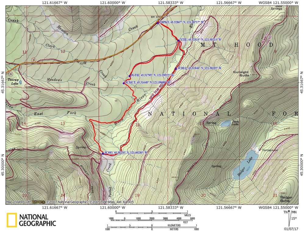
Trail Maps:
Topo Map, National Forest Service Map, Download Garmin .gpx file, Open Garmin .gpx file
Length and Elevation:
6.3 miles roundtrip. Elevation at the trailhead is 3,830 feet. Total gain is 570 feet and loss is 570 feet. Highest elevation is 4,220 feet and the lowest elevation is 3,720 feet.
Review: January 7, 2017, March 16, 2020
From the north end of the parking area walk past the bathroom, cross the bridge, and go about 0.4 mile, curving right, on Pocket Creek Trail. Turn right onto Meadows Creek Tie Trail #679 and travel 1 mile gently uphill following the blue diamonds on the trees. At the map/gps junction marked JGTIE turn left to stay on the tie trail.
There is a nice mix of hemlock, cedar, white spruce, and pine trees in the thick forest.
In 0.2 mile turn left again onto Meadows Creek Trail #680 after crossing over Clark Creek. Snowshoe gently uphill through a broad valley before crossing Meadow Creek and the East Fork of Hood River.
Continue following Meadows Creek Trail #680 through meadows and a young forest of Ponderosa Pine to Pocket Creek Ski Trail #683 at 3.5 miles, elevation 4,220. Coming up the trail there are glimpses of Mt. Hood and better views from some open patches of forest next to the trail. The Pocket Creek Ski Trail is the same as Forest Road 3450. The Pocket Creek Trail leads downhill through a forest that changes from Ponderosa Pine to a mix of larch, pine, hemlock and White Spruce.
The route soon parallels the East Fork of Hood River and there are some nice viewpoints of Mt. Hood across the valley until the trail enters into the thick forest. After following the Forest Road downhill for 2 miles the trail makes a sharp turn to the left and crosses the East Fork of Hood River. Climb gently for 0.6 mile back to the trailhead and parking area.
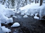
This is spectacular on a cold snowy day walking through the forests and over the streams that flow through the area. Without cold temperatures and fresh snow the trails can turn into Cascade Concrete.
This is a great trail for children as you can turn around at any time, the trails are fairly wide, and all the streams have bridges.
Enjoy the photos!!
Gallery Pics
Switchback Steve