Salmon-Morgan Creeks, WA
Vicinity Location:
The trailhead is about 17.5 miles northeast of Portland, Oregon.
Directions:
From Portland take I-205 north past Vancouver, WA.
Drive on I-205 North and take exit 32 towards Battle Ground, keeping to the right. In 0.3 mile turn right onto NE Padden Pkwy.
Drive 3.6 miles and turn left onto NE 152nd Ave.
Drive 4.9 miles towards the Cedars Golf Course and turn right onto NE 181st St.
Drive 0.3 mile. The road jogs to the right and turns into NE 180th.
Turn left onto NE 159th Ave and drive 0.1 mile.
Turn right onto NE 183rd St and drive 0.1 mile.
Turn left onto NE 161st Ave and park along the road, being careful not to block anyone’s driveway.
There are pit toilets at the trailhead.
No permits are required for parking.
Dogs should be kept leashed because of nearby houses and other pets.
Length and Elevation:
1.5 miles. Elevation gain is 55 feet and elevation loss is 55 feet. Elevation at the trailhead is 260 feet and the high point is 300 feet. The low point is 250 feet.
Trail:
Fir Loop Trail, Alder Loop Trail, Red Cedar Trail
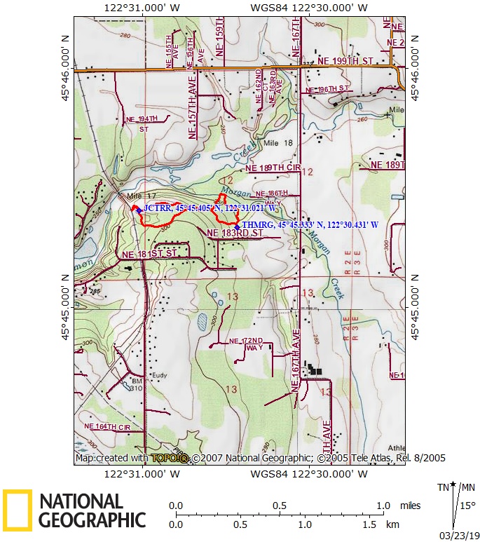
Trail Maps:
Topo Map, Download Garmin .gpx file
Review: March 23, 2019
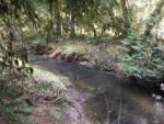
This is an all-year trail that passes through cedar forests and several other kinds of trees. From the trailhead, turn to the right and proceed counterclockwise. The wide dirt path passes through dappled forest of majestic cedars. These aren’t the biggest cedars in the Northwest but several of them are over 48 inches in diameter. This is very close to being a temperate rainforest and many of the cedar trees have a green patina of moss or algae on the trunks.
The trail curves to the left and passes by a viewpoint of Morgan Creek. Soon you come to a junction where the Fir Loop Trail and Red Cedar Trail come together. Continue to the right to get to the unimproved Alder Loop Trail. Just before you get to the Alder Loop Trail turn right on a short spur trail that ends in an overlook of the confluence of Morgan Creek and Salmon Creek.
Retrace your path back to the main trail and continue to the Alder Loop Trail. Keep to the right, passing views of Salmon Creek and drop down and pass through Grand fir, Birch, and Douglas fir trees.
At the next junction, turn left or you will come out to a dead-end at the Chelatchie Prairie Railroad tracks. Staying on the trail, it soon widens and crosses some patches of ground that are wet and mudding in the winter and spring.
Back in the cedar forest you soon come to the trail junction for the Red Cedar Trail. This leads to a different trailhead. Continue straight and you will shortly arrive where you started the Alder Loop Trail. Turn right and turn right again when you reach the Fir Loop Trail. In less than 0.2 mile you will arrive back at the trailhead.
Enjoy the photos!!
Gallery Pics
Switchback Steve