Silver Star South Snowshoe, WA
Vicinity Location:
The trailhead is about 24 miles northeast of Portland, Oregon in on Washington DNR land.
Directions:
From Portland take I-84 east for about 5 miles.
Take exit 8 for Interstate 205 N towards Seattle/Portland Airport and drive about 5 miles, crossing over the Columbia River.
At the end of the bridge, take exit 27 for Camas and drive 9.5 miles on Hwy 14.
Turn left onto Washougal River Rd. and drive 6.8 miles.
Turn left onto NE Hughes Rd and drive 1.6 miles.
Follow the main road as it changes into NE 392nd Ave, NE 28th St, NE Miller Rd, and NE 39th St.
3.4 miles after turning onto NE Hughes Rd, turn left at NE 412th Ave and follow the main road for 2.7 miles then make a left at the junction with County
Road. The pavement ends and the last few miles are dirt road.
Drive 1.7 miles further on the 1200 Road to a wide spot in the road. The next available parking is about .7 miles further up the road and may not be passable in the winter.
A State of Washington Discover Pass is required for parking.
You can see avalanche forecasts here: Northwest Avalanche Center
National Weather Service Snow Level forecast: South Washington Cascades
Length and Elevation:
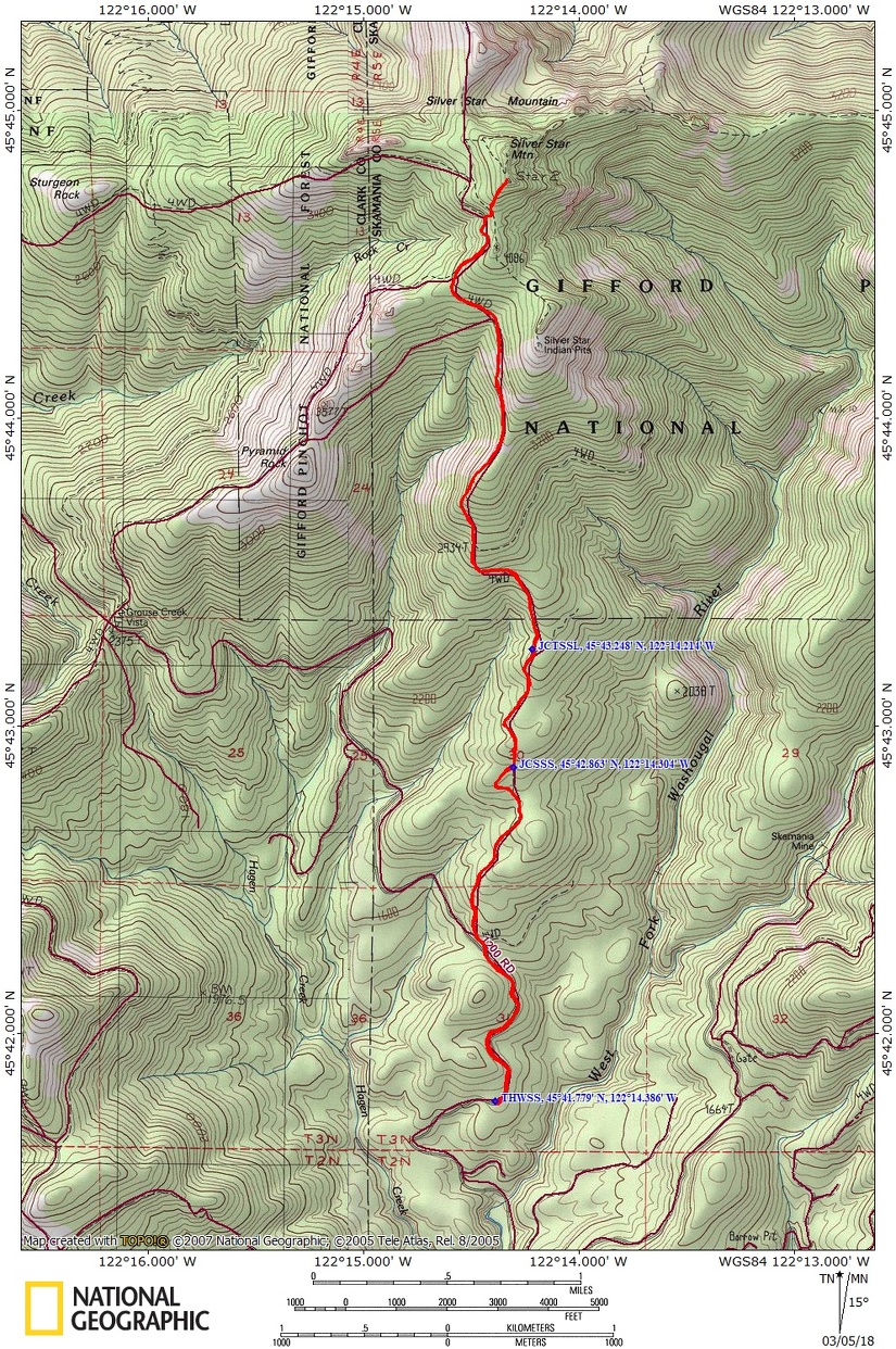
8.6 miles roundtrip. Elevation at the trailhead is 1,430 ft. Highest Point on the trail is 4,340 ft. 3,050 ft elevation gain and 3,050 elevation loss.
Trails:
There is at least one geocache for this trail at: N 44° 51.400 W 121° 56.685 Info at Geocaching.com.
Trail Maps:
Topo Map, DNR Forest Map, Download Garmin .gpx file
Review: 3/4/2018
The open slopes of this trail are subject to avalanches and you must know the snow conditions and weather conditions before you go. You must educate yourself to the avalanched dangers before attempting this trip and know when to turn back.
The trailhead is at about 2,000 feet in elevation and is not always accessible during the winter. There is a place to park about .75 mile before the trailhead at 1,800 feet in elevation. The next closest parking area is over 2 miles from the trailhead. The road is not plowed. It is not uncommon for people to be target practicing in the area.
From the parking area walk uphill on the forest road for about 1 mile as it winds up the hill. Look for the trail as it leaves the road and goes almost directly steeply uphill into the woods.
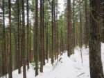
Head straight up the hillside for about 0.5 mile before levelling out a bit and even losing a bit of elevation. Soon you pass a a recent clear-cut and the climb resumes. The mix of alder and hemlock trees screen the views and the snow weighs the alder across the trail. At the time of this review there were a few areas where it was better to step off the trail and avoid the alder. There is a little rivulet running down the abandoned road but it is easy to negotiate.
After about 2.8 miles the forest opens up to views of the mountains and distant valleys to the north and west. Pyramid Rock can be seen across the valley. During moderate avalanche conditions and stable temperatures, continue across the sweeping, open slopes for about 1,000 feet back to the forested hillside. If the avalanche is moderate and the snowpack is unstable then you will have to ascend to the ridge here and follow it to the summit or turn around and head back downhill.
The snow creates a tangle of alder in places and there is a small stream to cross along the way. Now the forest has changed to mostly Noble Fir and the trail steepens again as it gets closer to Silver Star. When the trail breaks out of the forest again, head towards the ridge using the edge of the forest to stay off the steep slope. Stay on the crest of the ridge and head up to the south summit. On a clear day are wonderful views of Mt. St. Helens, Mt. Rainier, Mt. Adams, Mt. Hood, and Mt. Jefferson.
If you have time, continue north to the actual summit of Silver Star Mountain. Evaluate avalanche conditions again and avoid the open slopes if wet snow avalanches are possible.
Enjoy the photos!!
Gallery Pics
Switchback Steve