Soda Peaks Lake, WA
Vicinity Location:
The trailhead is about 42 miles northeast of Portland, Oregon in the Gifford Pinchot National Forest.
Directions:
From Portland, Oregon, there are two ways to drive to the trailhead. If you have an extra 30 minutes then make your trip a loop drive.
For the loop drive, take I-205 north across the Columbia River. Exit I-205 on Highway 14 east for about 28 miles through the town of Stevenson.
For the non-loop option, take I-84 east from Portland and take exit #44 for Cascade Locks.
Take the first right turn, just after you go under the Bridge of the Gods. Pay the $3.00 toll, cross the bridge, and turn right onto Highway 14 and drive 2.5 miles to Stevenson.
Once you get to Stevenson, drive about 2 more miles east to Wind River Road. Wind River Road is 5.9 miles east of the Bridge of the Gods.
Drive on the Wind River Road north for about 13.4 miles until about 0.25 mile past the Carson National Fish Hatchery. Take a left on Mineral Springs Road (Forest Road 3065) and drive for 0.5 mile.
Take the first right on Forest Road 5401 and drive about 0.3 mile to the parking area and trailhead.
There is an outhouse at the trailhead.
A Northwest Forest Park permit is required at the trailhead.
Length and Elevation:
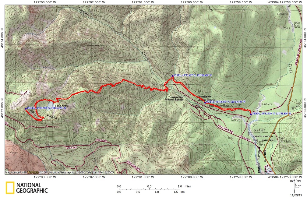
To Soda Peaks Lake: Length 4.8 miles, total ascent 3,069 feet, descent 463 feet.
To Soda Peak: Length 6 miles, total ascent 3,877 feet, descent 500 feet.
Total: Length 12 miles, total ascent 4,180 feet, total descent 4,180 feet. Lowest elevation: 1,263 feet. Highest elevation: 4,432 feet.
Trail:
Trapper Creek Trail #192, Trapper Creek Bridge #133A, Soda Peaks Lake #133 with connections to Dry Creek Trail #194 and Observation Trail #132.
Trail Maps:
Topo Map, Download Garmin .gpx file, Open Garmin .gpx file
Review: November 8th, 2019
Just a couple hundred feet from the trailhead, the trail curves gently to the left and the junction for Dry Creek Trail #194 is on the right. Stay on Trapper Creek Trail. At the second junction on Trapper Creek Trail, a 4-way junction, the trail to the left leads to an old Forest Road. The trail on the right is Observation Peak Trail. Continue straight on the Trapper Creek Trail into the Trapper Creek Wilderness.
Right after you cross Trapper Creek look for the junction for the Soda Peak Lakes Trail. There is a sign but you may not see it depending on where you cross the creek. You can cross on a slanted log which is slippery when wet or you can step across rocks when the creek is low.
Travel along the valley floor for about .5 mile then when a giant deadfall appears to block the trail make a sharp right and start climbing steeply up the hillside on a series of switchbacks. There have been old growth trees along the way but along this climb there are several gigantic Douglas fir trees along with some old growth cedar trees. These Douglas fir trees took to be at least 200 feet tall.
Continuing to climb up and up the relentless switchbacks the undergrowth changes to be Oregon grape, vine maple, huckleberries, beargrass, and some bunchberry dogwood.
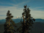
Eventually the ground becomes rockier and harder for trees to grow, opening up the views a bit so that you can see Mt. Hood and Mt. Adams through the trees. Every once in a while you’ll pass a grouping of massive Douglas fir and hemlock trees.
As you reach Soda Peaks Lake the undergrowth has changed to a mixture of salal, Oregon grape and bracken fern. There are a couple of campsites around the forested lake. To continue to Soda Peak, cross the outlet stream and climb up through the forest through a few switchbacks to a fairly open ridge with views of Mt. Rainier, Mt. Adams, and peeks of Soda Peaks Lake.
There are really no unobstructed views of the cascade peaks until you reach the ridge high above the lake. To reach Soda Peak leave the trail once the trail begins to traverse Soda Peak and it is an easy bushwhack up to the top of Soda Peak. The peak is treed over but you traverse a lovely meadow just a few hundred feet from the peak with great views of Mt. Adams.
Retrace your steps to return to the Trapper Creek Trailhead.
Enjoy the photos!!
Gallery Pics
Switchback Steve