White River Falls, OR
Vicinity Location: The trailhead is about 77 miles southeast of Portland, Oregon in White River Falls State Park.
Directions:
From Portland drive I-84 E to for about 84 miles US-197 S/US-30 W in The Dalles. Take and take exit 87.
Take Hwy 197 S for 28.3 miles and turn left onto Hwy 216 E. Drive 4 miles to the park.
No permits are needed to park here.
There are restrooms at the trailhead.
Length and Elevation:
Total distance is 0.8 miles. Elevation at the trailhead is 3,600 feet. Ascent 340 ft, descent 340 ft, maximum elevation 1,047 ft, minimum elevation 814 ft.
Trails:
White River Falls Trail
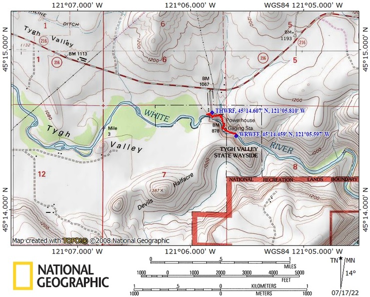
Trail Maps:
Topo Map, Download Garmin .gpx file, Open Garmin .gpx file
Review: June 7, 2022
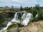
There are interpretive signs to tell you how the water created electricity. From the overlook area you can continue down a trail which is very steep and somewhat slippery even when dry down to the powerhouse. On the way down take a short side trail on the right to a viewpoint looking straight at White River Falls. Most days you can feel the mist coming off the waterfall. Continue down towards the river negotiating steep stairs to the old powerhouse.
Even though graffiti is prohibited, equipment is littered with graffiti. You can look through the bars and see the old generator room. There’s a nice boulder above the river by the powerhouse where you can sit and enjoy the falls in the river.
From here there’s a short trail heading downstream which comes out to a spot where the river has scrubbed the soil all the way down to bare basalt. You can walk out and get a nice view of another small waterfall.
Along the way you’ll pass by sagebrush, Desert parsley, dogwood bushes, and alder trees. Be careful where there is poison oak along the trail and watch out for rattlesnakes.
Enjoy the photos!!
Gallery Pics
Switchback Steve