

Vicinity Location:
About 30 miles northeast of Portland, OR in the Gifford Pinchot National Forest.
Directions:
From Portland take I-84 East and merge onto I-205 North towards Portland Airport/Vancouver. Drive past the Portland Airport Exit and cross the Columbia River. Move over to the right lane as you cross the bridge. Take exit 27 for Vancouver/Camas and move into the left lane on the off ramp heading towards Camas. Follow SR-14 for 25.9 miles through Camas and Washougal and past Cape Horn.
Turn left onto Duncan Creek Road and drive for 2.9 miles uphill to a small parking area just on the other side of Duncan Creek.
No permits needed to park
No bathrooms at the trailhead.
Length and Elevation:
Total length is 7.3 miles. Trailhead elevation is 1,011 feet. The elevation at the summit is 2,096 feet. Total ascent is 2,188 feet, total descent is 2,280 feet.
Trail:
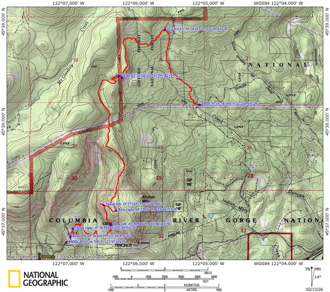
Duncan Creek Trail, Russ Jolley Trail, Archer Mountain Trail
There is at least one geocache for this trail at: N 45° 38.362 W 122° 05.270 Info at Geocaching.com
Trail Maps:
Topo Map, Download Garmin .gpx file, Open Garmin .gpx file
Review: April 3, 2024
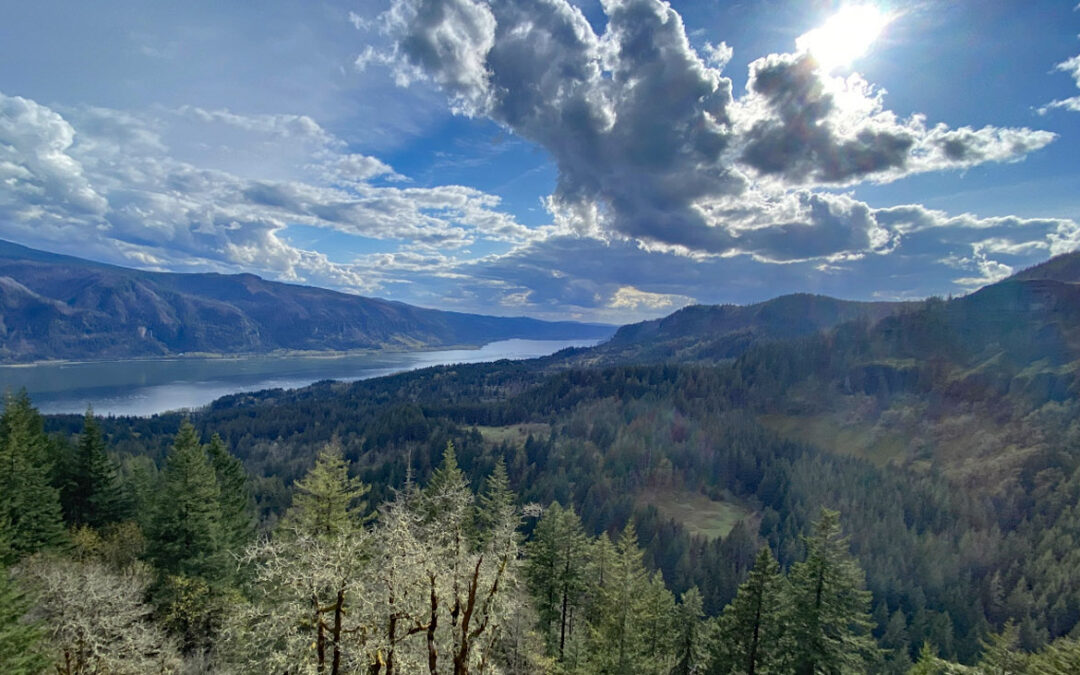
From the parking area, cross Duncan Creek and climb over the guard rail to find the trail which heads uphill. The trail is near the stream for a bit then crosses on foot-logs. From there the trail climbs steeply at times above the creek through a nice second-growth forest.
Enjoy the photos!!
Gallery Pics
Switchback Steve
Recent Comments