by Steve Jones | Apr 16, 2026 | Dayhikes |
Find the large parking lot on your right.No permits needed to park.Bathroom at the trailheadThe trail starts out going up stone steps and then is level for a short distance and crosses a railroad track. It is a gentle climb until the trail goes around a corner then it...
by Steve Jones | Apr 14, 2026 | Dayhikes, Hiking |
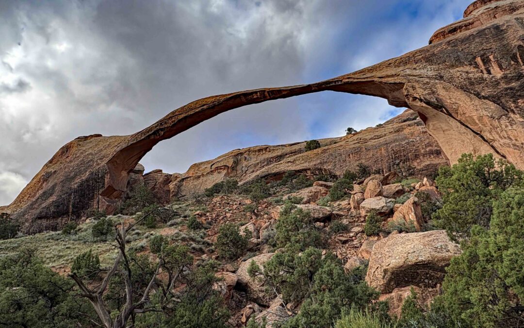
Vicinity Location: 814 miles southeast of Portland Oregon near Moab, UT in Arches National Park There are bathrooms in the parking lot. No pets allowed on this trail, and most National Park Trail National Park Entrance fee of $30.00 for a car 7 day pass or $25 for a...

by Steve Jones | Mar 5, 2026 | Dayhikes |
Vicinity Location: The trailhead is about 26 miles northeast of Portland, Oregon in the Yacolt Burn State Forest in Clark County. Directions:From Portland: The drive takes about 90 minutes from downtown Portland. Take I-205 North into Washington and drive about 4...

by Steve Jones | Feb 22, 2026 | Dayhikes |
Vicinity Location:The trailhead is about 67 miles west of Portland, Oregon near Clatsop State Forest. Directions:From Portland take Hwy 26 and turn south on Hwy 101. This hike goes through Weyerhaeuser land but public access is permitted during daylight hours. Park at...
by Steve Jones | Feb 20, 2026 | Dayhikes, Hiking |
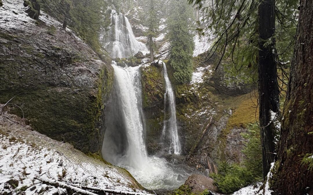
Vicinity Location:The trailhead is about 37 miles northeast of Portland, Oregon in the Gifford Pinchot National Forest. Directions:From Portland take I-84 to Cascade Locks. Take exit 44 and then the first right turn, just after you go under the Bridge of the Gods. Pay...
by Steve Jones | Feb 18, 2026 | Dayhikes, Hiking |
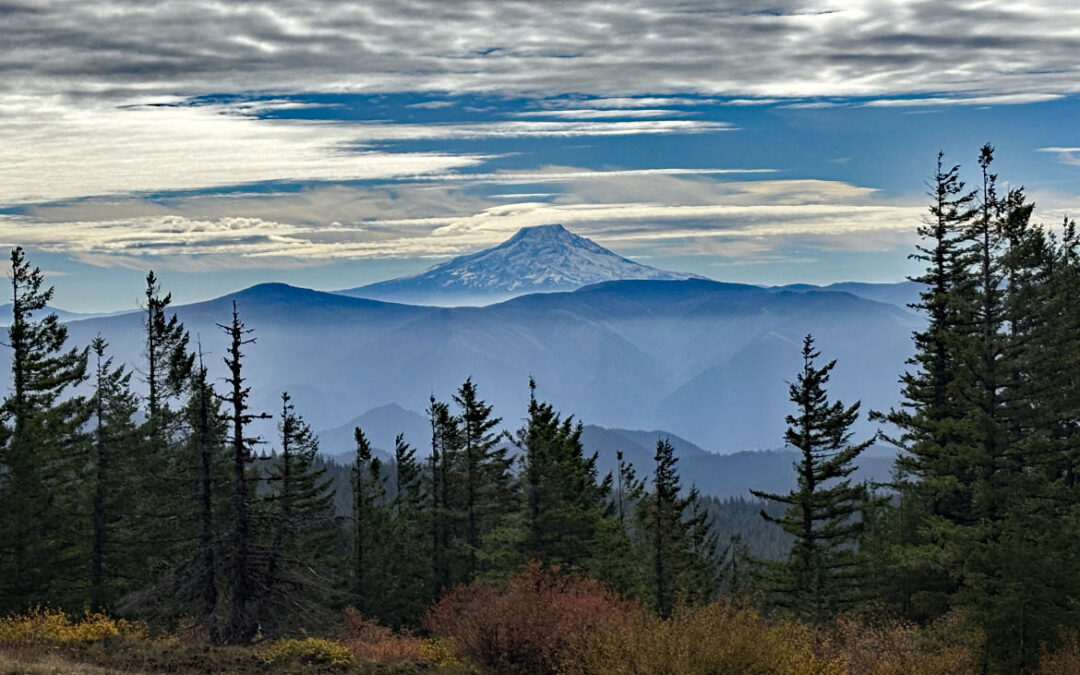
Park where FR68 crosses the Pacific Crest Trail Road & Access (FR 68)Access via Forest Road 68 is the most cited “downside.” FR68 is once again becoming notorious for deep potholes. High-clearance vehicles are strongly recommended to avoid scraping....
Recent Comments