

Vicinity Location:
The trailhead is about 37 miles northeast of Portland, Oregon in the Gifford Pinchot National Forest.
Directions:
From Portland take I-84 to Cascade Locks. Take exit 44 and then the first right turn, just after you go under the Bridge of the Gods. Pay the $3.00 toll, cross the bridge, and turn right onto Highway 14 and drive 2.5 miles to Stevenson.
Once you get to Stevenson, drive about 2 more miles east to the traffic circle and take the 2nd exit for Wind River Road. Wind River Road is 5.9 miles east of the Bridge of the Gods.
Drive on the Wind River Road for 8.6 miles and turn left onto Hemlock Rd and drive for 1.6 miles, crossing a bridge over Trout Creek.
Follow the road and turn right onto the small road that has the sign for the Arboretum Trail. Park in the small parking lot.
Length and Elevation:
Total trip is 14.7 miles. Elevation at the trailhead is 1,048 feet. Total ascent is 3,094 feet and total descent is 3,094 feet. Highest point is at 3,150 feet. Lowest point is 1,048 feet.
Trail Maps:
Topo Map, Download Garmin .gpx file, Open Garmin .gpx file
Trails:
FR41, Stevenson Ridge Trail, PCT 2000
Review: February 15, 2026
Walk back towards the cluster of houses and then up into the wind river Arboretum. You can stop and admire the big slab of Douglas fir near the parking lot. Head uphill on the middle fork of the three trails just past the big Douglas Fir slab. Keep heading up the hill, turning right to exit the Arboretum and then in about 100 feet you turn left onto the decommissioned Forest Service 41 Road.
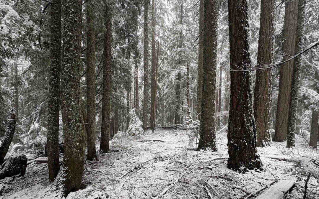
This is a lovely second growth forest with lots of Douglas fir trees, and lush undergrowth of sword ferns, Oregon grape and Salal.
After walking up the road about 0.6 mile, you’ll see an old shed on your left. You can look inside but there’s just junk in there. After a 1.25 mile of climbing steadily up the route, you pass a sign for for a study area. This study area encompasses most of the Martha Creek drainage, and there are some trails and sensors throughout the study area.
Continuing to climb, after about 3 miles of forest changes more to a mix of hemlock, Douglas fir, and cedar trees. These trees are much older than at the beginning of the trail.
The old road that is still in great shape, but it gets a little brushy. At 3.4 miles you pass above a small lake on the right that looks like you could make your way down to and camp at and maybe take a swim. After about 5 miles you enter stands of old growth trees with trees between 5 and 6 foot and diameter along the path.
At about 5.5 miles look for a cut through the brush on the left. This is the junction for the Stevenson Ridge Trail. For this review, I followed this up to Green Knob, which is just a forested knob with no views. After you return to the old road, the trail starts to level out and it has some rises and falls as it goes along a ridge.
In about 3/4 of a mile, you’ll reach signed junction for the Pacific Crest Trail. Turn right here and start following the Pacific Crest Trail towards Trout Creek. Along the way you’ll pass several rock cliffs where the trail has to dip and climb to get past. The trail traverses a steep hillside for a fair distance and some switchbacks to get down the hillside.
As you drop down the terrain becomes less steep and the trail in much nicer condition. At about 8.5 miles, you may notice the remains of trees. These were probably from the Yacolt Burn, 120 years ago. On many of the snags you can still see burn marks on the trunks.
At about 9.75 miles, you come to an overlook that looks out over the Trout Creek Valley, and down about 300 feet to Trout Creek. As you drop down from the viewpoint, gentle switchbacks lead towards trout Creek. The trail crosses the same stream three times, each time it gets a little bigger but it always remains a step across. At about 11 miles is another stream crossing that when the water is high, it is hard to get across on the stepping stones. This crossing is a challenge for people with poor balance and may have to be waded.
After a bit cross over Trout Creek on a nice concrete bridge and the trail continues on the other side of a forest road. This section is essentially flat and is an easy walk. This trail parallels the road back to the wind River Arboretum so there’s no advantage of walking down the paved road that’s by Trout Creek.
At about 12.25 miles you’ll come out to another road which you follow on the left for a couple hundred feet and the Pacific crest leaves the road. In a few hundred feet, you’ll get to another road. Turn right here and walk out to the paved road where you turn left. Walk down to the main road, stopping at the Hemlock picnic area if you would like, and walk towards the bridge , turning right crossing the bridge and returning to your car.
Enjoy the photos!!
Gallery Pics
Switchback Steve

Recent Comments