

Vicinity Location: The trailhead is about 26 miles northeast of Portland, Oregon in Clark County.
Directions:
From Portland, OR, take I-205 north to exit 30b to Battle Ground. Move over to the middle lane and proceed north on SR503 for about 10 miles to Battle Ground. Continue north on SR503 about 5 1/2 miles further and turn right on Rock Creek Road. Follow Rock Creek Road, turning into NE Lucia Falls Road for about 6.7 miles to the first parking area which is open year-round. If this small parking lot is full there is a larger parking lot on the right and up the hill in just 0.2 mile. This second parking lot can close during winter.
There is a bathroom at the trailhead and a bathroom building open seasonally in the park.
Length and Elevation:
Total trip is 1.1 miles. Elevation at the trailhead is 550 feet. Total ascent is 300 feet and total descent is 300 feet. Highest point is at 660 feet. Lowest point is 510 feet.
Trails:
Big Tree Creek Trail, Moulton Falls Trail with connections to the Chinook Trail (Bells Mountain Trail)
There is at least one geocache for this trail at: N 45° 49.931 W 122° 23.099 Info at Geocaching.com.
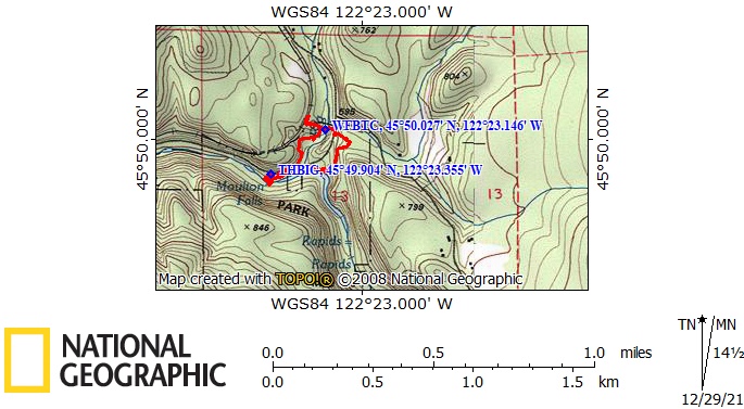
Trail Maps:
Topo Map, Download Garmin .gpx file, Open Garmin .gpx file
Review: February 9, 2021
From the trailhead parking lot walk east and use the first crosswalk which is on the west side of Big Tree Creek to go onto the other side of NE Lucia Falls Road.
Walk on the outside of the guardrail back towards Big Tree Creek and find the rough trail heading upstream. Wind through Douglas firs, past water seeps, and over mossy rocks along Big Tree Creek. Pass some broken down picnic tables, a steel rim pinioned by a tree, and reach slippery stone steps.
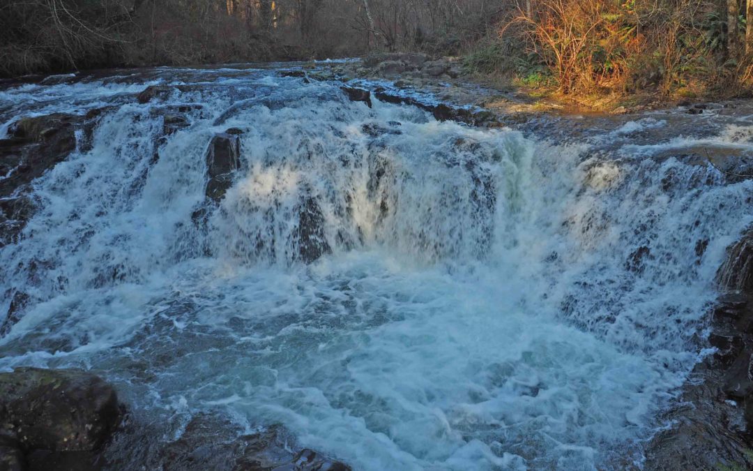
Here the trail forks and going to the left leads up the the Chelatchie Prairie Railroad which runs sightseeing trains from the nearby town of Yacolt. This railroad was built in the late 1800’s to haul timber out of the area. Head back down to the falls and enjoy the waterfall. In summer there will be people fishing below the falls and in the winter the bridge over the falls is open which prevents you from completing the loop.
This little swinging bridge is open in the winter to prevent logs from destroying the bridge and it is closed again sometime in the spring.
In summer walk across the bridge and climb up to NE Lucia Falls Road. Be careful using the crosswalk because people drive faster than the speed limit. Once safely across climb up the gravel trail to the upper parking lot. From the upper parking lot follow the main trail downhill towards the east fork of Lewis River. Follow the wide gravel trail down through the forest of second growth Douglas fir trees with undergrowth of sword ferns, salal, and vine maples. Bear right at the junctions, walking past the summer restrooms, and cross on a pedestrian bridge over Big Tree Creek.
You can take a side trip up to the bridge over the east fork of the Lewis River and continue down the Moulton Falls Trail by turning left at the second trail junction from the upper parking lot.
Once back at the main parking lot, walk to the downstream end of the parking lot and follow a short trail to viewpoints of Moulton Falls and trails that lead to the rocky riverbank next to the falls. Walk the short distance back to the parking lot to finish your hike.
This hike is good for children who are experienced hikers as there are dropoffs along the trail and climbing on the slippery rocks by the waterfall is a hazard. Make sure to keep your dogs on a leash so they don’t fall off the cliffs. This is an excellent area to picnic in and upstream of Moulton Falls is a popular swimming hole.
Enjoy the photos!!
Gallery Pics
Switchback Steve
Recent Comments