

Directions:
There is a pit toilet at the trailhead.
There is water at the trailhead all year.
No permit permits are needed to park.
Length and Elevation:
3.6 miles roundtrip. Elevation at the trailhead is 14 feet. Total gain is 240 feet and loss is 240 feet. Highest elevation is 33 feet and the lowest elevation 0 feet.
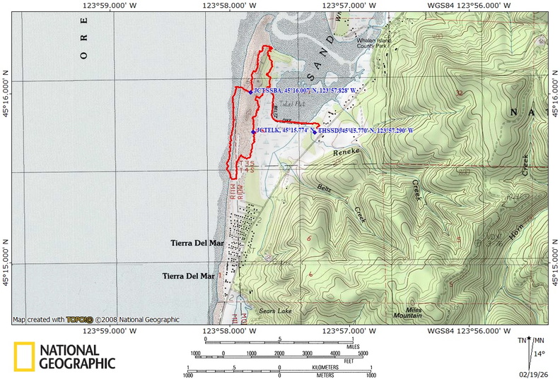
Trail Maps:
Topo Map, Download Garmin .gpx file, Open Garmin .gpx file
Trails: Beltz Dike Trail, Estuary View Loop
Review: December 6, 2024
The trail starts on the right side of the parking area and heads off on a causeway crossing wetlands.
Trees, salal, ferns, and blackberries grow along the edges of the trail, providing a shady walk on a sunny day.
After walking 0.5 mile, reach the first sign post which has fairly confusing directions, but the map clearly shows that you were walking on the Beltz Dike Trail and now you are turning right on the Estuary View Loop.
Turn right onto the needle covered trail and walk along the path which has been carved through the understory of brush. The trail becomes bumpy from the protruding roots of spruce trees.
Soon you’ll cross a boardwalk with a trail junction that has a shortcut for the loop, but bear right and the trail climbs a gentle hill.
Wind your way over small dunes and tiny valleys on your way to the beach. You can hear the roaring surf in the distance.
As you get closer to the beach, you will begin to see shore pines mixed in with Sitka spruce trees. It appears there are several game trails through different parts of the forest as well as a couple of user trails.
After another, about 0.5 miles, you will come to an area reserved for snowy plovers where the old trail to the right has been closed. Continue south for 0.3 mile to the end of the snowy plover nesting area where there is beach access.
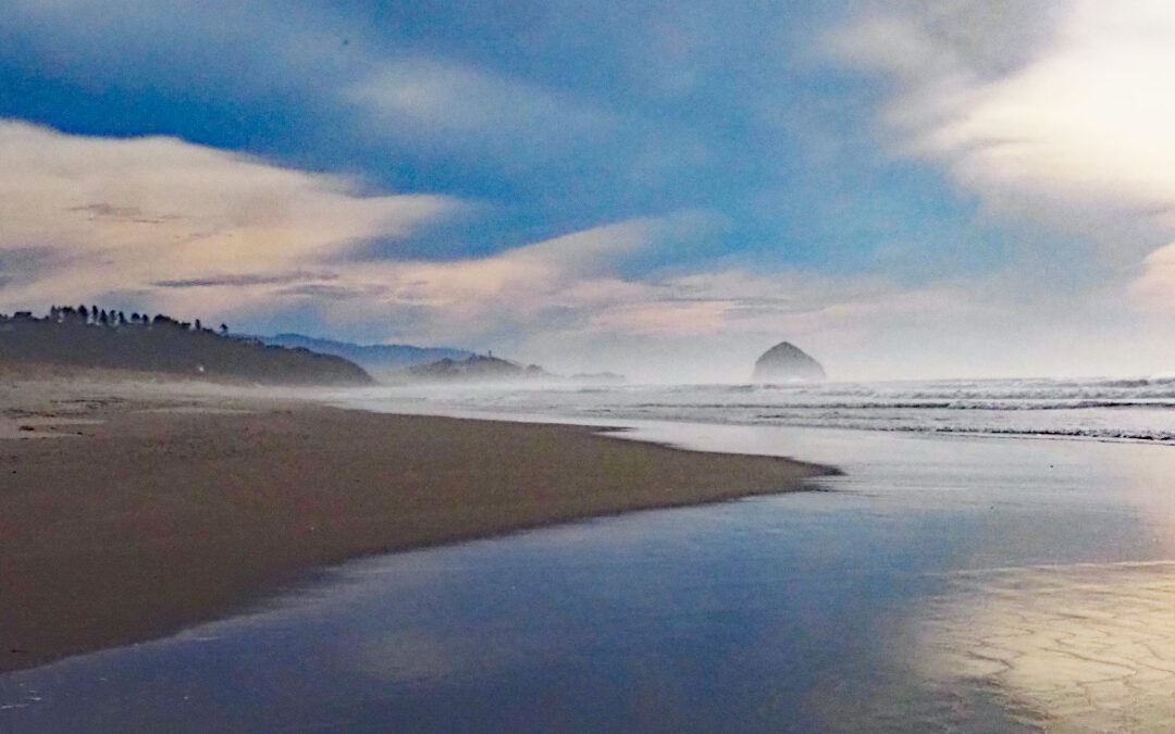
From this junction, the trail is all sand instead of a layer of organic matter. At about 1.4 miles from the trailhead you come to the junction for the beach access where you can turn to the right and go see the ocean.
This looks like a nice place to walk along a wide sandy beach. Take your shoes off and walk along the surf on the soft sandy beach.
At the next beach access sign leave the beach and walk into the scrubby forest where you take a left at the next junction. Here the trail is once again covered by pine needles and seems to be good for walking, barefoot.
After walking about 0.1 mile you’ll reach another trail junction where you turn right on the Kinnikinnik Woods Loop.
At about 2.5 miles from the trailhead, you will reach the junction for Elk Knoll Trail, which is just a short little loop on the right. Walk along this gently winding sandy trail through the forest to views of the wetlands.
Return back on the same trail and then turn right to continue back towards the trailhead through the forest of pines and spruces.
Once again, turn right at the next trail Junction to head back to the trailhead and parking lot.
Enjoy the photos!!
Gallery Pics
Switchback Steve
Recent Comments