

Notice: 12/21/2023 There is a large tree down across three switchbacks leading down to the bridge over Oneonta Creek. Consider using the Oneonta Trailhead.
Vicinity Location:
About 30 miles east of Portland, OR in the Columbia River Gorge National Scenic Area.
Directions:
From Portland, OR, take I-84 east past Troutdale to exit 28 or exit 35. The easiest way to get to the trailhead is to go east from Portland and take exit 28 from I-84. This is the Bridal Veil exit. Drive about .3 miles to the stop sign and turn left, heading east on the Columbia River Scenic Highway. After about 3 miles from the stop sign, you pass Multnomah Falls. Follow this road for about 3 more miles to the parking lot for Horsetail Falls.
If you take exit 35, then head west on the Columbia River Scenic Highway back towards Portland for about 1.4 miles and look for parking. Be aware parking fills up fast all along the Columbia River Scenic Highway on weekends.
To return to Portland, drive east and cross underneath the freeway in about 1.3 miles, then follow the road as it loops around and merges onto the westbound I-84 back to Portland.
From Hood River, OR, take I-84 west to exit 35. Cross underneath the freeway and drive west on the Columbia River Scenic Highwayfor about 1 mile.
To return to Hood River, drive east for about 1.5 miles and merge onto I-84 east to Hood River.
No restroom facilities or drinking water is available at the trailhead. The closest water and bathrooms are at Ainsworth State Park, .5 mile east of Horsetail Creek. There is a water fountain just before the bathrooms, along the road near the day use area.
Length and Elevation:
4.9 miles roundtrip. Trailhead elevation: 50 feet. 1,710 feet gain, 1,710 feet loss. 690 feet at the highest point
Trail:
Columbia Gorge Trail #400 and Oneonta Trail #424 with connections to trails 400, 245, 427, and 459
There is at least one geocache along this trail at: N 45° 35.232 W 122° 04.466 Info at Geocaching.com
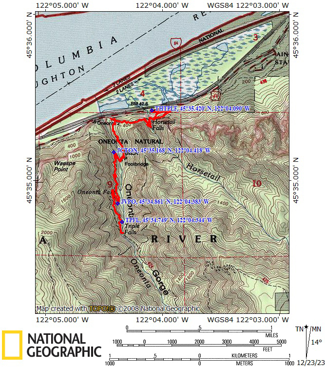
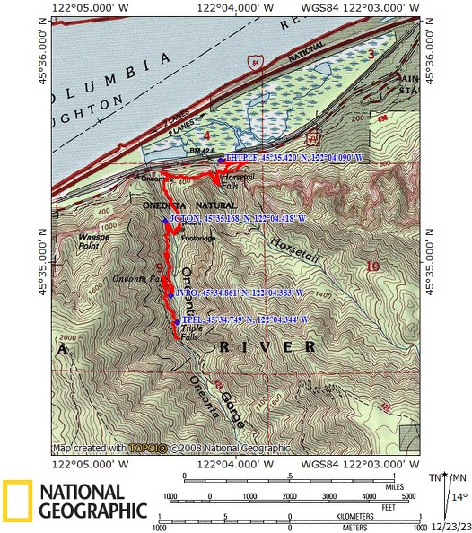
Trail Maps:
Topo Map, National Forest Service Map, Download Garmin .gpx file
Review: July 12, 2008, March 29, 2009, December 20, 2023
The trailhead is just east of Horsetail Falls. Enjoy some time admiring how Horsetail Falls arcs out from the cliff and falls into a pool right next to the highway.
Climb up a few switchbacks on the trail to the junction with Trail 400. Turn right and walk towards Horsetail Creek.
The trail climbs up a few more switchbacks, then turns left into the canyon for Horsetail Creek. The trail drops down a bit and goes behind Ponytail Falls. While walking behind the falls, stop to admire the blocks of basalt above your head. You can see how the creek wore away the soft layer of ground where the trail is. This is a great place to enjoy a cool breeze on a summer day.
The trail angles up and around the other side of the canyon, then levels out and passes a short side trail to an overlook of the Gorge. There are nice viewpoints looking to the east at the top of the tall cliffs. There is also a sign to be taken as a note of caution, a concrete memorial to Glenn Replogle who fell from the cliffs in this area in 1988.
The trail turns into the next canyon which holds Oneonta Creek. About halfway down the switchbacks that lead to a bridge over Oneonta Creek, look towards the Columbia River and you have a glimpse into the narrow Oneonta Gorge with the creek 200 feet below. Drop down the remaining switchbacks, cross the creek, then climb several switchbacks to the junction to trails 428, 434, and 424. Take a left at this junction and head south on the Oneonta Trail.
At JVPO, 45° 34.846’ N, 122° 04.425’ W is a small user trail that climbs over tree roots at the turn of the switchback and goes to a tiny waterfall about 75’ off the trail. See if you can find this trickling waterfall.
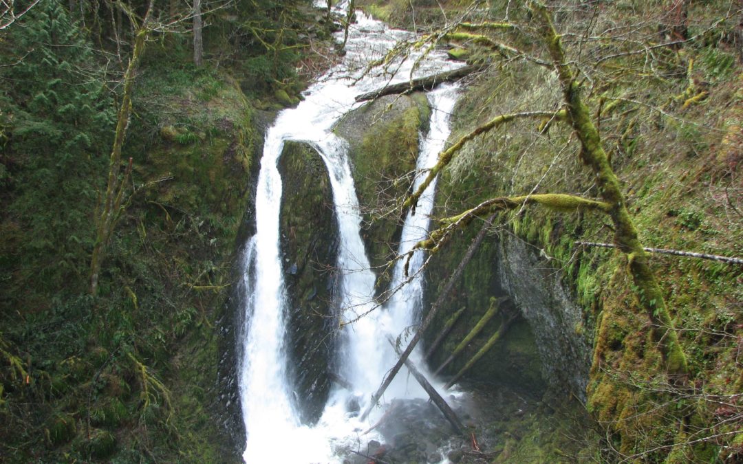
Take the short side-trail for a nice view of Triple falls and the plunge pool at the bottom. Just after Triple Falls is a small stream and cascading waterfall. This is a good point to turn around and return to the trailhead.
After passing behind Ponytail Falls again, pass by the Licorice Fern covering the rocks and after going down a few switchbacks, you come back to the junction with trail 400. Trail 400 continues to the right. Turn left and walk downhill back to the parking lot.
Enjoy the photos!!
Gallery Pics
Switchback Steve
Recent Comments