

Vicinity Location:
The trailhead is about 45 miles West of Portland, OR, in the Tillamook State Forest.
Directions:
From Portland, take Highway 26 west for about 20 miles. Take the left exit for Hwy 6 towards Banks, Tillamook, and Forest Grove. This is also known as the Wilson River Highway.
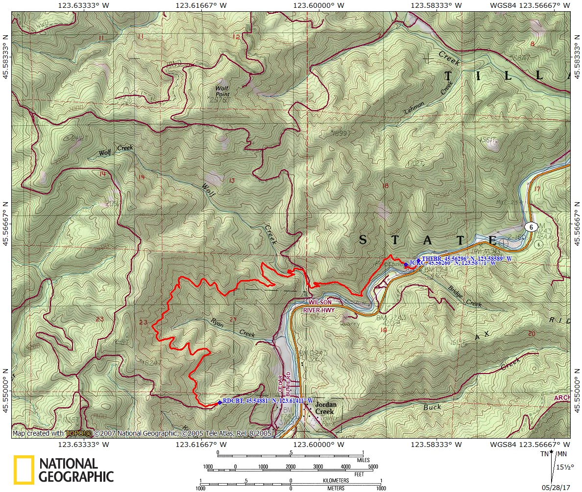
Continue on Highway 6 for 34.2 miles from the junction Hwy 26 and Hwy 6 and make a right onto Cedar Butte Rd.
Drive up Cedar Butte Road for about a mile and park on an uphill shoulder where the trail leaves the road from the right.
The road is fairly steep here and there is parking at a wide shoulder.
There are bathrooms at the official trailheads but not at the road crossing.
No permits needed to park.
Length and Elevation:
Distance is 4.2 miles one way. Trailhead elevation is 1,000 ft. Highest point is 1,289 feet in elevation. Lowest point is 469 feet in elevation. Elevation gain is 1,905 feet and elevation loss is 2,525 feet.
Trail:
Wilson River Trail – Keenig Creek to Footbridge. Connections to Footbridge to Jones Creek Trail.
Trail conditions (sometimes out of date)
Trail Maps:
Topo Map, State of Oregon Map, Download Garmin .gpx file
Review: 5/18/2017
Parking up Cedar Butte Road and parking where the trail crosses the road cuts off about 500 feet of elevation gain. The road is fairly steep here and there is parking at a wide shoulder.
From Cedar Butte Road, head east and enter the forest. The trail isn’t marked but is obvious. Walk along the trail which is fairly level at first but you soon start a rock and roll trip. The trail skirts along a watershed and though you climb up along a ridge you soon realize you are nowhere near the top of the mountains.
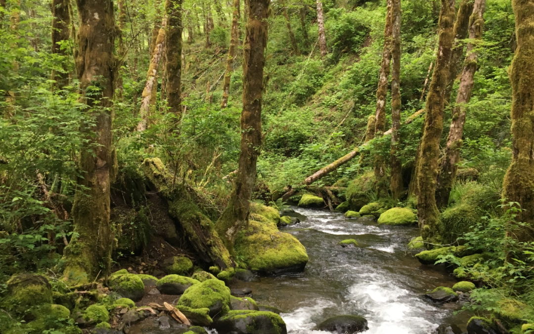
Many streams cross the trail in winter and spring before Wolf Creek. All are easy to step across and a couple of streams have waterfalls above the trail. There are some nice views into the drainage of Ryan Creek and of the mountains but mostly you’re in a forest of alder and maple. The trail is fairly well maintained and the forest canopy helps to keep brushy undergrowth manageable.
Even though the beginning and ending elevations are nearly the same, the trail constantly rises or falls, never staying level for more than one or two hundred feet.
After a couple of miles there are several switchbacks leading down to Wolf Creek. As of this review, the official bridge is out.
After the creek, climb up a bit to a Forest Service road and head downhill about 500 feet where the trail climbs up into the forest from the left side of the road.
Back in the forest you continue to rock and roll first up then down until you reach the signed junction where going right leads to the Footbridge trailhead. Heading towards the trailhead you pass a little side trail that leads to a nice view of the Wilson River. Here you can see a little of the footbridge and popular swimming holes along the river.
Cross the flood channel of the Wilson River then cross the sturdy bridge over the Wilson River and walk along a paved path to the large parking area.
Enjoy the photos!!
Gallery Pics
Switchback Steve
Recent Comments