

Vicinity Location:
The trailhead is about 70 miles southeast of Portland, Oregon in the Willamette National Forest.
Directions:
From Portland:
Drive to Marion Forks and turn right on to FR1168 for 2.3 miles. The turnoff is just before the sign for Coffin Mountain Trail and Bachelor Mountain Trail.
Drive 2.5 miles on a gravel road. Turn right and drive about 0.5 mile to the trailhead.
To get Bachelor Mountain from Coffin Mountain, turn left at the main road, drive about 0.75 mile on FR1155, turn left again, and drive about 0.5 mile to the trailhead which is at the end of the road.
It is a small parking lot with a couple of overflow parking areas just before the trailhead.
There are no bathrooms at the trailhead and no permits needed to park.
Length and Elevation:
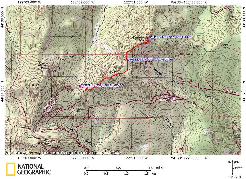
Total length is 4.2 miles. Trailhead elevation is 4,824. The elevation at the summit is 5,942 feet. Total ascent is 1,100 feet, total descent is 1,100 feet.
Trail:
Bachelor Mountain Trail #3420 with connections to Bugaboo Ridge Trail #3423
Trail Maps:
Topo Map, Download Garmin .gpx file
Review: July 13th, 2019
The trail starts out steeply and almost immediately enters a tall dense forest of hemlock and fir trees. The trail is very nice as it is covered in a layer of tree needles, cones, and small sticks.
Anemones, Sitka Valerian, daisies, thimbleberry, beargrass, and columbine are some of the flowers that dot the forested slopes on the lower portion of the trail as it switchbacks up the mountainside.
About 2 miles from the trailhead is a junction for Bugaboo Ridge. Turn left here for Bachelor Mountain.
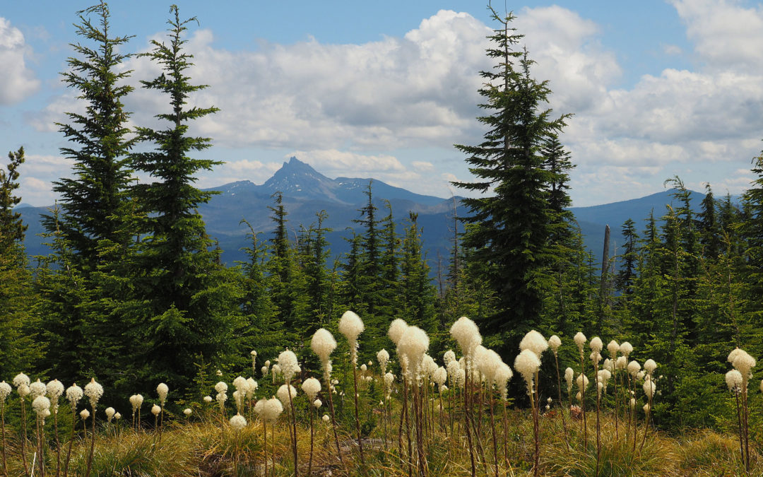
As you climb, the slopes become more and more open. Off to your right you can’t miss seeing two prominent mountains, Three-fingered Jack and Mt. Washington in the distance., Three-fingered Jack is on the left and you can see the 3 peaks of the mountain, and to the right is Mt. Washington.
The trail really shows off that it is in a volcanic landscape because you’ll notice many of the rocks along the trail are pockmarked with gas bubbles.
There is a lovely patch of beargrass that blooms in June and July where the trail levels out and enters a lovely mountain meadow.
After passing through the meadow, briefly dip down before climbing up through the trees and out onto the open slopes of Bachelor Mountain. The trail crosses up a scree slope then makes a sharp turn to the left right at the summit of Bachelor Mountain Summit, From the summit you have a 360 degree view of the area. You can see Detroit Lake, Mt. Jefferson, Three-fingered Jack, Mt. Washington, and all the small peaks in between.
There was an old fire lookout here and like many fire lookouts that were decommissioned, this one appears to have been burned because of the fused glass that is on the ground.
There are some nice places to sit with a view of Mt. Jefferson, just to the east of the flat-topped summit. Once you are done savoring the view, return back down the way you came up, remembering to turn right at the junction for Bugaboo Ridge so you return to your car at the correct trailhead.
Enjoy the photos!!
Gallery Pics
Switchback Steve
Recent Comments