
Directions:
From Portland, take Highway 26 west for about 20 miles. Take the left exit for Hwy 6 towards Banks, Tillamook, and Forest Grove. This is also known as the Wilson River Highway. Continue on Highway 6 for 51 miles to Tillamook. This highway, and around Tillamook usually have patrol cars looking for speeders. Turn left onto Hwy 101 S, Main Ave and drive two blocks. Turn right onto 3rd St and go 1.4 miles. Bear left onto Netarts Hwy W and drive 3.5 miles. Get into the left turn lane and make a left onto Whiskey Creek Road and drive 5.2 miles. Turn right onto the road into Cape Lookout State park and drive 1.1 miles into the day-use parking area.
At Tillamook, there are signs to Cape Lookout State Park.
State Park Day use permit for $3 or an annual Oregon State park permit is required for day-use parking.
Flush toilets and water available. Campground and trail conditions are available by calling the Oregon State Parks Information Center (1-800-551-6949)
Length and Elevation:
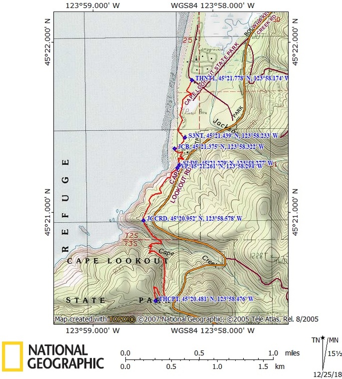
2.3 Miles one way. Elevation at the trailhead is 15 feet. Elevation gain is 1,155 feet and loss is 300 feet to the junction with Cape Trail. High point on the trail is 870 feet.
Trail:
North Trail (Cape Lookout Coastal Trail) with connections to Cape Trail and South Trail.
Trail Maps:
Topo Map, Download Garmin .gpx file
Review: September 1, 2008
The trail start at the south end of the day use area but start at the Cape Lookout Nature Trail near the check-in station if possible.
If you would like to learn the common names of some common plants growing in the forest then pick up a guide for the Nature Trail. Begin at the Nature Trail and walk on the western side of the level loop learning about some of the native plants of the area. Leave the Nature Trail at the Hiker/Biker Campground and walk to the Day use parking lot. Continue walking south past the picnic area and follow the North Trail signs. Soon you pass over shady Jackson Creek as the trail climbs gently using a jeep trail.
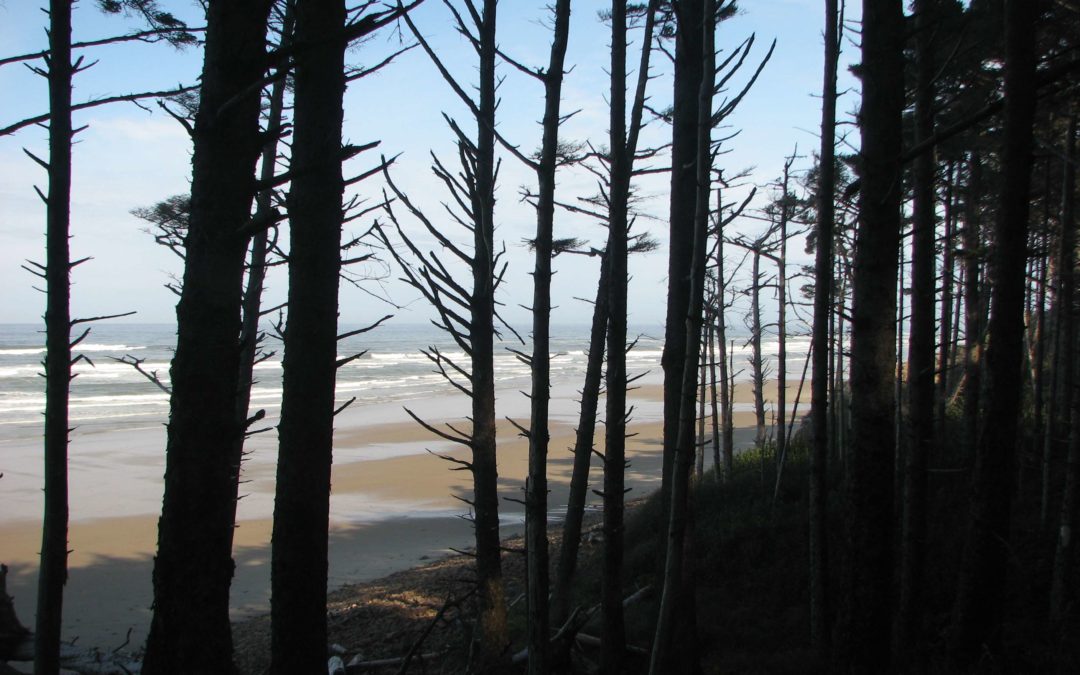
In about .2 miles, look for where there is a North Trail sign for the trail to leave the jeep path. The path passes through a forest of open fir trees with the ocean as a backdrop. The trail drops down to a signed trail leading down to the beach. From the trail junction, climb a few switchbacks and continue past a trickle stream and slippery spot in the trail. The undergrowth here is dense with salmonberry and salal bushes. It is a wonder how early explorers travelled through this undergrowth. Enjoy the ocean vistas as you climb farther and farther above the ocean.
After about 1.2 miles from the campground, the trail rounds a corner and heads inland and downhill to cross Cape Creek. After crossing Cape Creek, it is a steady climb up the junction with Cape Trail, South Trail, and a parking lot.
This trail is okay for children who are experienced hikers. There are steep dropoffs and slippery areas along the trail. This hike can be made into a shuttle hike by starting at the upper parking lot and hiking towards Cape Lookout Campground and day use area.
Enjoy the photos!!
Gallery Pics
Switchback Steve
Recent Comments