

Directions:
From Portland, take Highway 26 west for about 20 miles. Take the left exit for Hwy 6 towards Banks, Tillamook, and Forest Grove. This is also known as the Wilson River Highway. Continue on Highway 6 for 51 miles to Tillamook. This highway, and around Tillamook usually have patrol cars looking for speeders. Turn left onto Hwy 101 S, Main Avenue, and drive two blocks. Turn right onto 3rd St and go 1.4 miles. Bear left onto Netarts Hwy W and drive 3.5 miles. Get into the left turn lane and make a left onto Whiskey Creek Road and drive 7.9 miles. Turn right into the parking area at the top of the hill.At Tillamook, there are signs to Cape Lookout State Park.
No permits are required to park.
No bathrooms are available. The closest water and bathrooms available are at Cape Lookout State Park, though you may have to pay the day-use fee.
Length and Elevation:
4.8 Miles round trip. Elevation at the trailhead is 870 feet. Elevation loss is 670 feet and gain is 200 feet to the turn around point. High point on the trail is 870 feet.
Trail:
Cape Trail (Cape Lookout Trail) with connections to South Trail and North Trail.
There is at least one geocache along this trail at: N 45° 20.249 W 124° 00.170. Info at Geocaching.com
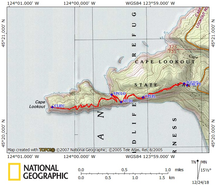
Trail Maps:
Topo Map, Download Garmin .gpx file
Review: September 5, 2005, April 4, 2018
Take the trail at the west end of the parking lot and walk along the trail about 300 feet to a trail junction and continue straight down the trail.
The path passes under a canopy of tall Douglas firs, Sitka Spruce, hemlock trees, and heavy salal and salmonberry underbrush. Enjoy the mosses and ferns that only a rain forest can support. Look for the ferns and other plants growing high above the ground on the tree trunks of the Sitka spruces. The trail wends its way from one side of the cape to the other as it goes out to the end of the cape.
After about .6 mile is an opening along the cliffs to the south with views of Haystack Rock and Cascade Head. This spot is near where a B-17 bomber crashed on August 1, 1943 in heavy fog. Look for a plaque along the trail talking about the four engine Army Air Force plane that crashed 500 ft. west of the memorial plaque.
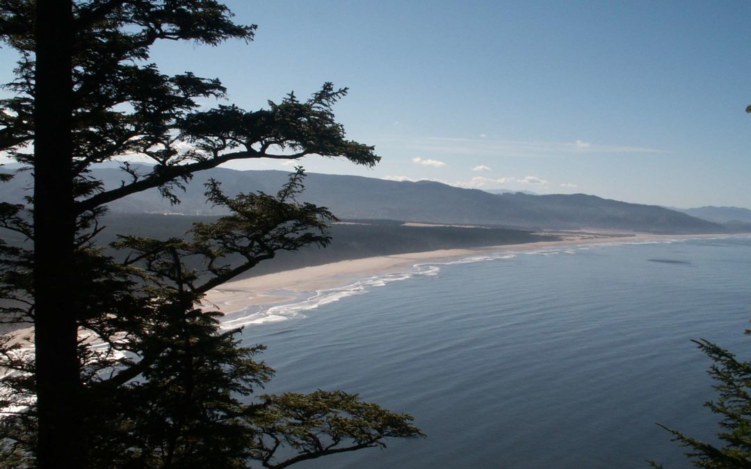
After walking another 0.6 mile you come to a clearing with views to the north of Three Arch Rocks and Cape Meares. Shortly after the viewpoint, the trail uses a boardwalk to cross a muddy patch in the trail. There is a bench where you can sit to enjoy the views from the end of the trail at the top of 200 foot cliffs overlooking the ocean. The views of the ocean and coast are superb. The cliff-top viewpoint offers views of Cape Kiwanda and Cascade Head to the south, and Cape Meares, Garibaldi, and Neahkahnie Mountain to the north. You can see whales during the months of their migration. It is surprising that Cape Lookout juts out over 2.5 miles into the ocean.
This trail is not recommended for young children because of the cliffs along the trail and at the end of the trail.
Enjoy the photos!!
Gallery Pics
Switchback Steve
Recent Comments