by Steve Jones | Feb 18, 2026 | Backpacking Trips |
Vicinity Location: About 54 miles southeast of Portland, OR in the Bull of the Woods Wilderness You need a Northwest Forest Pass for parking. Fill out a free wilderness permit at the trailhead. There are no bathrooms at the trailhead. Length and...
by Steve Jones | Oct 16, 2024 | Backpacking Trips |
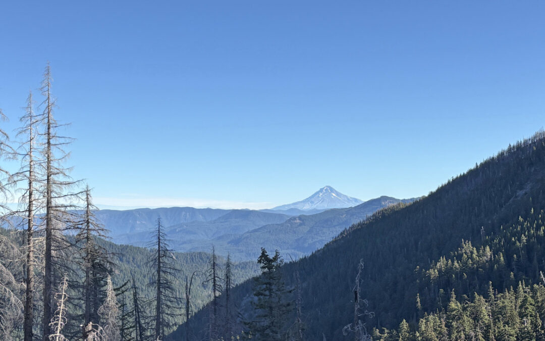
Vicinity Location: About 75 miles northeast of Portland, OR in the Gifford Pinchot National Forest.Directions: From Portland: Drive east on I-84 about 58 miles and take exit Take Exit 64 for Highway 35, White Salmon, and Government Camp down to the...
by Steve Jones | Sep 7, 2024 | Backpacking Trips |
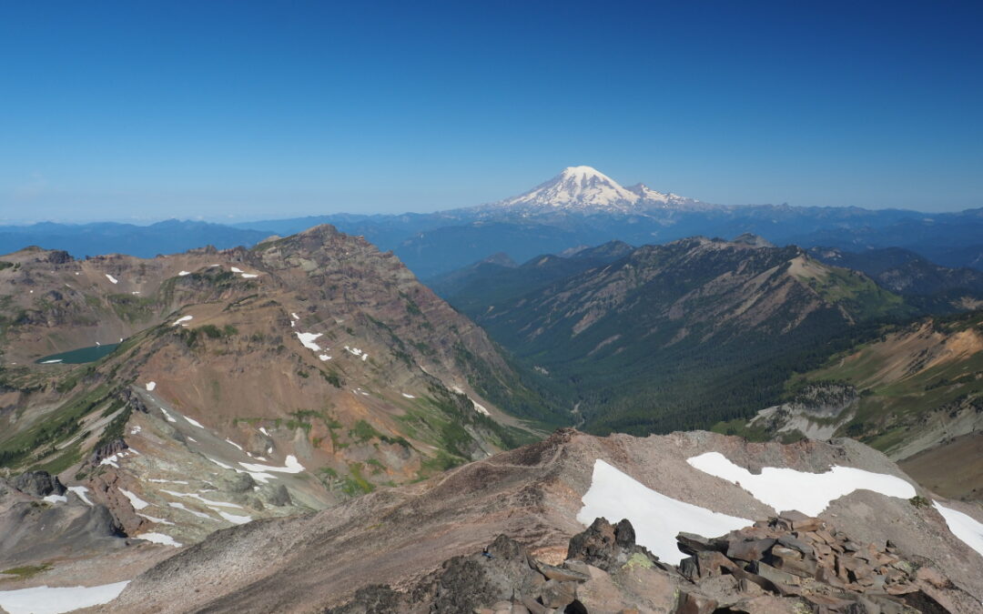
Vicinity Location: About 90 miles northeast of Portland, OR in the Gifford Pinchot National Forest.Directions: From Portland: Drive north on I-5 and take Exit 68 for US-12 E toward Morton/Yakima. Drive about 62 miles and turn right...
by Steve Jones | Mar 18, 2024 | Backpacking Trips |
Vicinity Location: The trailhead is about 7,200 miles southeast of Portland, Oregon in the Los Glaciares National Park, Argentina. Directions:We arrived after a long bus ride crossing the border from Chile to Argentina. It was an easy border crossing. We stopped at a...
by Steve Jones | Mar 18, 2024 | Backpacking Trips |
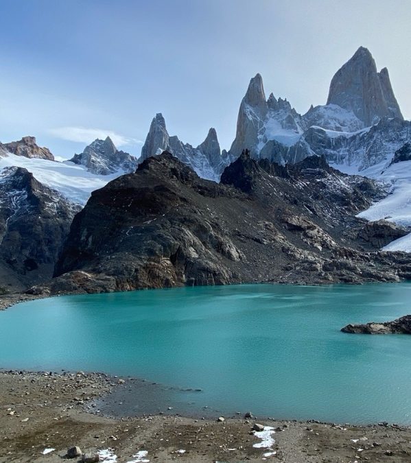
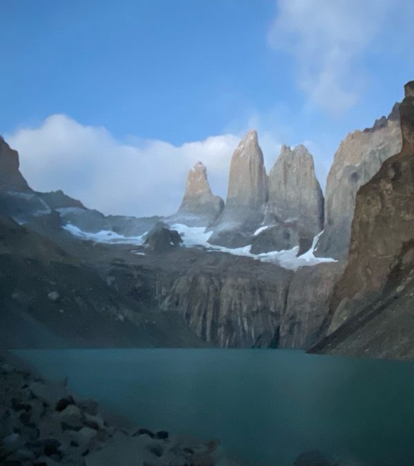
Vicinity Location: The trailhead is about 7,300 miles southeast of Portland, Oregon in the Torres del Paine National Park, Chile. Directions: Two days of flying brought us to Punta Arenas. We stayed at a homestead style AirBNB between the airport and town. Cell...
by Steve Jones | Dec 29, 2023 | Backpacking Trips |
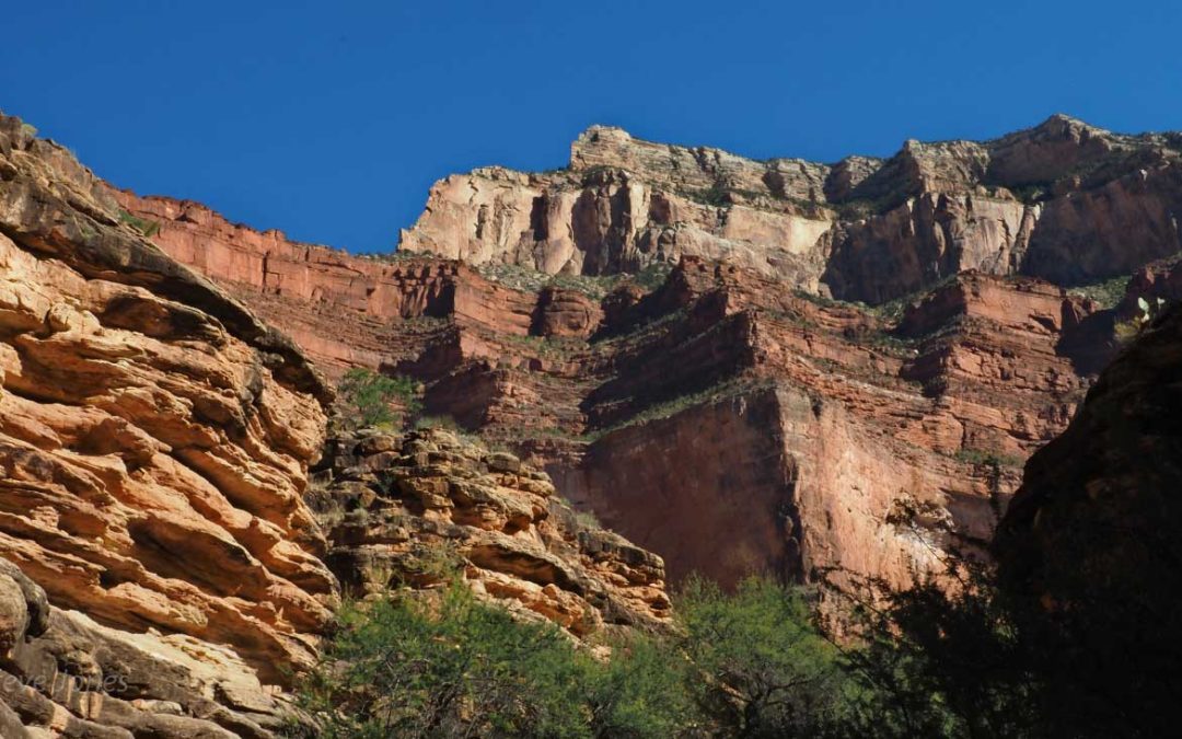
Vicinity Location:About 850 miles southwest of Portland, OR in Grand Canyon National Park.Length and Elevation:33.3 miles roundtrip + 7.3 mile car shuttle. Elevation at Bright Angel Trailhead is 6,835 feet. Total gain is 10,310 feet and loss is 10,178 feet for...
Recent Comments