

Vicinity Location:
About 675 miles northeast of Portland, OR in Glacier National Park.
Directions:
From Seattle, WA or Portland, OR – Take the Amtrak Empire Builder or drive to East Glacier Montana.
National Park permit need to park or enter the park.
No dogs are allowed on trails in the park.
Length and Elevation:
49 miles
11,118 feet of elevation gain
10,912 feet of elevation loss
Daily Stats:
Two Medicine Trailhead – 5,192 feet in elevation
Night 1 camp – 5,797 feet in elevation
7 hours of travel time
Traveled 11.5 miles
2,831 feet of elevation gain
2,226 feet of elevation loss
Night 2 camp – 4,708 feet in elevation
8 hours of travel time
Traveled 15.2 miles
2,773 feet of elevation gain
3,868 feet of elevation loss
Night 3 camp – 5,337 feet in elevation
6 hours of travel time
Traveled 10 miles
2,291 feet of elevation gain
1,550 feet of elevation loss
Night 4 camp – 5,337 feet in elevation
5 hours of travel time
Traveled 6.4 miles
2,070 feet of elevation gain
2.070 feet of elevation loss
Day 5
Finished at Jackson Glacier Overlook – 5,304 feet in elevation
5 hours of travel time
Traveled 5.9 miles
1,153 feet of elevation gain
1,198 feet of elevation loss
Trail:
Continental Divide Trail with connections to multiple trails.
Trail Maps: Topo Map, Download Garmin .gpx file
Review: August 7, 2017
Monday 8/7/17 – Three of us arrived in East Glacier on the Empire Builder from Portland at about 10:30 in the morning. Sean and I had booked a sleeper car and Lori slept fitfully in the seats. The train was sold out for one portion of the trip but Lori saw some empty seats in the train.
We walked over to the Glacier Park Lodge and found the earliest shuttle for Two Medicine was at 12:30 the next day. Julie at the concierge gave us a couple of places to call and by the late afternoon we had a 6:40 shuttle from our hotel to the ranger station at Two Medicine. That was stressful and now I know shuttles around East Glacier should be booked at least a month in advance.
We checked into the Sears Motel, a kind of run-down place with a very friendly proprietor. The rooms aren’t air conditioned but even when the day gets to 80 degrees, the rooms cool down okay at night. Lori V. was able to get a nice tent site there too. We walked over to the very small town of East Glacier and I bought fuel and a long-sleeved wicking tee-shirt because I had forgotten to pack one.
Later we hung out at the lodge and looked at wonder at the huge tree trunks that support the building and roof. Something like this is irreplaceable because of the huge old-growth trees that were used in the construction. When we split up, I took the short walk to town again and got an ice cream cone because I wanted something I couldn’t get on the trail.
Don and Lori K. also had trouble arranging a shuttle form East Glacier to drop off their car at Lake McDonald, our end point. Finally, they found a person willing to shuttle them for $130, again reinforcing making advance shuttle reservations. We all had dinner at the Mexican food place in town and then went back to the hotel for the night. Don and Lori K. left to shuttle their car and got back to the hotel about 11 pm after coming back through a thunderstorm.
Tuesday dawned cloudy and cool after the rainy night and some of us went to the bakery across the street for breakfast pastries and coffee and it wasn’t long before our shuttle arrived to take us into the park. Don and Lori K. told us that cell coverage is spotty in the area for both Verizon and T-Mobile and they had problems calling their shuttle driver. Our shuttle got us to the ranger station just before it opened at 7:00 a.m. and there were two groups in front of us. They were both walkups and it took the ranger 45 minutes to arrange trips for them. Meanwhile Don and I watched the video about Leave No Trace and bear encounter scenarios. It took us less than 10 minutes to get our permit then it was off to the general store, which is about 500 feet from the ranger station, for some nice coffee and last-minute items. Lori K wanted a latte but was sad to find that the machine was broken.
We walked back past the ranger station and along the road through the campground to start our backpack. We followed the road along the lakeshore, to space 90 where we looked left to see the trailhead for Dawson Pass Trail and the Continental Divide Trail across a stream. The sign across the bridge says Pitamaken Pass Trail but it is the trail we want to take.
We turned right after crossing the bridge and followed the trail as it rose up above Two Medicine River. The trail mostly rises gently but has a few dips as it crosses and then parallels Dry Fork Creek. The glacial valley has a lot of red jasper along the trail and a rainbow of colors in the pebbles of Dry Fork Creek.
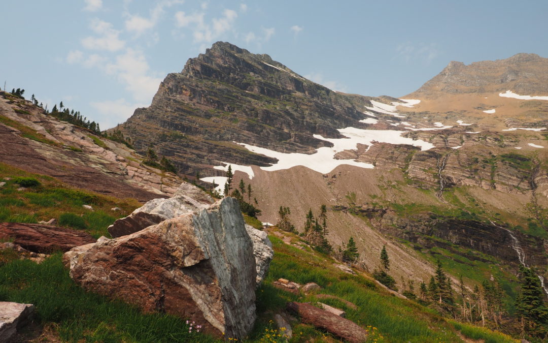
All the bigger creeks have bridges which were easy to cross and it seemed we were above Oldman Lake pretty quickly. The trail was rocky but not really rough. From above the lake it was another hour up the steepening trail to Pitamaken Pass where we had lunch. Looking back over the forest there are a lot of skeleton trees that were killed by bark beetles. From the pass, we climbed a bit farther then started dropping down fairly rapidly between the two lakes on the other side of the pass.
We passed the trail junction for Cut-Bank Pass and kept to the right. Soon we were in the forest, passed a lovely little waterfall, and found the junction to Morning Star Camp. We got our food hung on the bear pipe, which is like a 15-foot-tall staple. The camp has three nice sites and an outhouse.
We thankfully took off our packs. Lori V, Don and I had about 40 pound packs. Lori K had about 35 pounds and Sean had about 50 pounds. After we got water from the lake and compared menu items as we made dinner. Three of us dehydrated our dinners and Don and Lori K. had Mountain House. After dinner we planned some future day-hikes and headed for bed. The trail this day was very well maintained and having lightweight hiking shoes were great.
A lot of the flowers were bloomed out but there were some places where they were still really nice. The campsites are level and you can glimpse the lake through the trees. The mountains are all striated and tower above the valley.
Wednesday, day two dawned perfectly clear and no one heard anything alarming during the night. We gathered at the food prep and food hanging area for breakfast. The lake was a perfect mirror and it had mists rising when I first got up and went to check out views around the lake. Everyone got ready and we left Morning Star Camp about 8:45 am. We wound along the edge of the valley sometimes near the bottom and sometimes climbing up a bit to overlook the flat valley filled with golden grasses and willows.
After about three miles we turned left at the junction for Cut-Bank and started climbing up towards Triple Divide Pass on the Continental Divide Trail.
We passed Atlantic Camp and the junction to Medicine Grizzly Lake. Atlantic Camp is mostly in the trees and didn’t appear very scenic. From there it was a moderate climb up the side of Mt. James for a couple of hours. The views were incredible as we climbed above the trees and up the red slate trail.
After a while there were some flowers and only a few scrubby bushes on the rocky mountainside. There were no switchbacks, just a long steady climb up the glacial valley to Triple Divide Pass. Sean saw some big horn sheep run down the mountain and cross the trail as he approached Triple Divide Pass. Thankfully we all had enough water as we climbed up the sun-blasted trail because there was no snow or water at the pass.
The views were amazing on both sides of the pass. The marmots there will sneak behind your back and take things. They got someone’s trekking poles and chewed on the handles and straps for the salt. When someone walked towards them one of the marmots drug the pole into the bushes.
From the pass we could see a lake with ice in it far below and pretty close to the trail. We pictured the route in our minds and made our way down and went cross-country about 500 feet to the lake. Lori V was brave enough to dunk herself but it was too cold for the rest of us and we only waded.
After relishing the mountains and filtering water for our trip to camp we got back on the trail and dropped alongside a mountain stream. As we got lower I found a nice spring where I could bend down and slurp up my fill.
Once down from the pass the trail rises and falls then enters an old burned out area. The fire burned all the way past our camp at Red Eagle Lake. We camped at Red Eagle Lake Foot, which has a much nicer shoreline than Red Eagle Head, which has a muddy shoreline. The rocky shore was a great place to swim and filter water and there is an outhouse at the campsite too. The tent sites have a great view of the lake with the trees burned up and the cooking area has nice views too.
As I writing in my journal I thought back to the marmots and my advice to be sure to keep your poles in your tent at night and don’t leave them lying on the ground. It felt like a thunderbolt hit me when I realized my trekking poles were outside in the dark! It took a while to find them and then I brought them inside my tent. The night brought a little rain but no strap-eating critters.
Thursday August 9th was day three and the dawn brought mostly cloudy skies and a rainbow as we ate breakfast. I thought the rain would miss but a big cloud came over the mountain to surprise us. We got packed just as the first raindrops fell but luckily the rain was fleeting. The trail generally follows Red Eagle Creek and you cross after a few miles. We didn’t check our map and followed the main trail for a mile and then crossed the creek again before we realized our mistake of not turning left. We backtracked to the junction for the Going To The Sun Road and climbed up above the creek. The trail gets a little faint as it heads upstream. The trail heads further upstream than old maps show, then turns and climbs a ridge above St. Mary’s Lake. We had quite a discussion about following what appeared to be the only trail and trying to follow the trail on our map. I finally decided we had to follow the trace of the trail and not use the map.
Thankfully following the only trail was the right thing to do and after about ½ mile, the trail returns to the alignment shown on the map. The large lake comes into view and the trail drops down then curves left and stays above the lake for a few miles. The only really good place to get lake water is an unmarked beach access trail. There is a lovely flat pebble beach where you can sit in the shade or take a swim. After having lunch at the beach and continuing above the lake, the trail gets really brushy with a lot of alder and thimbleberry. We sang songs, clapped our hands, yelled out, and clacked our poles every once-in-a-while. There are several nice streams that you pass during the next few miles. For backpacking along a lake this part of the trail has a LOT of ups and downs.
We got to the bridge beneath Virginia Falls and suddenly saw dozens of people. They were crawling and hopping around the area around the falls.
From the falls we followed the wide hard-packed trail down to the waterfall on the St. Mary’s River. Sean and I took several pictures of the thundering falls. From there it was easy to find the trail to our campground at Reynolds Creek. The trail narrowed again as we left the popular trail to Virginia Falls though the trail wasn’t very brushy because of the forest fire from a few years ago.
We saw a thunderstorm in the distance and hurried to camp. The camp is just over a suspension bridge and I waited for Sean as the rest of the group set up tents. When I saw Sean had found the bridge and not gone on the wrong trail, I set up my tent.
A few drops splattered down just as I finished with my tent. I quickly threw everything inside and climbed in, preparing myself to miss dinner if things got really bad. Outside the sprinkles continued and I could hear Don talking at the food area. The rain started getting stronger and then the lightning and thunder broke loose. The time between lightning and thunder was seven seconds then six, then as close as four seconds apart, which means the lightning strike was only two miles away. The flashes were really bright and the thunder boomed between the valley walls and still I heard some talking. I later found out that Don and Lori K had eaten their dinner a little crunchy while huddling under a tree, Lori V. had abandoned her meal, and Sean had taken his food back to his tent.
The storm went on for about an hour then after about 90 minutes the thunderstorm moved on and I took my flashlight and came out to fix dinner. No one else wanted to get out so I had to cook my dinner in the eerie gloom. I went down to the river for water and slipped on the mud. Luckily, I ran quickly down the bank and into the shallow stream instead of falling. Later I found the best place to get water at Reynolds Creek Camp is about 50 feet upstream from the suspension bridge where the horse ford is a gentle trail down to the stream.
I boiled water to rehydrate my dinner and the odors filled the camp which made me feel paranoid as I ate. I had sliced off a piece of cheese and didn’t want that smell on my fingers and clothes so I put the cheese in my cup and let the cheese slide down the cup so I could take a bite without touching the cheese. I imagined a grizzly bear smelling my food on the rain-washed air and crashing through the brush to get me and my food. I was startled when I heard a noise in the brush but I didn’t hear it again. I ate quickly, brushed my teeth, hung my food, and got inside my tent. By then it was pretty dark outside and I hoped that no grizzly bears would come by and want me for a midnight snack.
Friday, day four dawned clear and cool. We looked at the map and decided to make the side trip to Florence Falls on the way to Gunsight Lake. We got started about 9:15 walking along a fairly level trail. We looked for moose whenever we could see a meadow or clearing but they eluded all but Sean, who was surprised when one crashed off into the brush.
The trail to Florence Falls is about .6 mile and climbs steeply the last few hundred feet. The falls are beautiful as water cascades over hundreds of little rock shelves. There are several excellent views of the falls and we chose this cool spot to have lunch.
We came back to the main trail snacking on Thimbleberries and huckleberries along the way. Back on the brushy trail, we crossed a nice log bridge then continued climbing gently for a mile or so then more steeply to gain elevation to Gunsight Lake. We saw several day hikers and after a few groups passed us, started commenting on how ill-prepared they looked. Later someone asked Lori V. “Did you hear about the fire?” We learned lightning from the storm had started a fire near Sprague Creek and everyone at Sperry Chalets was being evacuated. People were sent to hike out 13 miles with a snack and a bottle of water or two.
There is about a 1 ½ mile climb up a steady grade and the sun was pretty warm. Whenever you stopped the black flies landed on you and started biting. Sean said he was being bitten as he walked. It seemed to take forever to get up the ruler-straight grade but finally the trail leveled out and dropped down a bit to Gunsight Lake. The last part of the trail goes through a meadow filled with silky grass. I loved the feel of it as it brushed against my legs and hands. At the end of the day’s backpack we stepped across a small creek and we were in camp.
Gunsight Lake has about 10 campsites and we found a couple after wandering around for a while. There are two outhouses a little way from the food hanging and prep area. Most of the spots slope a little but Lori and I found a very level spot. We went down to the lake a soon as we could for a quick swim. The lake is really good for swimming with a nice flat-pebble beach and some submerged boulders out in the lake. Watch out because the rocks in the lake are slippery on bare feet. A deer came by and seemed VERY interested in our salty clothes and we hurriedly grabbed our stuff as the deer watched for any opportunity to get at our stuff.
After our swim we hiked up the super-steep trail to the Jackson Glacier Overlook. This is not the pull-off along the road but a trail that climbs up above the timberline to views that look directly across the valley at the glaciers and down a couple of glacial valleys. Climb up the mountainside a couple hundred more feet for jaw-dropping views. We saw some little white orchids, fireweed, and lots of other wildflowers.
Coming back we crossed paths with a doe and two fawns. They weren’t too alarmed and munched on brush just off the trail while we watched. We got warmed up heading down the steep trail so back to the lake we went for more skinny-dipping and sitting on the beach.
By now there were just a couple other people in camp because they left because of the fire. We later found out the park stopped issuing any backpacking permits. This made for a quiet camp and we had a nice dinner with just us, one other backpacker, and a snowshoe hare that was munching on grass at the edge of camp. The hare stayed for several minutes before dashing through camp and into the brush.
The next morning, day 5, now the last day of our trip, we made breakfast and Don and Lori K. readied to hike out so that Don could be sure to get back to work on Monday. Once we said our goodbyes Sean, Lori V, and myself hiked up to Gunsight Pass. It doesn’t take too long to get above the brush and have incredible views of the lake and surrounding mountains. The rocks across the valley are an amazing mass of multi-colored layers of sedimentary rock that have been tilted and rumpled into a massive rock wall. You feel insignificant when you think about the powers that created the rock, pushed it far above the ocean and then ground away the side to make a valley.
It wasn’t too long before we saw some mountain goats coming down the trail. We got above the narrow trail to let them pass and two walked by but the baby lagged behind and got separated. We could hear its bleating for mom or day. It didn’t take long for the other two goats to go back past us and then settle down next to the trail. We finally had to try and creep by them. It turns out they didn’t much care. One continued lounging and the other adult munched away. Only the baby was a little skittish as we went by.
Fires made the valley a little smoky but the scenery was still wonderful. We passed several waterfalls and beautiful mountain streams on the way to the pass. The pass was roped off with a closed sign so we carefully put our pole straps out of marmot reach and looked inside the cabin where I’m sure many people have taken shelter from thunderstorms. We walked a few hundred feet up a user trail to just over 7000 feet in elevation where we could get Verizon and some T-Mobile cell service. Sean and I changed our train tickets and I booked a shuttle to take us from Lake McDonald Lodge to the train station through the shuttles that Xantarra Resorts offers.
You see Gunsight Lake and Lake Ellen Wilson from the narrow pass. After having lunch, we headed back down to Gunsight Lake. Thankfully the goats were a little off the trail and we could easily walk by them after taking more goat pictures. On the way down there was also a marmot that posed for us at the edge of the trail.
Back at the lake we went for another swim and I tried and failed again to climb the one rock that sticks out of the lake near camp. We retrieved our food, which had been in the sun most of the day, met for dinner, and talked a bit with the only other camper who was there for two nights.
Saturday, day five was our final morning we talked about how we want to get to West Glacier. We met several day hikers on the easy walk out to the parking lot at Jackson Glacier Overlook, though the day was getting hot as we walked uphill to hit the road.
The free park shuttle didn’t take long and there was just standing room only as we headed to Logan Pass for a dayhike. We had room to stow our packs in the back cargo area of trhe bus and were able to sit down for the bus ride. When we got to the Logan Pass visitors center I noticed the bathrooms din’t have sinks! I guess they don’t want backpackers having sponge baths or something.
We took a side trip from Logan Pass Visitor’s Center along with hundreds of tourists to overlooks of Hidden Lake. We saw more goats hanging around the trail and super-fat ground squirrels at the visitor’s center.
From Logan Pass we caught a free park shuttle to Avalanche Valley where we had to transfer to another shuttle that goes to Lake McDonald and Apgar. It was raining on the way to Lake McDonald and had let up by the time we got there. We checked out the gift shop, wandered around the lodge and lake, then went to Jammer Joe’s Grill & Pizzeria for burgers and beer. The food is pretty good there and we found a corner where we could sit out of the way with our packs. It wasn’t crowded so we could stay as long as we wanted.
After that we waited for our shuttle at the lodge and sat near the empty fireplace, reminiscing, planning, and looking at all the animals mounted on the walls.
The shuttle made a stop at Apgar Village to pick up a few more people and dropped us off at the train station. Lucky for us the train to Portland was about on time. We barely had time to get some food from the snack car before it shut for the night so we should have brought dinner with us.
Some of us slept better than others in the seats and around Spokane the train got pretty full so you couldn’t take up two seats. The next morning, we found out the dining car had been detached with the part of the train that went to Seattle so we could only get microwave breakfast burritos and such from the lounge car.
The scenery is very nice going through the Columbia River Gorge in the morning and I think we got to Vancouver ahead of schedule.
Sean and I got off the train in Vancouver and Lori got off in Portland to end our epic trip. Later we heard that the fires in the park burned for several more weeks burning up Sperry Chalet and threatening the lodge at Lake McDonald. Fires burned more than 17,000 acres in the park in 2017.
Enjoy the photos!!
Gallery Pics
Switchback Steve

Recent Comments