

Vicinity Location:
The trailhead is 51 miles east of Portland, Oregon in the Gifford Pinchot National Forest.
Directions:
From Portland, Oregon, there are two ways to drive to the trailhead. If you have an extra 30 minutes then make your trip a loop drive. For the loop drive, take I-205 north across the Columbia River. Exit I-205 on HWY 14 east for about 28 miles through the town of Stevenson.
For the non-loop option, take I-84 east from Portland and take exit #44 for Cascade Locks. Take the first right turn, just after you go under the Bridge of the Gods. Pay the $3.00 toll, cross the bridge, and turn right onto HWY 14 and drive 2.5 miles to Stevenson.
Once you get to Stevenson, drive about 12 more miles east to Cook-Underwood Road and turn left. Drive uphill for about 0.3 mile to a parking area on the right. The parking area is just past Jackson Road.
To return, take HWY 14 west back through Stevenson, and after about 2.5 miles, turn left and cross the Columbia River at the Bridge of the Gods. The toll is $3.00 for the bridge.
After the bridge, the road loops around and intersects Hwy 30, Cascade Locks Hwy, near the base of the bridge. Turn left here and you will merge onto I-84 west in about ½ mile. Follow I-84 west, back to Portland.
No permits are required at this trailhead.
No bathrooms are available at the parking area.
Length and Elevation:
8.6 miles roundtrip. Elevation gain is 2,950 feet and loss 2,950 feet. Total gain and loss is 5,900 Feet. Elevation at the trailhead is 205 feet, the summit elevation is 3,010 feet.
Trail:
Cook Hill Trail.
There is at least one geocache along this trail at: N 45° 43.465 W 121° 39.822. Info at Geocaching.com
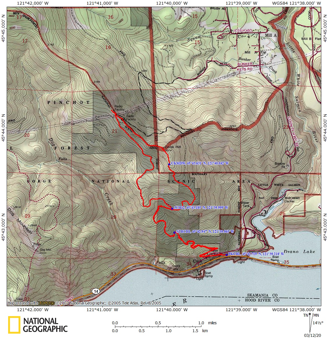
Trail Maps:
Topo Map, Download Garmin .gpx file, Open Garmin .gpx file
Review: June 2, 2019
As with many hikes in the Gorge, the beginning of this hike is near the mainline of a railroad. There is a good chance you’ll hear the long whistle of an approaching train because there is a train crossing nearby.
From the parking area, cross Cook-Underwood Road and walk west on Jackson Road for about 0.2 miles passing the sign for the end of county road maintenance. About 200 feet after the sign there is a fork in the road where you take the upper fork. Walk up an old abandoned road lined with poison oak traversing a hillside of Oregon White Oaks spread across grassy meadows. In about 0.3 mile there is a small spring next to the trail.
There is lots of poison oak on this trail. After about 1.3 miles you cross a nice little stream.
As we continue to climb up the road on the switchbacks there are glimpses of the Columbia River as you cross open areas of the slope. At 2.2 miles is a junction where you keep to the right along the old forest road. The trail to the left is the return portion of the loop.
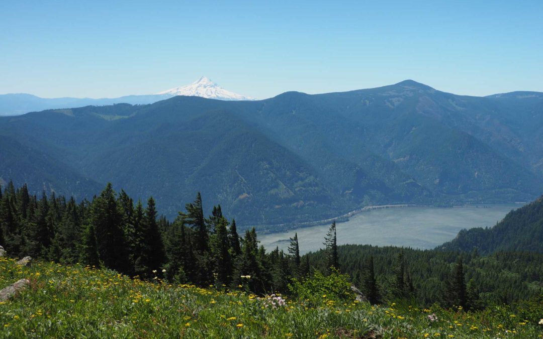
At about 2.5 miles you come out into a mountain meadow that is filled with balsamroot flowers in spring. There are wonderful views of the Columbia River and the forests below. Head up diagonally up the ridge and back into the forest. You can see the wind blows very strong here because many of the trees are missing their branches on the west side of their trunks.
At the second meadow you break out and angle up to the right. Looking back there are great views of Mt. Hood. Head up towards the corner of the meadow and the trail reappears as you pass through about a 50 foot gap between Douglas fir trees.
From the top of Cook Hill, drop down very steeply on the west side of the hill through a dark forest of second growth trees down to an old forest road. Walk along the old forest road along the top of a ridge. There are views of Mt. Adams through the trees on the right. Keep right where the road forks and descend through vine maples. Keep right at the next junction as you continue downhill through the forest, across the meadows, and back to the trailhead.
Enjoy the photos!!
Gallery Pics
Switchback Steve
Recent Comments