

Vicinity Location:
The trailhead is about 160 miles northeast of Portland, Oregon and 112 miles southeast of Seattle near Vantage, WA.
Directions:
From Ellensburg, drive east on I-90 to exit 143, Silica Road and The Gorge Amphitheater. At the bottom of the ramp, turn left, go under the freeway, and drive 0.7 mile. Turn left on Vantage Road SW.
For the upper trailhead, drive 2 miles to a parking area on the left.
For the lower trailhead, drive 2.6 miles and watch for a small, gravel parking area on the right, surrounded by concrete barriers.
A Discover Pass permit is required for parking.
There is an outhouse at the upper trailhead parking area.
Trail:
Upper trail and lower trail.
There is at least one geocache along this trail at: N 47° 01.467 W 119° 58.789. Info at Geocaching.com
Length and Elevation:
Total 4.1 miles. Total ascent 1,111 feet and total descent is 1,111 feet. Highest point is 1,210 feet and lowest point is 1,180 feet.
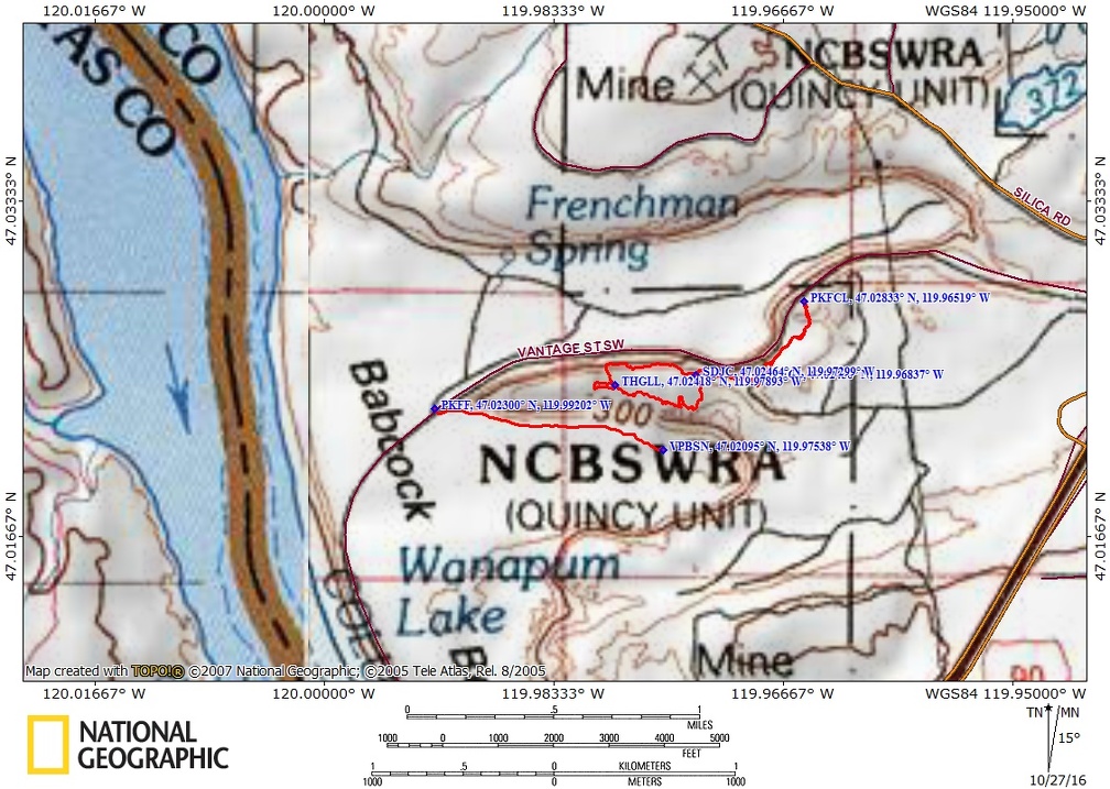
Trail Maps:
Topo Map, Download Garmin .gpx file
Review: April 19, 2015
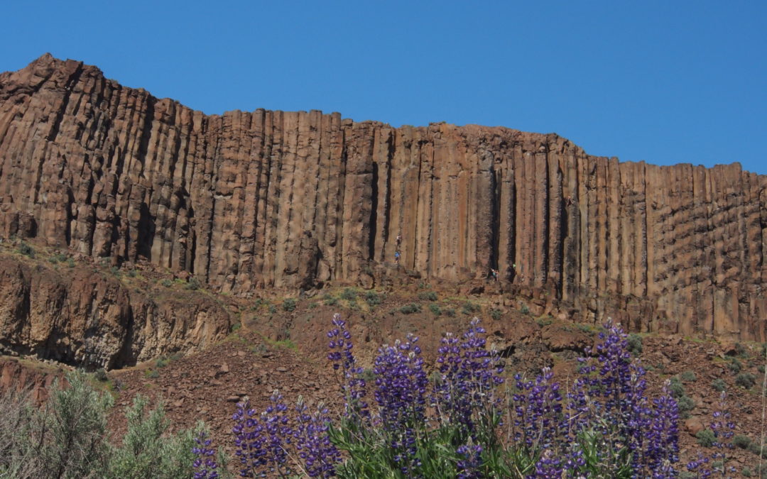
Each trail is short but it geologic features make it a worthwhile spring hike when other areas are covered with snow. The columnar basalt is fantastic. There is a third trip not included in tis review that leads from the lower parking area to a seasonal waterfall. As you come down the road you can see this was the old highway and once crossed the Columbia River. Now the Wanapaum Dam has flooded the old roadbed and I-90 now spans the river.
From the upper parking lot you can walk through a crack in the basalt wall where beginner climbers practice, then across an old gravel pit to the network of trails that cover the basalt rib that juts out above the Columbia River. There are several trails to wander around and we did a bit of cross-country to connect trails and mostly walk near the cliff edges. The upper area is very popular with rock climbers and there are sets of climbing anchors and chains along the top of the columnar basalt cliffs. Once you’ve explored the top, head back to your car and drive to the lower parking area.
Cross the road from where you’ve parked your car and follow an old jeep road heading east so that you look up at the cliffs you were at the top of on the first part of the hike. It is a flat walk along Echo Basin and there is a logical turn around point about .8 mile from the parking area. Walk back to the car and if you want more hiking then proceed from where you parked your car to the gate at the north end of the tiny parking lot, where you can see a dirt path that goes downhill.
Continue along the road which follows the base of the rock rib that rises from the valley floor. During spring runoff there should be a waterfall cascading down the head of the valley. There are patches of wildflowers along the way and the waterfall nourishes more as the water splashes over the rocks.
Enjoy the photos
Link to Photos
Switchback Steve
Recent Comments