

Vicinity Location:
About 58 miles east of Portland, OR in the Columbia River Gorge.
Directions:
From Portland: Drive I-84 E for 60 miles to exit 63 from I-84 E. Turn right at the stoplight onto 2nd Street.
Follow 2nd Street for 0.2 mile and turn right onto State Street and drive 0.2 miles to 6th Street.
Turn left onto 6th Street, drive one block and continue straight onto Serpentine Ave.
Drive 0.2 miles on Serpentine Ave and turn onto Hazel Ave. Drive 0.3 mile to the parking area. You may have to park on E 3rd St.
There is a restroom seasonally at the trailhead and another along the trail by the golf course.
No permits are needed to park here.
Length and Elevation:
9.2 miles roundtrip. Elevation at the trailhead is 230 feet. Total gain is 1,817 feet and loss is 1,817 feet. Highest elevation is 692 feet and the lowest elevation 230 feet.
Trail:
Indian Creek Trail
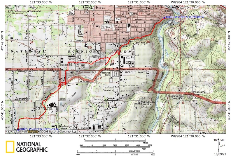
Trail Maps:
Topo Map, Download Garmin .gpx file, Open Garmin .gpx file
Review: November 9, 2020
The Indian Creek Trail climbs at a moderate rate for about 0.5 mile then levels off and at about 0.7 mile is an access to 7th street. As you continue along you cross 12th street and continue on the trail for a bit.
Going uphill you’ll pass a section of an old wood-stave water pipeline which disappears and reappears as you continue along the trail. This pipeline diverted water from Indian Creek down to Hood River for the fruit industry. There were water-powered refrigeration units that cooled entire buildings for fruit storage and made blocks of ice for the railcars that carried the fruit across the nation.
Just before 12th you’ll reach another junction for the Indian Creek Trail that heads back downhill on the other side of the Creek. Continue uphill past the Dutch Bros coffee shop.
This will bring you out to Devon Court where you walk out to the road and turn.
Turn left onto Avalon Way, go about 100 feet and turn right onto Rachel Way.
Make a right onto Samantha street and come out onto Avalon St.
Go on Avalon Drive for about 500 feet and then as it curves you turn onto Lois Drive. After that you go to McKena Drive and make a left.
Take McKena to the end and there is a cut-through trail through a parking lot and then take the street down to the bottom of the hill and take Arrowhead Ave.
In about 200 feet you’ll see the beginning of the Indian Creek Trail again as it goes through the edge of the golf course. There is also a bathroom here.
Follow the sidewalk about 150 feet and there is a dirt trail that branches off to the left and slightly downhill. This is the continuation of the Indian Creek Trail. The sidewalk is owned by the golf course and just after the trail junction the sidewalk is marked No Trespassing, No biking, No walking or jogging.
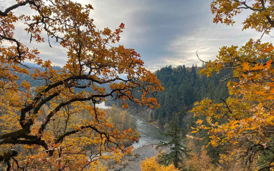
As you continue along Indian Creek you’ll cross it on two nice bridges. For the most part the trail is wide and shady as it winds its way along a forested creek setting.
The trail enters Barrett Park which has trees and large meadows. The trail ends at the edge of Barrett Park at Barrett Drive.
Enjoy the photos!!
Gallery Pics
Switchback Steve
Recent Comments