

Vicinity Location:
The trailhead is about 250 miles east of Seattle and about 280 miles northeast of Portland, OR.
Directions:
From Portland or Seattle drive to Colfax, WA. From Colfax, drive partway through Palouse and take a left onto State Highway 272 (Palouse Highway) East for 5 miles and go straight at the intersection of Hwy 272 and Clear Creek Road. Drive on Clear Creak Road for 7 miles. Take a sharp right onto Fugate Road(Road No. 5100). Travel .6 mile to Kamiak Butte County Park Road (Road No. 6710) to the park entrance on the left.
The park gates close at dusk and opens at 7am.
No permits are needed to park at the trailhead.
Restrooms and drinking water are available at the main parking lot.
Dogs on leashes are allowed on these trails.
Length and Elevation:
Pine Ridge Trail: 2 miles one-way. Kamiak Butte Trail: 1.5 miles one-way.
Trailhead elevation: 2,960 feet. High point on trail: 3612 feet.
Trail:
Pine Ridge Trail
There is at least one geocache along this trail at: N 46° 51.740 W 117° 10.035. Info at Geocaching.com
Trail Maps:
Topo Map,
Whitman County map for Kamiak Butte
History:
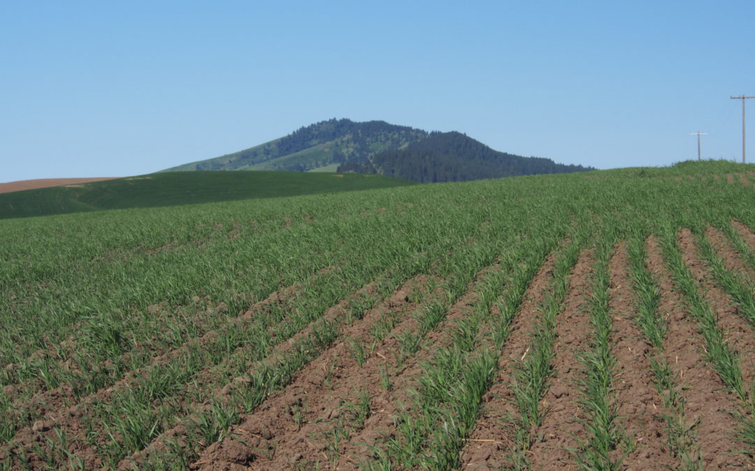
The deep soils of the Palouse region were created from pulverized rock from the ice age glaciers. Duststorms deposited the loess in up to 200 foot deep drifts. These drifts have become some of the most productive wheat producing soils in the world. In this area, there are just a few buttes and steptoes protruding from the rolling hills. Both Kamiak Butte and Steptoe Butte are complsed of quartzite over a layer of basalt.
Review: June 20, 2009
Park in the main day-use parking area near the pit toilet if you plan to hike the whole loop. Walk up the wide trail which gently switchbacks up the north side of the butte. There is a wide variety of plants growing on the hillside. A second parking lot is past the main one if overflow parking is ever needed.
From the main parking lot, walk east along the trail and begin climbing via the switchbacks as the trail climbs through the open forest. Sections of split-rail fencing have been installed to discourage people from cutting switchbacks. The trees become a bit more open as the trail gains elevation. After about 1.2 miles, the trail reaches a ridge which it follows for about .5 mile to the top of the butte.
Along the ridge, the Ponderosa pine forest opens up and there are plenty of views among the trees of the farm fields stretching as far as the eye can see. Wheatfields are most commonly seen, mixed in with lentils, peas, and occasionally rape seed. In spring and early summer the land is covered in greens except for a few fields that are fallow for crop rotation.
From the top are great views in all directions but to the west, which is mostly blocked by trees and cell towers. Looking to the north, you can see the conical shape of Steptoe Butte, about 10 miles in the distance.
To the west of the butte, there is an old service road just below the ridge that leads to cellphone towers. Walk along the road and in spring, enjoy the flowers along the road, the fields of wildflowers carpeting the slopes, and majestic views. Though rattlesnakes aren’t numerous, be aware that the grassy, rocky terrain along the butte is ideal habitat for snakes.
To return on a different trail, make a left at the first trail junction, which is about 300 feet from the butte. This trail is steeper but shorter than the trail from the main parking lot to the butte. The narrow trail drops down several switchbacks with steps. Even in the forested slopes there are openings in the trees giving territorial views. After about a mile the trail passes a grassy trail which is a winter cross-country ski trail. Head down the main trail to the next junction and turn right to return to the trailhead at the main parking lot. Heading straight at this trail junction leads to the upper parking lot.
There are some steep side slopes along this trail and the possibility of rattlesnakes, but with reasonable care this trail is safe for small children and pets.
Enjoy the photos!!
Switchback Steve
Recent Comments