

Note: Larch Mountain Road up to the Larch Mountain day use area and trailhead at MP 14.5 typically closes at mile 10 sometime in November and reopens sometime in May. Check the Multnomah County website to near those dates to find the current status of Larch Mountain Road.
Vicinity Location:
About 20 miles east of Portland, OR in the Columbia River Gorge National Scenic Area.
Directions: Drive east on I-84 from Portland and take exit 22, At the stop sign, turn right and drive for 1.3 miles on NE Corbett Hill Road. Turn left at the 3-way junction onto Hwy 30 East, the Historic Columbia River Hwy. Drive 1.9 miles and make a slight right onto E Larch Mountain Road then drive about 14 miles to the parking lot.
There are bathrooms at the trailhead. The trail requires a Northwest forest permit to park.
Length and Elevation:
Elevation at the trailhead is 3,883 feet, 6.7 miles round trip, elevation gain of 1,300 feet and loss of 1,300 feet. Highest point is 4,055 feet.
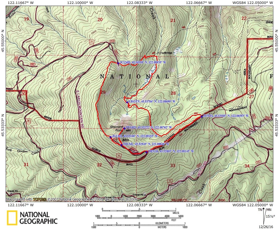
Trails: Larch Mountain Trail #441, Multnomah Creek Way Trail #444, Multnomah Spur Trail #446, Oneonta Trail #444.
Trail Maps: Topo Map, Download Garmin .gpx file
Review: November 7, 2016.
To start this hike, walk past the bathrooms that are at the left side past the upper end of the parking lot and go into the forest along a trail covered with fir needles and squirrel shredded cones from the fir trees. This first short section of the trail is level but soon starts dropping down off of Larch Mountain.
After walking about 500 feet you come to a trail Junction where you turn left to follow the trail gently downhill past picnic tables and through the forest. There isn’t a lot of undergrowth here because the tree canopy is so dense.
At 1.4 miles you drop down fairly steeply for .1 mile to the junction of Larch Mountain Trail 1.5 miles from the trailhead. Turn right here following a nicely gravelled trail and continue to drop down through the forest.
At 2 miles turn right at the next Trail Junction onto the Multnomah Creek Way Trail #444. This goes to the Multnomah spur Trail in .2 mile and cross the small Multnomah Creek. Just before the crossing is a nice campsite where you can stay if you’re doing a beginning backpacking trip. Just on the other side of the bridge is a junction where you turn right and walk next to a marshy area which was once a lake.
Continue following gently uphill a bit and the trail makes right turn away from the little dry streambed that you’ve been following and goes over to the parallel along the headwaters of Oneonta Creek. At 2.9 miles you walk along the noisy creek which makes a nice splashing noise as it drops down through the forest.
Soon the trail climbs a little steeper and at 3.3 miles you cross one of the main branches that contributes to the Oneonta Creek. There’s a nice place to sit down on a nearby log and take a break while enjoying the water that rushes downhill. The rocky and rooty trail continues as it switchbacks up and goes along the creek climbing ever higher. After about 3.75 miles the grade of the trail becomes much more moderate but the rocks and roots of the forest trees continue. Soon after that you climb over a small ridge and in about .3 mile drop down to an old road. Here the old road is nearly level and is much smoother without the ankle twisting roots and rocks.
After about a mile walking through forest, From here you traverse along the side of a ridge coming from Larch Mountain. This section of the forest is older second growth with silver firs and hemlock trees growing in abundance. The understory isn’t very thick because the trees grow densely here. The old road turns right and cuts across the ridgeline then comes to the junction of Multnomah Creek Way Trail #444 and the Oneonta Trail #424. This is .9 mile from the Larch Mountain Highway and the trail goes gently upward from the trail Junction.
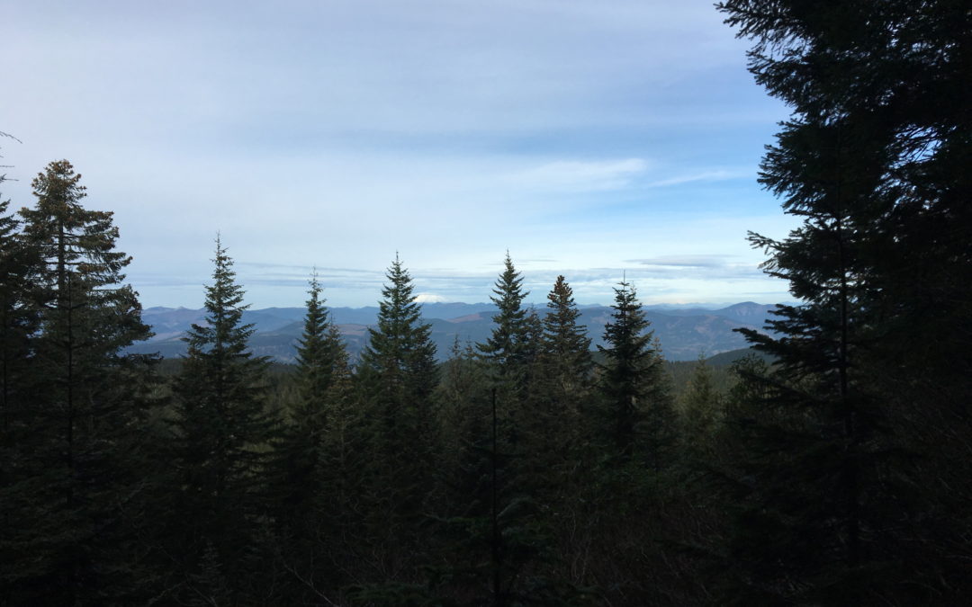
Climbing up the forested ridge on the Oneonta Trail there is a small cutoff Trail on the right which leads to a nice view of Mt. St. Helens. Back on the trail, continue along the wide trail, continuing to climb the ridge towards Larch Mountain Road.
When you reach the road, turn right for the short uphill walk to the parking lot.
Once back to the parking lot make the short trip to Sharrad Point. The trail leave the northeast edge of the parking lot and begins on a level grade. It doesn’t take long before you start climbing up the stairs to reach Sherrard Point. The view is well worth the climb up about 120 steps.
There are great views of Mt. Jefferson, Mt. Hood, Mt. Adams, Mt. Rainier, and Mt. St. Helens are all dotting the horizon. This is very crowded in summer, so once you’ve taken in the view and fresh air, make your way back down the stairs and to the car to complete the trip.
Enjoy the photos!!
Gallery Pics
Switchback Steve
Recent Comments