
Vicinity Location: Siuslaw National Forest
Location: The trailhead is 24 miles west of Corvallis, OR near the community Philomath.
Directions:
Take a pleasant drive west from Corvallis on Highway 20 for about 6 miles and turn left onto Highway 34 and drive southwest. After milepost 52 the road suddenly changes from a road with gentle curves to a twisty turny road climbing up through the forest. This hill climb section is popular with cyclists so be careful of bikers pedalling their way slowly uphill along this portion of the road.
You’ll see the sign for Mary’s Peak Recreation Area on the right at about 15.5 miles from Corvallis and just after milepost 48, turn right onto Mary’s Peak Road. At 5.4 miles from the turnoff you will pass through a gate that is used to close off the road in the winter. After driving approximately 9.3 miles on Marys Peak Road you will have circled most of the way around the peak and you’ll reach a large parking area. The trailhead is on the southeast corner of the parking area.
A Northwest Forest Pass is needed for parking.
Dogs are to be on a leash not longer than 6 feet.
Toilets available at the parking lot.
Bicycles allowed on the East Ridge, North Ridge and Tie Trail between May 16th thru October 14th. There are no bicycles allowed on Meadow Edge and Summit Trails.
Length and Elevation:
Elevation at the trailhead is 3780 feet. Total ascent is 415 feet and total descent is 415 feet. Highest point is at 4,095 feet. Total trip is 1.6 miles.
There is at least one geocache for this trail at: N 44° 30.268 W 123° 33.138 Info at Geocaching.com.
Trail Maps:
Topo Map, National Forest Service Map, Download Garmin .gpx file
Review: 6/26/2016
From the trail sign at the east edge of the parking, bear to the left and walk along a fairly level path and into the woods. It’s a walk through a lovely grove of old Noble Fir trees and the trail is fairly level and even drops down a bit. In just .2 mile you’ll come to a trail Junction where you want to turn right at the junction and onto Summit Loop Trail 1324 which climbs up some fairly steep switchbacks. The trail climbs up these switchbacks because a micoburst has downed dozens of trees.
At just past .3 mile the trail pops out of the woods into a grassy mountain meadow and you climb at a more leisurely grade. If you know what Sheep Sorrel looks there are plenty of tart leaves for you to snack on as you walk along through the meadow. This trail passes through the largest patches of Sheep Sorrel that I have ever seen.
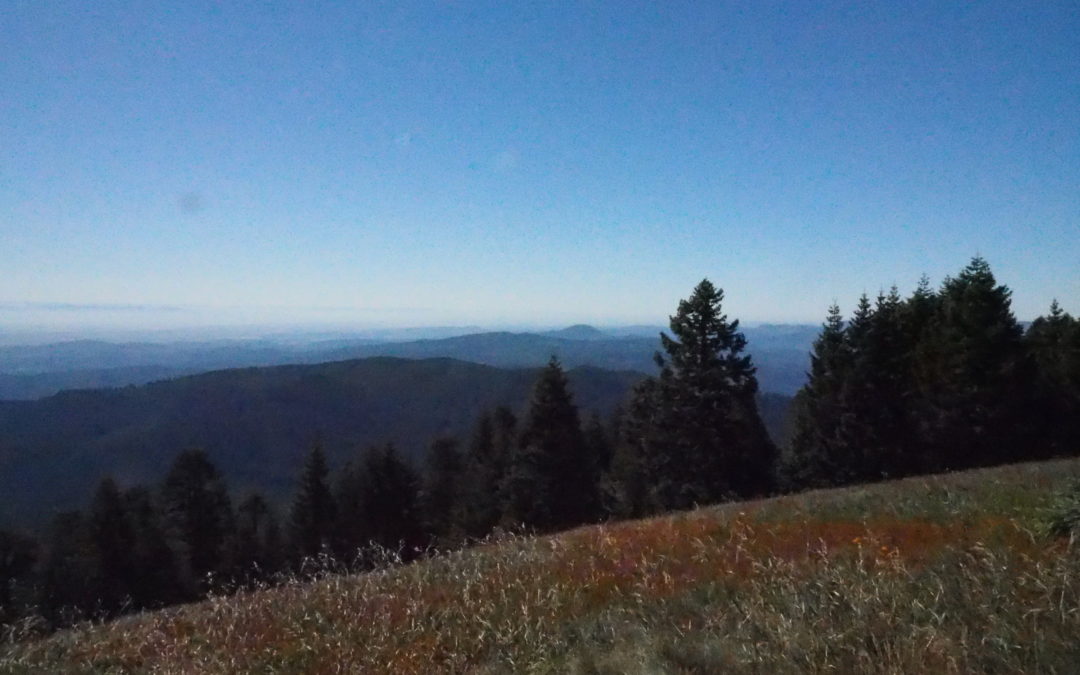
In just over half a mile you come out to the road which winds up to the top. Turn left here and follow the road up to the side trail to the summit. As you continue walking up the service road you get spectacular views to the west and north. A fence around radio towers occupies the actual summit of the peak but there’s a nice path leads around the fence and to 360-degree views of the surrounding area. Marys Peak is the highest peak in the coast range and there aren’t really any other tall peaks nearby so the distant views are unobstructed to the horizon.
The trip to the summit is just under a mile you will find the return trail for this loop on the southeast corner of the fence. Follow the trail approximately a .1 mile and make a left onto Meadow Edge Trail.
Head downhill looping through a field of lupines and re-enter the forest as you now head south. After walking about .25 mile, continue through the forest past a trail junction switchback which leads down to Marys Peak Campground.
Continue straight ahead to the service road. Cross over the road and follow a trail to the top of a grassy knoll. At the top of the knoll is a user trail that leads southeast to a nice vantage point. There is more than a 180 degree panorama from the north to the south with spectacular views of the distant Mountains. You can see so many peaks from here on a clear day, Starting in the north you can see Mt. St. Helens, Mt. Adams, Mt. Hood, Mt. Jefferson, then many smaller mountains including Mt. Washington, the Three Sisters and many more.
Trace your way back along the user trail and make a right at the junction. Continue over the top of the grassy knoll and drop down towards the parking lot. You will soon pass through a meadow of short little Tiger Lilies and other wildflowers. The parking lot appears and you drop down to it for the finish of the hike.
This is a great hike for kids as it is safe with no cliffs. The trails are wide and the grades are not too steep.
Enjoy the photos!!
Switchback Steve
Recent Comments