
Notice: This trail is closed until mid-2022 due to a construction project.
Vicinity: 52 miles east of Portland in the Columbia River Gorge.
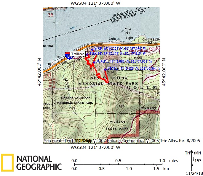
Directions:
From Portland, take I-84 east to exit 58.
The exit road leads to the parking lot.
To return to Portland, drive east to exit 62 for Hood River, cross over the freeway, and merge onto I-84 west, back to Portland.
No permits are needed for parking.
There is a restroom in the parking lot.
Length and Elevation:
Total length is 2.2 miles for the loop. Elevation gain is 1325 feet and 1325 foot loss. Elevation at the trailhead is 188 feet. The high point is 1,178 feet.
Trail:
There are no geocaches on this trail.
Trail Maps:
Topo Map, Download Garmin .gpx file
History:
The Native American names for these prominent outcrops were called Storm King for Mitchell Point and Little Storm King for Mitchell Spur. The current name reportedly comes from an early trapper who lived in the area. In the 1940’s there was a roadhouse, service station, sandwich shop, and bungalows for rent at Mitchell Point.
Mitchell Point is composed of floods of dense layers of basalt lava that reached all the way to the Pacific Ocean. In this part of the Gorge, earth movements have tilted the earth by 30-degrees. This tilt is very apparent by looking at the layers composing Mitchell Spur. This tilt is also why the Oregon side of the Columbia River Gorge has more waterfalls than the Washington side of the Gorge.
The trail briefly follows a wagon road through the Gorge which was built in the1870s.
Review: April 26, 2014
The trail meanders through the forest for several hundred feet, passing a few remnants of a powerhouse, then begins climbing several steep series of switchbacks up the rocky slope. After about .3 mile from the trailhead, there is a junction that drops off on the left. This leads to Mitchell Spur and is good for the return trip. Watch out for Poison Oak along the trail.
After about .4 mile from the trailhead, cross a talus slope with a nice field of spring blooming wildflowers. There are some nice views from the open slope but better views are ahead.
Back in the woods there are more spring wildflowers including Fairy Slipper, Prairie Star, and Oregon Grape. Continue climbing fairly steeply up towards the point.
In about 0.75 mile, you reach the powerline corridor with some nice views from a saddle. Of course the powerlines are part of the view. From here it is a short, fairly steep walk along the unprotected trail to the top of Mitchell Point. Spring wildflowers abound on the open slopes.
At the point there are great views all around. To the west, the Columbia River curves gracefully.
On the way back, take the junction out to Mitchell Point and return the same way to the junction. Continue back to the trailhead.
Enjoy the photos!!
Gallery Pics
Switchback Steve
Recent Comments