

Vicinity Location:
The trailhead is about 47 miles northeast of Portland, Oregon in the Gifford Pinchot National Forest.
Directions:
From Portland, Oregon, there are two ways to drive to the trailhead. If you have an extra 30 minutes then make your trip a loop drive.
For the loop drive, take I-205 north across the Columbia River. Exit I-205 on HWY 14 east for about 28 miles through the town of Stevenson.
For the non-loop option, take I-84 east from Portland and take exit #44 for Cascade Locks.
Take the first right turn, just after you go under the Bridge of the Gods. Pay the $3.00 toll, cross the bridge, and turn right onto Highway 14 and drive 2.5 miles to Stevenson.
Once you get to Stevenson, drive about 2 more miles east to the traffic circle and take the second exit for Wind River Road. Wind River Road is 5.9 miles east of the Bridge of the Gods. Drive on the Wind River Road for 6.8 miles.
Turn right onto Old State Road. After about 200 feet, turn left onto Panther Creek Rd. and drive 7.4 miles. This turns into Forest Road 65 in about a mile as it enters the Gifford Pinchot National Forest.
Park at the wide parking area on the right. It is an old rock quarry.
To return, take Highway 14 west back through Stevenson, and after about 2.5 miles, turn left and cross the Columbia River at the Bridge of the Gods. The toll for cars to cross the bridge is $3.00.
After the bridge, the road loops around and intersects Hwy 30, Cascade Locks Hwy, near the base of the bridge. Turn left here and you will merge onto I-84 west in about ½ mile. Follow I-84 west, back to Portland.
No permits to park are required at this trailhead.
There are no bathrooms at the trailhead.
Length and Elevation:
0.4 miles roundtrip. Elevation gain 0 feet and loss of 90 feet to the falls. Total gain and loss is 180 feet. Elevation at the trailhead is 1,815 feet, the falls are at 1,725 feet.
Trails:
Panther Creek Falls Creek Trail #137.
There are no geocaches along this trail.
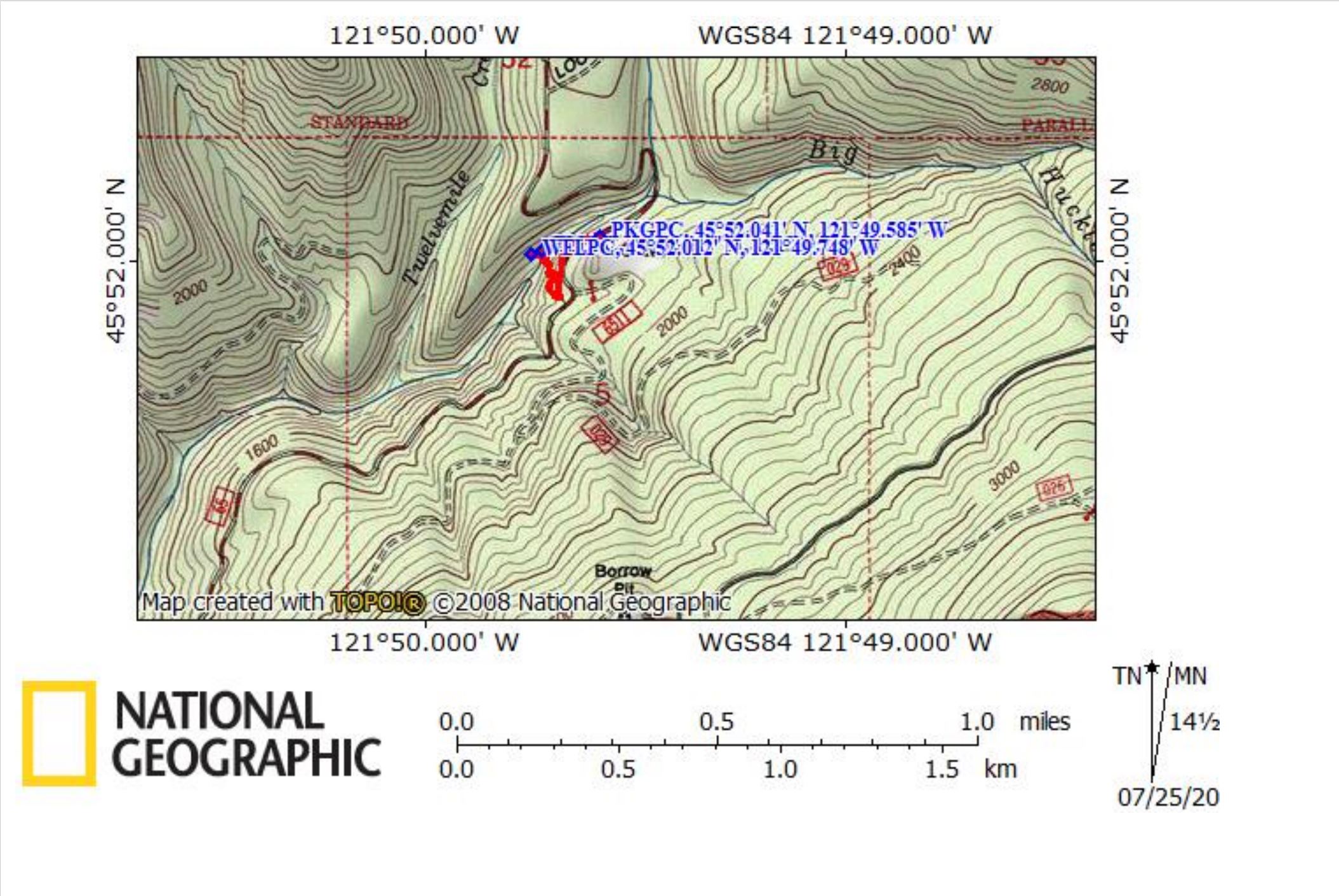
Trail Maps:
Topo Map, Download Garmin .gpx file
Review: September 1, 2018, June 27, 2020
Walk across the parking area and head to the left. In about 150 feet you will find the trailhead leading down to the falls.
The trail drops off the side of the road and is hard to see until you are right at the trail. There is a sign on a nearby tree but it isn’t obvious either. Once you’ve found the trail it is a short, easy walk down towards the overlook for the falls. A bit above the overlook of the top of the falls is a junction leading to the bottom of the lower falls. Taking the left fork leads up a bit and though it may not seem your heading towards the bottom of the falls, the trail soon rounds a corner then starts dropping steeply along a rocky cliff.
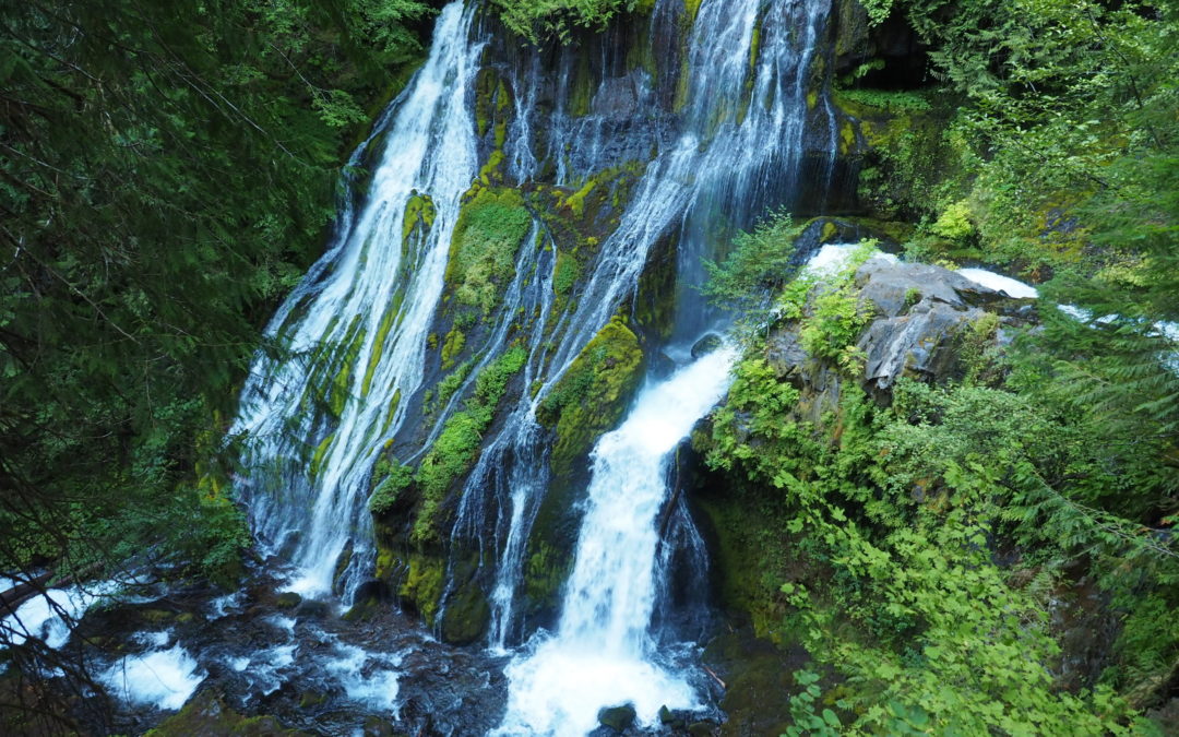
Drop about 100 feet to a viewing platform that looks directly at the bottom of the lower falls. Enjoy seeing water cascading from multiple places off the cliffs and the greenness of the area being constantly watered by spray from the falls.
This is actually a pair of waterfalls dropping next to each other from Panther Creek and Big Creek. The waterfalls are about 75 feet tall and you look down and across to the top of them from the overlook.
After admiring the bottom of the falls, hike back up to the overlook platform at the top of the falls. This provides a nice view of the falls and you can see a second little waterfall just downstream which is somewhat hidden by trees.
Enjoy the sounds of the falls while walking in the small area that allows views of Panther Creek. Return back up the moderately steep trail to the parking area.
The trail can be very dusty during summer and is probably a little slippery when it is wet and muddy.
This hike should be combined with other nearby hikes like the Whistle Punk Trail or Bunker Hill.
This trail is good for children who are experienced hikers who are careful around cliffs and will stay behind the fences. This trail is not good for dogs because of the steep dropoffs on the trail to the lower falls.
Enjoy the photos!!
Gallery Pics
Switchback Steve
Recent Comments