

NOTE: Road restrictions and closures can occur during the winter. The highway from Longmire to Paradise may not open until 9:30 a.m. or later. Inquire about the road opening time before you go. Call 360-569-2211 and press 1, 1, 2 at each prompt. You can usually see road closures and opening times at twitter.com/MountRainierNPS
Vicinity Location:
61 miles southeast of Seattle in Mt. Rainier National Park.
NOTE: Road restrictions and closures can occur during the winter. The highway from Longmire to Paradise may not open until 9:30 a.m. or later. Inquire about the road opening time before you go. Call 360-569-2211 and press 1, 1, 2 at each prompt. You can usually see road closures and opening times at twitter.com/MountRainierNPS
Directions:
From Portland, take I-5 North and take exit 68 to Hwy 12. Take Hwy 12 for about 30 miles to Morton. Turn left on Hwy 7 and drive about 17 miles to Hwy 706. Turn right on Hwy 706 and drive to the Nisqually entrance on the west side of Mt. Rainier National Park. Drive about three miles from the entrance and cross the bridge over Kautz Creek. Continue to Longmire and take a right turn just after the lodge. Drive about .1 mile and park on the right.
From Seattle, take I-5 South to Hwy 512 East and go towards Puyallup (Exit 127). Follow Hwy 512 East for about 2 miles. Turn south onto Hwy 7 towards Mt. Rainier. Follow Hwy 7 south to Elbe. At Elbe, turn left onto Hwy 706, travel through Ashford, and then to the Nisqually entrance of Mt. Rainier National Park. Drive about three miles from the entrance and cross the bridge over Kautz Creek. Continue to Longmire and take a right turn just after the lodge. Drive about .1 mile and park on the right in the parking lot.
Flush toilets are available at Longmire.
Pets aren’t allowed on National Park trails.
National Park 7-day Entrance fee of $30.00 or Annual Pass is required to enter the park.
You can see avalanche forecasts here: Northwest Avalanche Center
National Weather Service Snow Level forecast: West Slopes South Central Cascades
Length and Elevation:
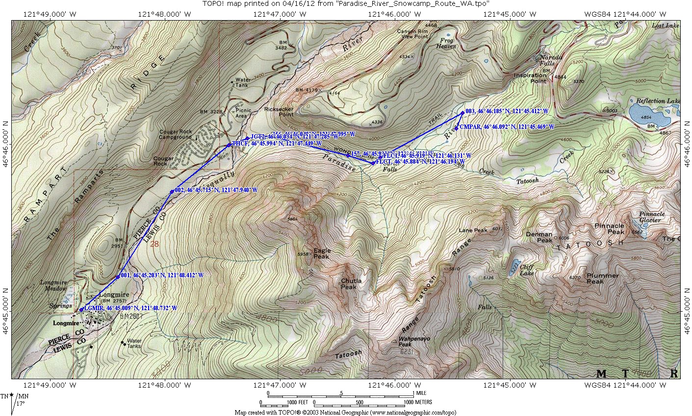
7.5 miles round trip. Elevation gain 555 feet and 30 feet loss. Total gain and loss is 1,170 feet. Elevation at the trailhead is 3,165 feet, the high point of the trail is 3,920 feet.
Trail:
Wonderland Trail. Connections to Trail of Shadows, Rampart Ridge Trail.
Trail Maps:
Topo Map, National Park Service Map, Download Garmin .gpx file
Review: February 18, 2012
This is a great snowshoe trip to take when the road to Paradise is closed. However the log bridge over the Nisqually River by Cougar Rock Campground is washed out during the winter about 2 of every 5 years. Make sure the log bridge is in before going on this trip.
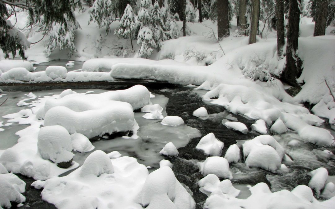
In about .6 mile from the Nisqually and 600 feet higher, you reach Carter Falls. Though it is a bit hard to see, it sounds wonderful. From the falls, walk just a bit farther to Madcap Falls. This is more a steeply sloping riverbed than a waterfall but you have a great view of it. The steep trail is mostly past and the trail soon passes little side streams and wet areas where the standing water keeps the snow melted.
Watch out for places where the snow hides voids. There won’t be many that a snowshoe will fall into but walkers could well find some nasty step-through places.
This is a wonderful snowshoe trip because of all the water along the trail. Avalanche danger is low along this section of the Wonderland Trail. There is just one bare slope to watch for avalanches.
Enjoy the photos!!
Gallery Pics
Switchback Steve
Recent Comments