
Vicinity Location:
The Pole Creek Trailhead is about 83 miles Southeast of Salem OR, and about 102 miles Southeast of Portland, OR, in the Deschutes National Forest.
Directions:
Pole Creek Trailhead: From Sisters, Oregon, drive to the Southwest side of town and find Forest Road 15. Head west, then southwest on Forest Road 15 for about 10 miles and follow the signs for the Pole Creek Trailhead and park in the dusty parking lot.
A Northwest Forest Pass is required to park at this trailhead.
The trail enters the Three Sisters Wilderness Area shortly after leaving the trailhead.
Wilderness Permits are required for both day-use and overnight travel in the Wilderness from Memorial Day Weekend until Oct. 31. The permit box has been removed for 2020. In 2021 an advance reservation permit system will be in place to limit visitors.
Link to Three Sisters Wilderness Area Camping and hiking regulations.
Outhouses are available at the parking lot.
Length and Elevation:
50 Miles roundtrip, Elevation gain 11,000 feet and elevation loss of 11,000 feet. Trailhead elevation is 5,300 feet. High point is 1,0363 feet (3159 m).
Day 1 – Pole Creek Trailhead to Golden Lake: +1,800, -600, 7 miles.
Day 2 – Golden Lake to Moraine Lake Camp: + 950, -1,200, 7 miles.
Day 3 – Climb South Sister: +3,900, -3,900, 3.25 miles.
Day 4 – Moraine Lake Camp to James Creek Shelter: +920, -1,550, 7.1 miles.
Day 5 – James Creek Shelter to Minnie Scott Spring: +2,300, -1,600, 9.5 miles.
Day 6 – Minnie Scott Spring to Pole Creek Trailhead: +1,300, -2,100, 12.7 miles.
Trail:
Pole Creek Trail #4072, Green Lakes Trail #4070, Sisters Trail, the Pacific Crest Trail #2000, Scott Pass Trail #4068 with connections to various trails.
There is at least one geocache along this trail near: N 44° 12.000 W 121° 52.000. Info at Geocaching.com
Trail Maps:
Topo Map
Review: July 16th, 2007.
This is one of the classic Oregon backpacking trips.
Before the hike we met to discuss food and gear. I always advise taking between 24 and 32 ounces of dried food per full day of hiking. I also like to take 2 water filters for the group in case one filter breaks or clogs. We talked about how to split up the weight of shared tents and the importance of breaking in boots by walking while carrying a pack. We talked about equipment and what works well. I think most packs on the market work pretty well when you follow the manufacturing guidelines and most any pack will last for a 50 mile hike if it isn’t overloaded. For clothing, I told them I take one pair of zip-off pants, one pair of running shorts, one long-sleeved shirt, and a lightweight short-sleeved shirt. The next layer is a thick fleece and a lightweight hat for the sun, with a flap to cover my neck. I always use liner socks and a pair of chushioning socks. Usually they’re a wool-synthetic blend. I’ve been pleased with the Fox River liner socks and Ultimax socks for cushioning. These socks usually last me about 3 seasons of hiking before wearing out. An outer shell should consist of breathable rainpants and raincoat and gaiters. Gaiters really help keep the forest duff out of your boots. I’ve spent too much time picking tree needles out of my socks when I’ve forgotten them. In the Pacific Northwest, having boots that are waterproof or mostly waterproof is important because weather systems can move in and rain for a day or two quite commonly. The last thing I think is essential when backpacking is a pair of trekking poles for the freedom they provide while walking. With trekking poles, I can look up from the trail more often and catch myself for the times I do trip over a rock or root. Usually I take some sort of camp shoes.
It was an easy drive to Redmond, where we stopped for snacks, gasoline, and a bathroom break. The road to the trailhead is mostly paved and the potholes were mostly avoidable. We arrived without getting lost, assembled our gear, and weighed it for the trail. A couple of the Scouts had too heavy of a pack so we went through them and pulled out some extra clothes and extra food.
Our group consisted of Drew, Zach, Dennis, Lucas, Mark, and myself when we started out at the Pole Creek Trailhead under a blue sky and pleasant temperatures. The first part of the trail is very well maintained as it goes through the forest. The soil in this whole area is volcanic, there isn’t a lot of undergrowth, and the dry climate discourages the fallen trees and branches from rotting quickly. The trail gently gains elevation or is flat almost all the way to our first night’s camp.
The first junction is after 1.4 miles and we turned left. The streams we crossed were bordered by wildflowers and I stopped to take pictures. We kept a good pace until the trail climbed to our junction to camp. We looked hard to find the junction to camp and finally found it with the help of our GPS. As the trail climbed, the wind increased. The wind was really blowing by the time we dropped down to the lake and chose our camp for the night. Golden Lake doesn’t have many trees to break the wind, so we were happy to get into our tents for the night.
The next day dawned clear, calmer, and colder. I was glad that I brought gloves to function as potholders while cooking and gloves for when it is cold. We had our breakfasts, broke camp, and went back to the trail junction for Golden Lake and headed southeast towards Green Lakes and Moraine Lake. The trail went through a meadow that had great views of Broken Top and I stopped to take pictures. We broke for lunch at one of the crystal-clear streams and I looked at Steven’s blisters. He had huge blisters on both heels and he had worn off the top layer of skin. He said they didn’t hurt, but I knew that his raw skin would be tender soon. I was unhappy that he had let his feet get in that condition. He told me that he hadn’t noticed it, which I found hard to believe by the size of the blisters.
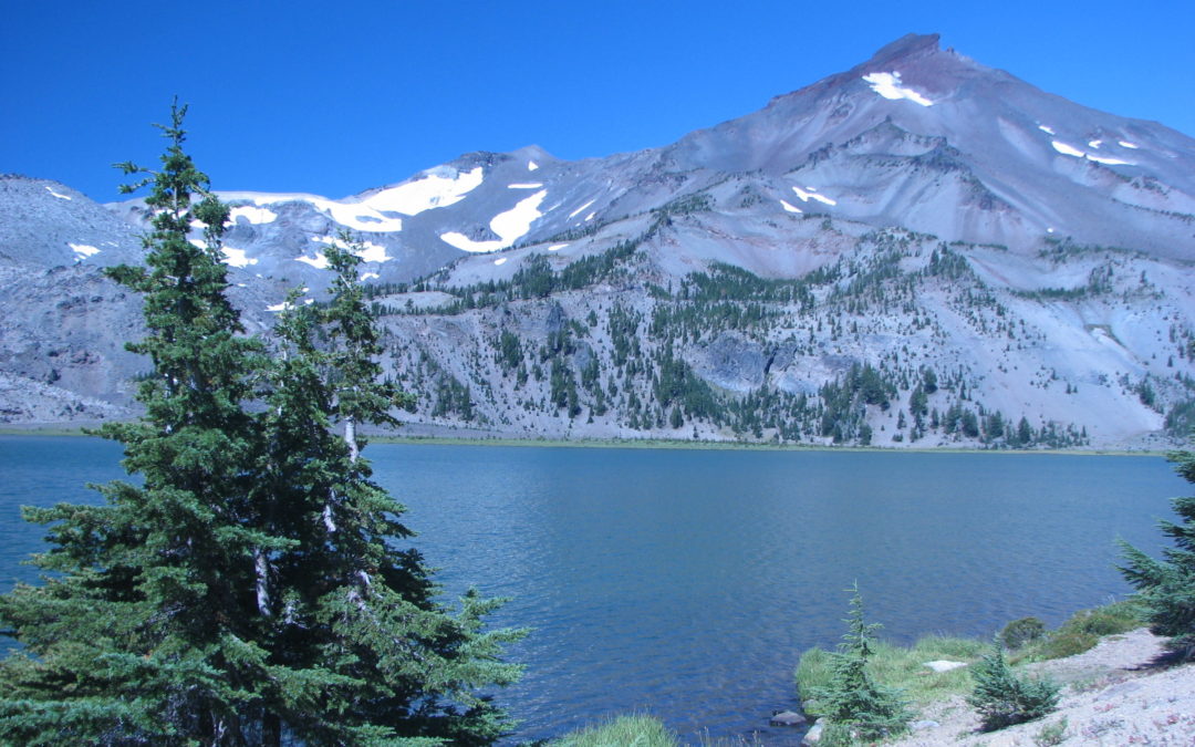
The rest of the group caught up as I was bandaging up his blisters and everyone stopped and had lunch along the Fall Creek. In the distance we could see sunlight glittering off the Newberry lava flow. Plants grow slow in this dry climate and the lava flow looked like it had happened only a few years ago. There must be a lot of obsidian in the lava and the sparkling and twinkling of the light on the lava made for quite a sight. The trail went just above a stream that had been rerouted by the lava flow and the lava looked like a giant pillow rising from the stream. Up to this point, the trail hadn’t been crowded, but now e passed a junction to a popular trailhead and saw more people. It was a Friday and we met people who were coming in to camp and climb South Sister the next day. From the junction, the trail climbs up to Moraine Lake, which has quite a few secluded campsites. The Forest Service tries to minimize the visual impact of campers be locating campsites away from the lake and in the trees. We split up to scout out campsites. We liked a spot on the northeast side of the lake, but it sloped too much for our liking.
We found a nice flat campsite on the south side of the lake that would fit all our tents without a problem. The campsite had a view of the lake, through the trees, and a fine view of Broken Top to the east. Once we finished setting up camp and rested for a bit, we went down to the lake to check it out. The lake wasn’t very cold and it felt good to soak our feet. The Scouts made up a rock-throwing game and we had a contest and kept score on who could knock a certain rock into the lake by throwing small rocks at it. We played long enough to where it was hard to get any more small stones to throw. Mark knocked the rock into the lake the most times and was declared the winner.
While we were having our rock-throwing contest, some hikers walked over to the far side of the lake, peeled off all their clothes, and went for a swim. We finished our game and walked farther along the lake while the skinny-dippers whooped and hollered. I was feeling grimy myself so later in the day I went back to camp, put on some shorts, and went back the lake for a swim. By then clouds were moving in and I didn’t spend a very long time in the shallow lake as the air was cooling down. I got out of the lake during a sun break and dried off. While I was walking along the lake, I saw a woman who was visibly upset. She had gotten lost from her group and had now idea what trail to take back to the trailhead. Drew and I tried to calm her down so she would stop crying and start thinking. She had no map, no food, no water, no flashlight, and no clue as to which trailhead she had come from. Drew was eventually able to puzzle out that she had not come along from the Fall Creek Trailhead, so she must have come from the trail just west of Moraine Lake. We gave her some water and she went on her way to meet her group.
I went back to camp to get dressed and met the Scouts down by the lake. They had been throwing pieces of pumice into the lake to see which ones would float. We walked along the lake and when we stopped and I got out my camera to take some pictures, I found out my hydration bladder wasn’t screwed down tight and water leaked into my backpack. i reached in and pulled my camera out of a pool of water. I pulled out the batteries, shook water out of it, and dried it off as best I could. I waited a while, put the batteries back in, and turned it on. The camera acted funny, but after a few on-off cycles, it seemed to work. There was a little LED that glowed all the time, when before the dunking, it only glowed when the camera was turned on.
The next morning brought more of the same weather, but we were still planning to climb South Sister, called “Charity”. A trail along the east side of Moraine Lake to South Sister is now closed to prevent erosion. We headed west from our campsite for the summit trail that skirts the south side of the lake, then climbs up to a bench above Moraine Lake. This area has a volcanic sand soil and not much can grow on the flat, dry areas, so we had a perfect view of South Sister.
After about a mile, the trail begins to climb the lower slopes and enters a grove of trees. After a short walk through the trees, the woods become more open and the trail gets rockier. It isn’t long before we were walking up barren slopes and seeing volcanic rocks in shades of reds and browns.
The increasing elevation exposed us to the elements. Today it is a layer of high clouds and gusty winds.
The walk is quite steep now and sometimes we grab rough, pumice-like rocks to steady ourselves. We see a couple of people who are already on their way back down. They make clouds of dust that blow past us, and on us as they scurry down the mountain.
About halfway up, we met and talked about safety. Hypothermia is a danger in this kind of weather and if conditions deteriorated much more, we would turn around and head back to camp. The cloud ceiling was still above the mountain and it wasn’t raining yet, so it seemed safe to go on. So many people climb South Sister that the trail easy to find, even in a dense fog.
Now we were noticing the thinner air and climbing was getting harder. As usual, Drew led with the fast group while I brought up the rear.
We reached a small snow-rimmed lake, at about 10 am, and joined the groups of people lounging around. There is a low ridge between the downslope and the lake, which made a nice windbreak. it was even warm sometimes when the sunshine weakly came through breaks in the clouds. After a good rest, we left the lake and picked our way along the rocks and climbed the last 1,000 feet or so to the top.
The top of South Sister is a crater rimmed with craggy rocks. A rugged path goes most of the way around the rime edge. The wind was intense and blowing about 40 mph with gusts to 50 mph or so.
We trudged to around the rim and onto a snowfield that filled the crater. Off to the west side, the crater drops down to an icy-blue melt-water lake. We walked counter-clockwise, picking our way among the broken crags while admiring the steep slopes and nearby mountains. The clouds slid by like ice on a cookie sheet and the peak of North Sister was plastered by one cloud after another. It was hard to stay warm in the gals and Lucas and I found Mark in his sorts and jacket, looking a little cold. We found a hand-stacked rock wall and hunkered won, somewhat out of the wind, and had lunch. We walked a but farther and stopped for pictures on a promontory, then turned back and took a shortcut across the snowfield to the descent route.
We found Drew and headed back down. We passed a lot of other people heading towards the summit and we were glad to be heading down, especially while we watched the weather slowly deteriorating.
It took a while to get back down because we wanted to be careful not to fall and get cut on the rocks or blown off the trail by a sudden wind gust. We could see rain falling out of the sky but most of it evaporated as it fell. On the way along the plateau overlooking Moraine Lake, we saw some people cutting the trail, but we were good hikers and stayed on the trail.
Moraine Lake is the only source of water in the area, so we stopped to filter water out of the crystal clear lake and saw that Sooth Sister was mostly covered in clouds. In the evening, the mountain came out a little more and we agreed going up early was the best choice.
The next morning was a Monday, and it was one of those Mondays that you would like a do-over for. The weather was windy and damp and didn’t look like it would get better any time soon. We broke camp after breakfast and shook as much water as we cold off our tents. We dropped down to the trail along the lake and filtered water for the morning. No one will be swimming today, I thought. The wind picked up as we climbed up the trail and over a saddle. There were few trees for shelter and the farther on the trail we went, the harder the wind blew. It drove home every tiny and not-so-tiny raindrop falling from the gray sky. The trail crosses a couple of pumice plains and there is no shelter of any kind from the elements. We had to stop and look at the map tor a while at one of the trail junctions on the plains because the map seemed to show the trail going on a section of the trail signed as closed. We decided the trail had been re-routed and headed northwest.
All of us were grateful whenever the trail passed through trees and it seemed to take an eternity to see the trail climb out of the pumice plains and into the wooded hills. We stopped under a big fir tree for snacks and to get away from the wind and rain a bit. Mark looked wet and kind of cold. Dennis had a jacket and a thin plastic poncho, which was ripped, and the rest of us looked like our raingear was working okay. Thankfully, the rain and wind were light and the wind wasn’t blowing very hard in the trees.
From here the trail gradually climbed through the forest and was well maintained with just small puddles to negotiate. When we reached the junction to James Creek Shelter, I was confused in my directions and wanted to continue up the Pacific Crest Trail. Luckily Drew and Lucas pointed out the right direction. We walked about a mile past the junction and stopped at the log shelter.
There was a lone backpacker there with his dog, but they were getting ready to leave and head south. We talked about the trail and the rain. It hardly rains in Central Oregon in the summer, but we were pretty wet. The 3-sided shelter was a welcome relief. Hikers before us had left a supply of dry wood which made it easy to start a fire to warm up and dry out. My camera was dead and I was sad that I couldn’t take any more pictures.
We gathered more wood for the fire; there was plenty to be found. We all brought wood from the forest to the fire. Drew and I fixed the loose cedar shakes on the roof of the shelter as best we could. There were still a couple of leaks, but they were small and didn’t let much water in. We hung up our wet stuff to dry out and Drew and I set up our tents. Zach and the Scouts planned to stay in the shelter for the night.
We had a great time talking and getting dinner ready. Of course the Scouts played with the fire by sticking in branches and waving them around once they caught. There isn’t a lot else to do when a light rain is falling outside.
I had about four ounces of water pooled in my tent from setting it up, but I used my handkerchief to sponge it out. I went to sleep hoping for better weather and that I didn’t have a leak in my tent.
The next morning was still cloudy and drizzly. We filtered water from the stream by the shelter and started on our way. Our feet were still a little wet from yesterday and it didn’t look like we would have dry feet today. I had been checking on Steven’s heels to make sure the blisters didn’t get worse. Now his heels hurt him when he walked. Thank goodness we didn’t get them bandaged up later. The trail is mostly in the woods on a hillside and I wished the weather was clear so we could have views from the mountains towards Salem.
We continued walking along the mountain slope until around lunch when we met some hikers with their dog. We warmed ourselves near their fire, but they built their fire over tree roots. I could only hope the fire wouldn’t smolder in the roots and then spring to life and cause a forest fire later in the summer.
We reluctantly left the warm fire and forged ahead, hoping for a break from the wind and maybe see some sun. In the afternoon we came to the obsidian area. It is amazing to see shards of obsidian all over the ground. We found a small spring there and helped ourselves to the spring water. The trail passed out of the trees and into the grips of the howling wind.
The wind blasted us without relent as the landscape became a surreal moonscape. The landscape became more jumbled with every step towards Opie Dilldock Pass, though it should have been called Blow Down Pass. The volcanic rocks here are like a pile of giant granola. We marveled at the effort taken to carve a trail through this desolate landscape. We looked up towards the pass and couldn’t see where the trail was. The hiking guide book we looked at warned about heatstroke climbing this pass in the afternoon. We were more worried about hypothermia.
Mark and I saw a marmot checking out the weather but it quickly went back under cover. I wished we could have gotten out of the wind and mist. Thankfully the rain was barely falling, but it was driven by 50 mph winds with stronger gusts. There was one gust of wind that blew me towards the edge of the trail. I was able to get control before I was blown off a ridge and down the hill.
Drew was bringing up the rear and when he caught up, he told me that Dennis had wanted to stop before the pass, but he would have just gotten colder until hypothermia set in. Sometimes you have to keep moving even though resting seems like a good idea.
We grouped together in a sparse grove of trees just after getting over the pass. We were all getting cold but the place we planned to camp was only about a mile away. We passed a stream fed by Minnie Scott Spring and stopped at the spring to decide what to do. We split up into two groups to find a good campsite. We eventually found a large level area, though I would have liked a few more trees to shelter us from the wind.
We were supposed to meet Mr. Beatty and his son that afternoon. They had driven down to hike with us on the last two days. We had looked for them when we were scoping out campsites, but though we saw about four other campers, they weren’t among them.
We worked together to start a campfire in an existing fire ring but the blowing rain and wet wood made starting a fire challenging. The fire almost went out a couple of times however we had found some dry, punky wood and finally got the fire going.
Our next problem was that Dennis had a broken tent pole. Drew lent his pole repair kit to Dennis and he fixed his tent pole as best he could. Drew had tent pole issues too. The end of one of his pole sections for his Half-Dome tent splintered and he made a barely serviceable repair.
I heated up water for the Scouts to make hot chocolate, or just drink hot water to get warmed up. This was the first time that Mark looked pretty cold in his shorts.
Mr. Beatty and Nicholas showed up later in the afternoon and they helped heat water as they set up camp. The weather was finally calming down, but we didn’t linger outside. We got in our sleeping bags as soon as we could. I was acting like I was running in place inside my bag to warm up. The next morning Drew asked me what the heck I had been doing because it sounded like someone sawing.
Most everyone was chilly during the night, but no one was really cold. Steven got water in his tent during the night, but no one could figure out where that much water had come from. It hardly rained during the night and it wasn’t very windy.
The next to last day of our hike dawned clear. At last, nice weather again. My camera was dead but with all the clouds there hadn’t been much in the way of scenic vistas to photograph anyway.
We had a meeting to decide about the rest of our backpacking trip. Drew and I wanted to stay and hike in the area and push out on the last day, but most of the Scouts were ready for home. Since it was a Scout rip, we agreed to push out a day early and backpack all the way to Pole Creek Trailhead. Mr. Beatty and Nicholas decided to dayhike in the area, stay the night, and return to there car.
We said goodbye and headed up the trail through another section of volcanic boulders. With the sun out and our feet wet, I made sure to take breaks every hour to dry out our feet. The sun felt good on our wrinkled toes. I talked about how easy blisters form on wet, wrinkly skin and I didn’t want people to get blisters on the last day.
By lunchtime were had been travelling in the open forest for a couple of hours, heading downhill most of the time. Our feet were looking almost normal and the weather remained clear. I was sad we didn’t stay and see some of the cinder cones near last night’s camp. During the lunch break, Dennis had pulled stuff out of his pack. He still had a whole lot of food, and he had some dry socks in plastic bags. He hadn’t thought to put clean socks on to help dry out his feet and boots. Lucky for him that he didn’t’ get blisters.
We made good time as the trail was mostly downhill and the Scouts were motivated hikers, wanting to get back to the truck, drive to a hamburger place, and get home.
The trail breaks out of the thinning trees and passes over a section of rubble. Some places seem washed out but it is just the way this area of volcanic terrain is. There are views of Middle Sister, but we don’t pay much attention because we’re focused on getting back to the truck.
Our group has strung out along the trail as we near the end of our hike. Zach has turned out to be a strong hiker. Sometimes he is in the lead group and other times in the rear group. l Dennis and Lucas also switch back and forth during the day. Mark is always in the lead group and leading the hike during many segments of the trail.
We pass into an open forest of second-growth trees and reach our final junction. From here the trail descends over vaguely familiar territory and we talk about getting off the trail and what food we want to eat. We make it back to the dust-covered truck and car about 4:30 in the afternoon, which leaves us plenty of time to stop for burgers and get home before dark.
We all learned a lot on this hike or reaffirmed things we once knew but had forgotten. Staying dry to avoid hypothermia on our rainy, windy trip; setting up camp to avoid dead trees that could blow down on a tent; carrying enough matches and tinder to save us from having a cold, miserable evening at the cinder cones was nice. Properly breaking in footwear is critical to the enjoyment of a backpacking trip, and finally, having a group that cooperates and enjoys each others company helped get us through the bad weather that we encountered along the way. This trail should be on every backpacker’s “must” list who lives in the Pacific Northwest.
Enjoy the photos!!
Gallery Pics
Switchback Steve
Recent Comments