

Vicinity Location:
About 59 miles east of Portland, OR in the Columbia River Gorge National Scenic Area.
Directions:
Take I-84 east for about 55 miles and take exit 64 in Hood River for Hwy 35. Drive to the traffic signal and turn right onto Button Bridge Road/Hwy 35.
Drive south on Hwy 35 for .3 mile as it winds up the hill. Turn left at the 4-way stop sign that is just past Tum-A-Lum lumber. Drive about 1.2 miles and the road dead-ends at the Mark O. Hatfield West Visitor Center and State Park.
The Mark O. Hatfield East trailhead only has handicap parking.
There are bathrooms at the western trailhead.
You need an Oregon State Park permit to park at the trailhead. You can purchase an annual pass on-line for $30 and print a temporary pass at home. Daily parking passes are $5.
Length and Elevation:
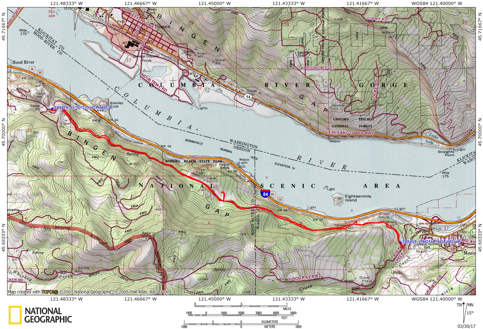
Distance is 9.6 miles. Trailhead elevation is 340 ft. There is 1,000 feet elevation gain and loss. Highest elevation is 540 feet and the lowest elevation is 190 feet.
Trail:
Historic Columbia River Highway State Trail – Twin Tunnels trail
Trail Maps:
Topo Map, Wind and rain forecast for Hood River, Download Garmin .gpx file, Open Garmin .gpx file
Review: 3/26/2017
The Mark O. Hatfield West Visitor Center offers information about the sites along the trail and in the Columbia River Gorge where you can buy annual passes and other merchandise. Current hours are 10am-2pm every day of the week.
The beginning of the trail gently rises as you follow the sweeping curves of the old Columbia River Highway. The trail is a far enough from the freeway that the sounds are not very intrusive.
As you climb you’ll pass by moss-covered stone railings and the old-style wood guardrails which were constructed for the highway. Soon you crest the hill and slowly start to drop down towards the twin tunnels on the lovely forested path. At 2.2 miles is a side trail to the north leading to a nice overlook along the trail and the Gorge.
The 4.5 mile Twin Tunnels segment between Hood River and Mosier passes through two climate zones. The west end of the trail is a in forest of fir trees and other common western Oregon plants lining the trail. From the Mark O. Hatfield Trailhead at the western end there are overlooks of the Columbia River and several more viewpoints along the first 3 miles of the trail up to the tunnels.
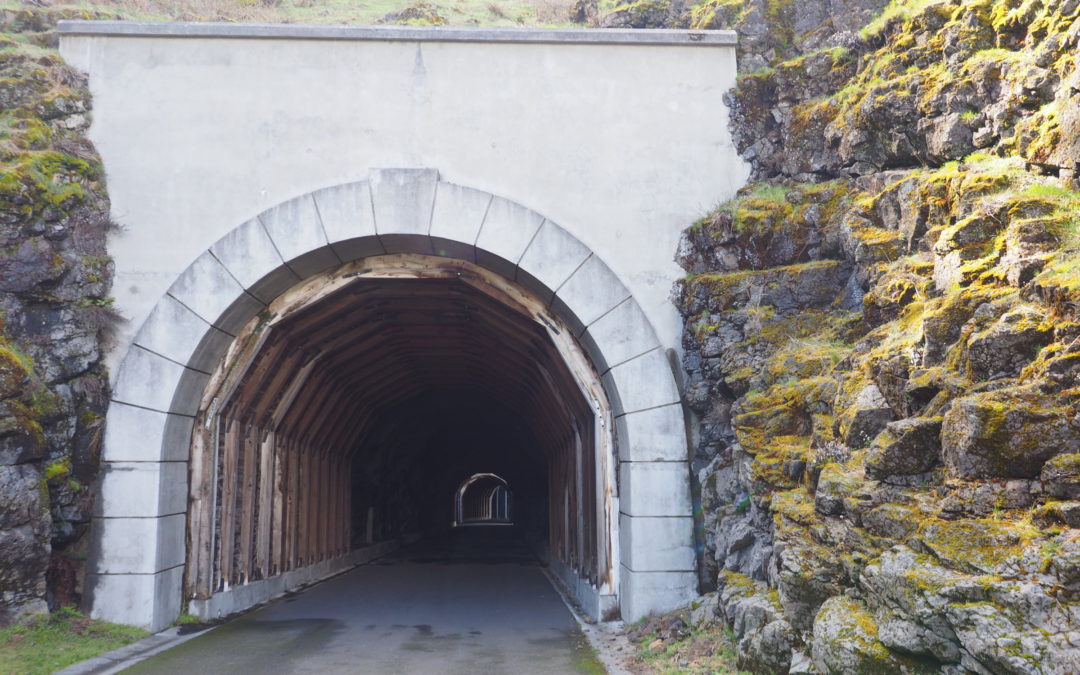
Passing through the twin tunnels is a little like passing back into time when cars were slower. The length of the tunnels are short enough so that daylight filters in through the tunnel portals and windows that were blasted through the rock. The tunnels were built in 1921 and were abandoned about 1954. The tunnels filled with rock over time until the trail was restored in 2000.
The last 1.5 miles of the trail leads through a semi-arid terrain dotted with ponderosa pine for about a mile, leading to the east Mark O. Hatfield Trailhead near Mosier. The basaltic formations along the way show the story of the gorge’s creation.
Today, this section of the old highway is known as the Historic Columbia River Highway State Trail (HCRHT).
This is a great hike or bike ride for children as you can turn around at any time and there the cliffs and dropoffs have railings. Kids will like going through the tunnels and going into the little tunnels for the windows.
Enjoy the photos!!
Gallery Pics
Switchback Steve

Recent Comments