

Vicinity Location:
The trailhead is about 49 miles southeast of Portland, Oregon in the Mt. Hood National Forest.
Directions:
From Portland take I-84 East to the Wood Village, exit (16A). Head south and turn left onto NE Burnside Rd. Heading East, Burnside will merge into Highway 26. Follow Hwy 26 for 37.5 miles. Make a slight left at the flashing yellow light and turn onto Government Camp Loop road and drive about 0.3 mile. Park along the road just before the Thunderhead Lodge.
In winter, it is required to carry chains or have traction devices. The parking area is on a downward slope and not having chains could leave you stuck.
This is a very popular area and parking fills up on nice weekends.
No permits needed to park.
Nearest bathroom is the Government Camp rest area.
Length and Elevation: Total length is 4.4 miles out and back. Total elevation gain is 850 feet and 850 foot loss. Elevation at the trailhead is 3,800 feet, the high point is 4,094 feet and the low point is 3,555 feet in elevation.
Trails:
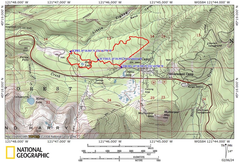
Skiway Trail #755B, Crosstown Trail #755, Enid Lake Trail #692A, Pioneer Bridle Trail #795, and Maggie’s Trail #753 with connections to several trails..
Trail Maps:
Topo Map, Download Garmin .gpx file, Open Garmin .gpx file
Review: January 22, 2024
At the trailhead just east of Thunderhead Lodge is a signed trailhead on the north side of the road leading to the trails.
Walk slightly uphill from the road and in about 75 feet reach a trail junction where you turn right to take the Skiway Trail #755B.
The forest in this first part of the trail is a young mix of pine, firs, and hemlocks and the trail through the woods is wide.
Remember to stay off the ski trail tracks by either the following and existing snowshoe trail or break your own trail. The first 0.1 mile is pretty steady uphill and then the trail levels out. At about 0.3 miles is a junction to the left. Continue straight ahead on the Crosstown Trail.
Soon you start following a powerline and come to the junction for Wally’s Tie Trail #755A. Continues straight ahead along the powerline for another half mile where are you turned left on the crosstown Trail #755.
This section of trail winds through the forest and goes gently downhill to trail junction number five. Turn right here and continue on the Crosstown Trail.
The trail gently winds downhill to the next junction, sign post number three. Here you turn right to continue on the Crosstown Trail.
About 0.3 mile further is sign post number two and the junction for the Enid Lake Loop, Trail. Turn right here again and continue on towards the pioneer bridal Trail.
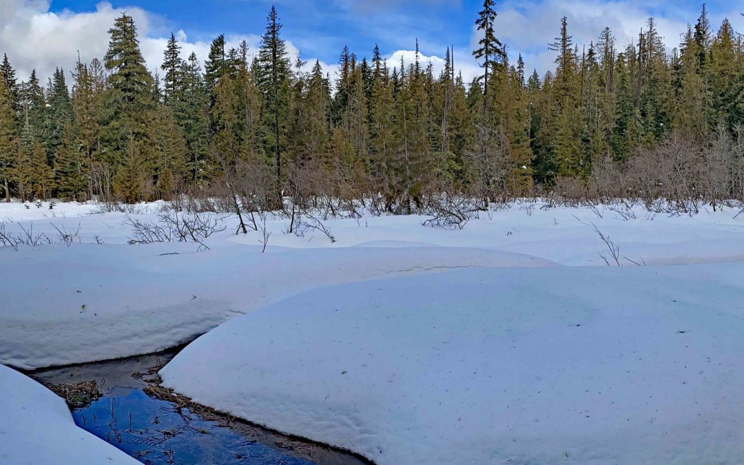
The lower elevation and wetter terrain creates a micro-climate that brings out a change in the forest. Here it is a mix of cedars, hemlocks, and Douglas fur with an understory of Rhododendrons poking through the snow.
At the next junction, turn left and take the Pioneer Bridle Trail, looping back towards the trailhead. Cross a couple small streams on bridges and then switchback up towards Enid Lake.
The trail levels out, and then you come to the Glacier View Trailhead and signpost number one. From here start on the Crosstown Trail again continuing back towards the area where you parked.
About 1,000 feet past the Glacier View Trailhead, you will see an opening on your left. This is Enid, Lake, and you can walk out to the lake and see Mount Hood on a clear day.
Climb up and reach one of the earlier trail junctions and complete the loop around Enid Lake. Turn right and you are now about .75 mile from where you parked.
At just under 4 miles you return to signpost number three where you turn right and take Maggie‘s Trail #753.
At the next junction, you stay on Maggie‘s trail to head back to the Thunderhead Snow Park. You’ll soon see the signboards where you started the trip.
This is an excellent beginning snowshoe trip and is great for children. This trip can be shortened by taking Wally’s Tie Trail #755A instead of continuing along the powerline and Skiway Trail. This trails is basically flat and has no avalanche danger. This trail can have limited snow cover at the beginning and end of the snowshoe season.
Enjoy the photos!!
Gallery Pics
Switchback Steve
Recent Comments