

Vicinity Location:
About 30 miles northeast of Portland, OR in the Gifford Pinchot National Forest.
Directions:
From Portland take I-84 East and merge onto I-205 North towards Portland Airport/Vancouver. Drive past the Portland Airport Exit and cross the Columbia River. Move over to the right lane as you cross the bridge. Take exit 27 for Vancouver/Camas and move into the left lane on the off ramp heading towards Camas. Follow SR-14 for 25.9 miles through Camas and Washougal and past Cape Horn.
Turn left onto Duncan Creek Road and drive for 2.9 miles uphill to a small parking area just on the other side of Duncan Creek.
No permits needed to park
No bathrooms at the trailhead.
Length and Elevation:
Total length is 4.5 miles roundtrip. Trailhead elevation is 1,011 feet. The elevation at the summit is 2,070 feet. Total ascent is 1,210 feet, total descent is 1,210 feet.
Trail:
Duncan Creek Trail
There is at least one geocache for this trail at: N 45° 38.932 W 122° 05.645 Info at Geocaching.com
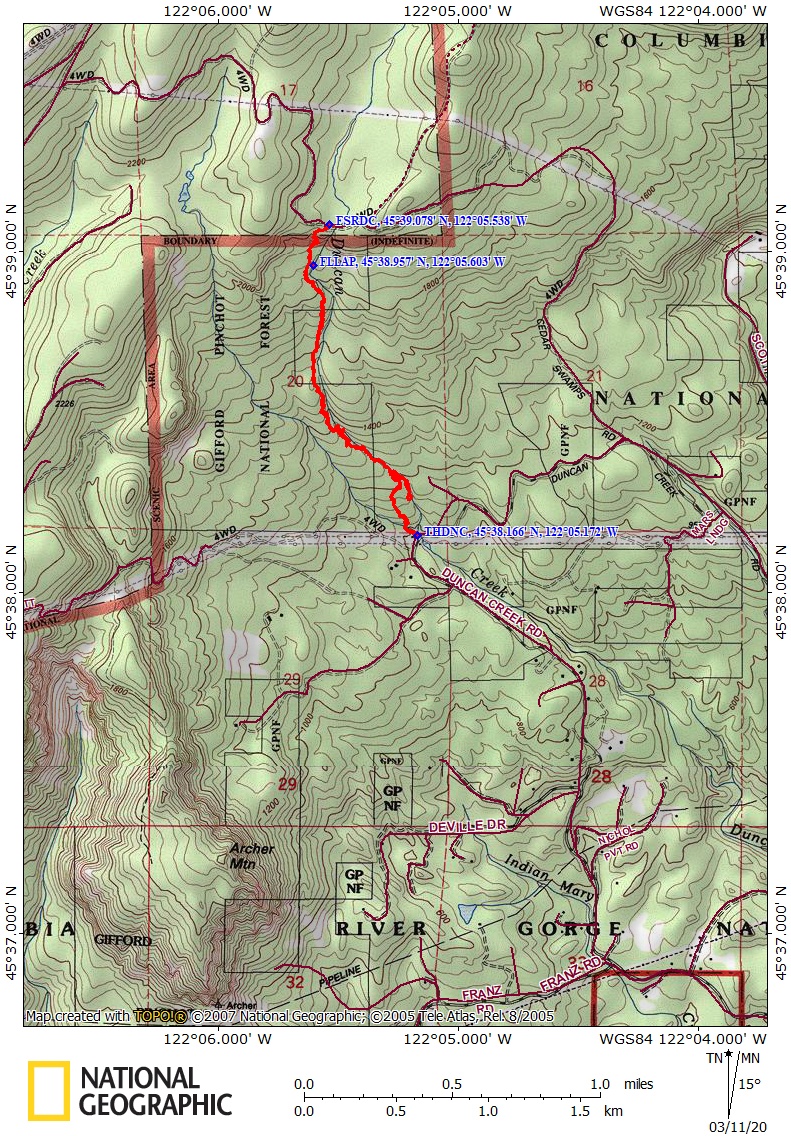
Trail Maps:
Topo Map, Download Garmin .gpx file, Open Garmin .gpx file
Review: February 21, 2020
From the parking area on the east side of Duncan Creek, walk back on the road over the creek and look for the path going into the brush on your right, on the other side of the guard rail. Once you’ve walked about 25 yards from the guard rail, you’ll see a side trail branching off to the left and leading up a small bluff. The path climbs a bit above the creek, skirts a clear-cut then drops back down to the creek to cross on a fallen tree that has a makeshift railing bolted to the fallen tree across the creek.
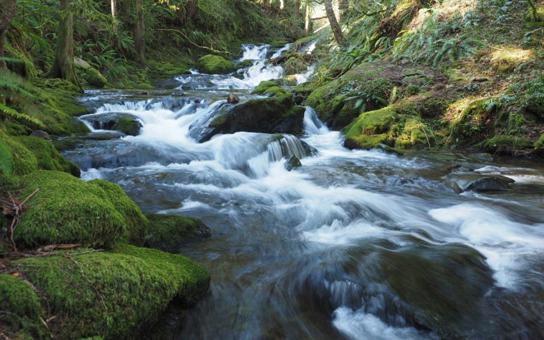
Walk upstream a short distance, and then steeply climb up the hillside on your right going through sword ferns, around trees, and up a rocky ridge. The trail isn’t very brushy and there aren’t many deadfalls. Just before 2 miles the trail seems to lead straight towards a large waterfall but actually the trail forks off to the left, a couple hundred feet before the waterfall.
The trail has a mix of Douglas Fir, Hemlock, and cedar trees. Some of the cedar trees are fairly large. The other trees look to be 70 to 80 year old second growth trees. The understory is Oregon Grape and sword ferns.
The final section of the trail is a very steep climb up a clear-cut hillside to a Forest Service road. There is one viewpoint from the little promontory to the left when you navigate the trailing blackberries and stumps. There is a nice view of the creek from the bridge, which is made of an old rail car. If you walk across the bridge and down the road a bit, you get another view to the Columbia River. This is the turn-around point. Tread carefully down the steep clear-cut section back to the forest and along Duncan Creek.
About a mile from the trailhead is a section of the trail next to 50 foot cliffs so don’t take children or dogs on this trail. There are other places on this rugged trail where you could trip over a root and take a tumble.
Enjoy the photos!!
Gallery Pics
Switchback Steve
Recent Comments