

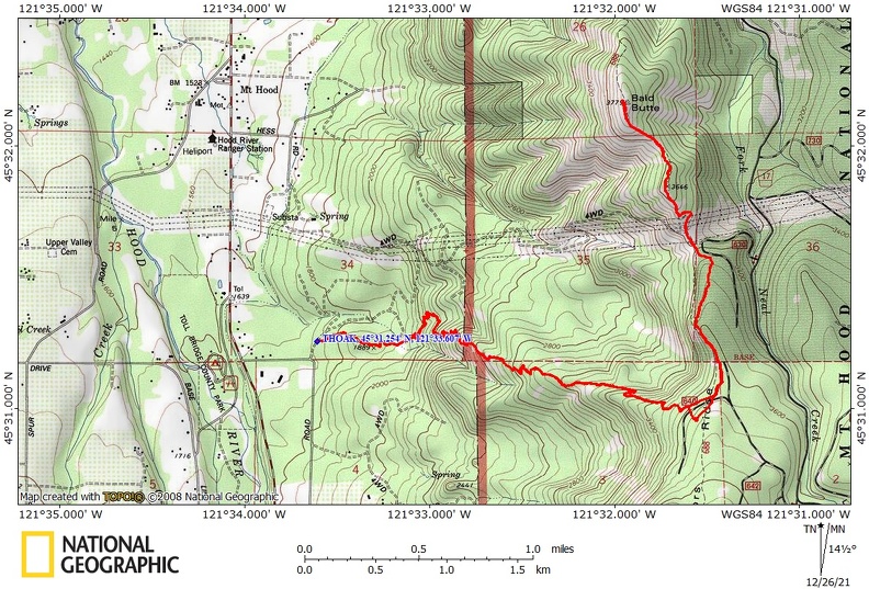
Vicinity Location: The trailhead is about 54 miles east of Portland, Oregon in the Mt. Hood National Forest.
Directions:
From Portland take I-84 E for about 55 miles.
Take Exit 64 for the Mount Hood Hwy, OR-35 towards White Salmon/Govt. Camp and at the bottom of the exit ramp turn right at the stoplight. Take OR-35 S for about 14.8 miles to Smullen Road and turn left.
Drive about 0.3 mile, turn left onto a dirt road and go about 500 feet to two little parking lots.
No bathroom at the trailhead.
Length and Elevation:
Total trip is 9.5 miles. Elevation at the trailhead is 1,750 feet. Total ascent is 3,050 feet and total descent is 3,050 feet. Highest point is at 3,700 feet. Lowest point is 1,750 feet.
Trails:
Oak Ridge Trail #688A, Surveyor’s Ridge Trail #688
There is at least one geocache for this trail at: N 45° 31.257 W 121° 32.829 Info at Geocaching.com.
Trail Maps:
Topo Map, Download Garmin .gpx file, Open Garmin .gpx file
Review: May 2, 2021
From the parking area pass through an old clear-cut being reclaimed by Douglas fir and ponderosa pine. The first 0.8 mile is fairly flat then begins a fairly steep climb up a slope where the forest thins and changes to open slopes of balsamroot flowers, lupines, Grand firs, and Oregon white oak trees.
Climb steadily through the forest which is sprinkled with wildflowers. The trail continues up many switchbacks up the slope passing multiple clumps of wildflower. The exposed trail gets rockier and passes into trees.
After about 2.5 miles you’ll re-enter the forest for a bit and meet the dirt road on Surveyors Ridge. Walk a bit farther and turn left onto Surveyors Ridge Trail. Follow this as it wends its way along the lightly forested ridge and drops down to cross under the large towers of high-voltage power lines.
Continue north on a Jeep track up to the summit of Bald Butte. The trees along here have been blasted by storms from the west which has stunted the branches on the west side of the trees. The meadows here abound with balsamroot and other wildflowers in May.
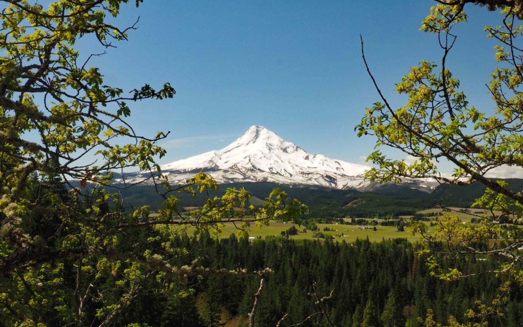
From the summit you can see Mt. Hood and the tip of Mt. Jefferson along with Mt. St. Helens, Mt. Rainier, and Mt. Adams.
Return back on the same trails enjoying great views of Mt. Hood on clear days. This is not a good choice for dogs because of the rocky spots, no water along the trail, steep slopes, and sun exposure.
Enjoy the photos!!
Gallery Pics
Switchback Steve
Recent Comments