
Directions:
From Portland take I-5 south to exit 271. At the stoplight, turn left onto Hwy 214, also called Newberg Hwy. Cross over I-5 and continue for 1.1 miles.
Stay on Hwy 214 by turning right at N Settlemeir Ave, then a left on Garfield St. Garfield turns into Young St. Make a slight left as Young St turns into Silverton Ave. After .2 miles, Hwy 214 turns right and the road changes to Wilco Hwy NE.
After about 5 ½ miles, you enter Mt. Angel and continue on Hwy 214 into town. Make a slight left off N Main Stto stay on Wilco Hwy NE and Hwy 214. If the road turns into S Main St, you have missed the turn. Drive 3.5 miles to Silverton and continue on Hwy 214 through town for about another 13 miles to the main entrance to Silver Falls State Park. Turn right into the park and park in the main parking area.
Alternate Return directions to downtown Portland:
Take a right out of the park back onto Hwy 214. Follow Hwy 214 for 16 ½ miles west and merge onto Hwy 22 West, towards Salem for 9.9 miles. Merge onto I-5 North. Take I-5 north for about 45 miles to Portland.
Length and Elevation:
8.8 Miles round trip. Elevation gain 500 feet and loss of 50 feet. Total gain and loss is 1,100 feet. Elevation at the trailhead is 1,000 feet.
Trail:
Trail of Ten Falls with connections Maple Ridge Trail, Winter Trail, Rim Trail, and horse and biking trails.
Flush toilets are available at the parking lot.
Bicycles, skateboards, in-line skates, and pets are not allowed on the Canyon Trail because there are sharp drop-offs along the trail.
An Oregon State Park parking permit is required to park at the trailhead.
Trail Maps:
Topo Map, State Park trail map and brochure, Download Garmin .gpx file
Review: April 5, 2007
I combined a trip to the Wooden Shoe Bulb Co. fields in Woodburn with the Silver Falls hike. I have only included directions to Silver Falls.
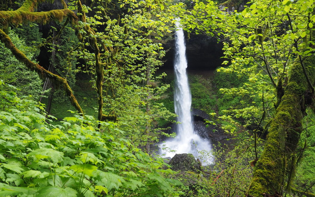
My favorite time of year to hike at Silver Falls is early spring while the falls are full and the parking lot isn’t. There are several loop hiking options and the trails are in good repair for 2007. This is a great hike for a cloudy, even drizzly day because you are in a stream valley for most of the hike. I like to hike the Trail of Ten Falls clockwise so you lose elevation at the end of the hike.
From the main parking area, stop in at the lodge if it is open and learn about the park history. Proceed from there to the Canyon Trail/Trail of Ten Falls, which goes down to the South Falls. You may want to stop off and see Frenchie Falls, though it isn’t big. The trail goes behind South Falls and drops down to Canyon Trail. Follow this trail along South Fork of Silver Creek, descend stairs, and take the trail behind Lower South Falls.
After about 3/4 of a mile, the trail crosses the North Fork of Silver Creek on a steel bridge. In about 1/2 mile, take the side trail to the 178 foot tall Double Falls, the tallest waterfall in the park. Once you are back on the main trail, continue along the creek for another 6/10 of a mile and reach the junction to Winter trail. Take a right and cross the bridge over the creek. In about 4/10 of a mile you will reach the base of Winter Falls. Climb the trail to the top of the falls, turn right again onto the Rim Trail and make you way back to the parking lot.
Enjoy the photos
Link to Photos
Switchback Steve
Recent Comments