Eyehike Gallery

Welcome to the Eyehike photo gallery

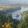
Home / Fire Lane 12 Photos OR /

Picture of the end of Fire Lane 13 showing the power poles that mark the start of the user trail. You can see the user trail going off into the brush just to the right of the poles.

aah.jpg The new Sauvie Island Bridge taken from near the junction of the BPA Road and Fire Lane 13.ThumbnailsLooking west from the clearing around the last powerline crossing Fire Lane 13. You can see the powerline in the distance.The new Sauvie Island Bridge taken from near the junction of the BPA Road and Fire Lane 13.ThumbnailsLooking west from the clearing around the last powerline crossing Fire Lane 13. You can see the powerline in the distance.The new Sauvie Island Bridge taken from near the junction of the BPA Road and Fire Lane 13.ThumbnailsLooking west from the clearing around the last powerline crossing Fire Lane 13. You can see the powerline in the distance.The new Sauvie Island Bridge taken from near the junction of the BPA Road and Fire Lane 13.ThumbnailsLooking west from the clearing around the last powerline crossing Fire Lane 13. You can see the powerline in the distance.The new Sauvie Island Bridge taken from near the junction of the BPA Road and Fire Lane 13.ThumbnailsLooking west from the clearing around the last powerline crossing Fire Lane 13. You can see the powerline in the distance.The new Sauvie Island Bridge taken from near the junction of the BPA Road and Fire Lane 13.ThumbnailsLooking west from the clearing around the last powerline crossing Fire Lane 13. You can see the powerline in the distance.

aah

Author
Steve Jones
Visits
1331
Rating score
no rating
Rate this photo