Eyehike Gallery

Welcome to the Eyehike photo gallery

ホーム / Fire Lane 12 Photos OR /

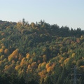
Picture of the end of Fire Lane 13 showing the power poles that mark the start of the user trail. You can see the user trail going off into the brush just to the right of the poles.

aah.jpg The new Sauvie Island Bridge taken from near the junction of the BPA Road and Fire Lane 13.サムネイルLooking west from the clearing around the last powerline crossing Fire Lane 13. You can see the powerline in the distance.The new Sauvie Island Bridge taken from near the junction of the BPA Road and Fire Lane 13.サムネイルLooking west from the clearing around the last powerline crossing Fire Lane 13. You can see the powerline in the distance.The new Sauvie Island Bridge taken from near the junction of the BPA Road and Fire Lane 13.サムネイルLooking west from the clearing around the last powerline crossing Fire Lane 13. You can see the powerline in the distance.The new Sauvie Island Bridge taken from near the junction of the BPA Road and Fire Lane 13.サムネイルLooking west from the clearing around the last powerline crossing Fire Lane 13. You can see the powerline in the distance.The new Sauvie Island Bridge taken from near the junction of the BPA Road and Fire Lane 13.サムネイルLooking west from the clearing around the last powerline crossing Fire Lane 13. You can see the powerline in the distance.The new Sauvie Island Bridge taken from near the junction of the BPA Road and Fire Lane 13.サムネイルLooking west from the clearing around the last powerline crossing Fire Lane 13. You can see the powerline in the distance.

aah

作成者
Steve Jones
訪問
1378
評価点
評価なし
この写真を評する

EXIF メタデータ

Make
Canon
Model
Canon PowerShot S3 IS
DateTimeOriginal
2008:10:24 16:29:10
ApertureFNumber
f/4.0