Eyehike Gallery

Welcome to the Eyehike photo gallery

Αρχική / Αποτελέσματα αναζήτησης /

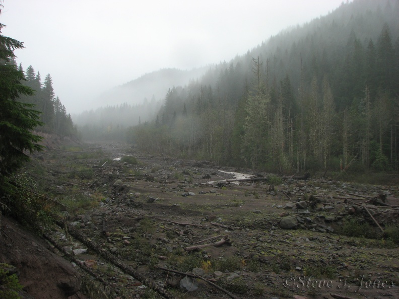
The Sandy River shows the devastation of flood from 2006 and 2011. A couple sections of the trail have been rerouted after being washed out.

aak.jpg Above the Sandy River is a junction for Ramona Falls Loop and the Pacific Crest Trail. From the junction, the trail parallels the Sandy River down to the stream crossing.ΜικρογραφίεςAbove the Sandy River is a junction for Ramona Falls Loop and the Pacific Crest Trail. From the junction, the trail parallels the Sandy River down to the stream crossing.ΜικρογραφίεςAbove the Sandy River is a junction for Ramona Falls Loop and the Pacific Crest Trail. From the junction, the trail parallels the Sandy River down to the stream crossing.ΜικρογραφίεςAbove the Sandy River is a junction for Ramona Falls Loop and the Pacific Crest Trail. From the junction, the trail parallels the Sandy River down to the stream crossing.ΜικρογραφίεςAbove the Sandy River is a junction for Ramona Falls Loop and the Pacific Crest Trail. From the junction, the trail parallels the Sandy River down to the stream crossing.ΜικρογραφίεςAbove the Sandy River is a junction for Ramona Falls Loop and the Pacific Crest Trail. From the junction, the trail parallels the Sandy River down to the stream crossing.ΜικρογραφίεςAbove the Sandy River is a junction for Ramona Falls Loop and the Pacific Crest Trail. From the junction, the trail parallels the Sandy River down to the stream crossing.Μικρογραφίες

aak

Συντάκτης
Steve Jones
Δημιουργήθηκε στις
Κυριακή 30 Οκτώβριος 2011
Αναρτήθηκε στις
Πέμπτη 2 Ιούνιος 2016
Λευκώματα
Επισκέψεις
1296
Βαθμολογία κατάταξης
χωρίς βαθμό
Βαθμολογήστε τη φωτογραφία

EXIF μεταδεδομένα

Make
Canon
Model
Canon PowerShot S3 IS
DateTimeOriginal
2011:10:30 12:18:55
ApertureFNumber
f/4.0