
Vicinity Location: The trailhead is about 77 miles east of Portland, in the Columbia River Gorge.
Directions:
From Portland, drive on I-84 East from Portland for about 65 miles, driving past Hood River.
Take exit 87 to Hwy 197 and drive 3 miles north to Highway 14 and turn right.
Go 2.8 miles, driving past the main entrance to Columbia Hills State Park. Look on the right for the paved parking lot for the trailhead.
There is a restroom in the parking lot.
A State of Washington Discover Pass is required for parking.
Length and Elevation:
Total length is 1.6 miles. Elevation gain is 220 feet and 220 foot loss. Elevation at the trailhead is 285 feet. The high point is 440 feet.
Trail:
There is at least one geocache for this trail at: N 45° 38.849 W 121° 05.861 Info at Geocaching.com.
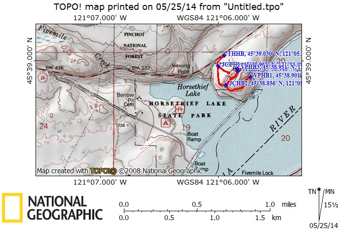
Trail Maps:
Topo Map, Wind and rain forecast for The Dalles, , Download Garmin .gpx file
Review: May 4, 2014
From the trailhead, walk past the restroom and down the gravelled path. Pass by a wet area containing dogwood and wild roses. After a short distance the landscape becomes very dry and the soil turns dusty. You soon come to a junction. The left fork heads to the butte and starts climbing. In a very short time the trail runs out and you are forced to climb rocks to continue. This is a good place to turn around and walk back towards that first trail junction.
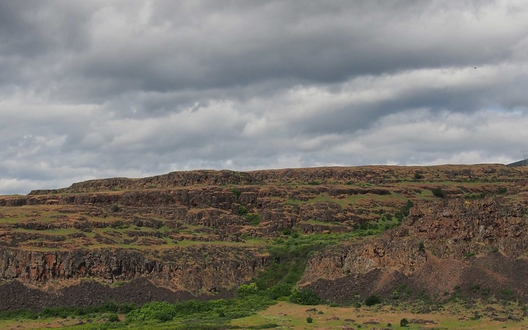
Continuing on the right fork of the trail, walk along the base of Horsethief Butte to another well-trodden junction and continue on the right fork, walking around the butte. There are really nice views of spring flowers with the Columbia River as a backdrop.
All too soon the trail starts passing through Poison Oak then ends at a precipitous drop. This is a good point to turn back, make your way back to the last main trail junction, and turn right to head up onto Horsethief Butte.
It is an easy but rocky walk that leads up and into the center of the butte. It isn’t long before you start seeing rock climbers. This is a very popular spot for beginning rock climbers and there is a good chance you’ll see clusters of
climbers learning the ropes.
You can walk all the way through the center of the butte. Near the far end of
the butte there is an easy scramble up to the north rim of the butte, providing nice views of the lava cliffs to the north and the Gorge both east and west.
Sit and watch the rock climbers then make your way back the way you came to the trailhead.
This hike has some shortcomings in that there isn’t a loop trail and the
terrain is dry. There are some wildflowers but not carpets of wildflowers. The views are nice but not spectacular. What can make this an outstanding trip is to hike Horsethief Butte then drive west for 1.2 miles and turn left down into the park and view the petroglyphs that were rescued when the dams were built and parts of the Gorge were flooded.
Enjoy the photos!!
Switchback Steve
Recent Comments