
Vicinity Location:
The trailhead is about 30 miles southeast of Portland, Oregon in the Mt. Hood National Forest.
Directions:
From Portland take I-84 East to the Wood Village, exit (16A). Head south and turn left onto NE Burnside Rd. Heading East, Burnside will merge into Highway 26.
Follow Hwy 26 for 30 miles. Near Rhododendron look on the right for the National Forest sign for Pioneer Bridle and turn into the parking lot for Pioneer Bridle Trail.
A Northwest Forest Pass is required to park at the trailhead.
No bathrooms are available at the trailhead.
Dogs on leashes are allowed on these trails. Keep dogs on a leash due to the proximity of Highway 26.
Length and Elevation:
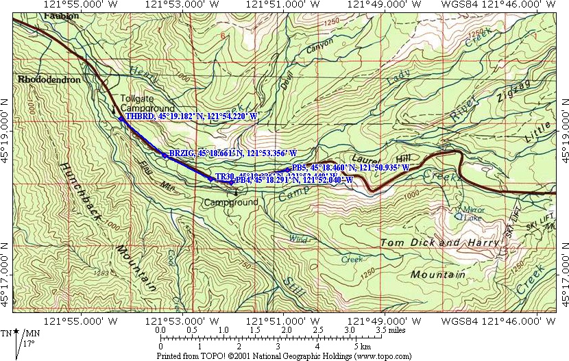
Pioneer Bridle Trail #795 is 8 miles one way. This review covers 3 miles from the Barlow Toll Gate to Forest Road 34.
Trailhead elevation: 1,770 feet. High point on trail: 2,320 feet. Elevation gain is 555 feet and elevation loss is 555 feet.
Trail:
Pioneer Bridle Trail #795.
There is at least one geocache along this trail at: N 45° 19.143 W 121° 54.177 Info at Geocaching.com
Trail Maps:
Topo Map, Download Garmin .gpx file
Review: April 10, 2010
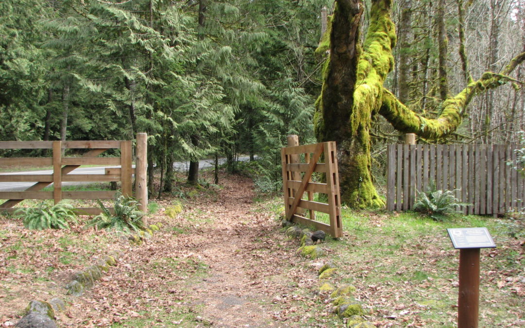
The trail leads from the Barlow Road Toll Gate, near Rhododendron, to Government Camp.
From the trailhead, walk southeast over to the replica of the Barlow Road Toll Gate. The two Big Leaf Maples, one on each side of the toll gate are believed to have been planted by Daniel Parker who was the toll gate keeper from 1883 to 1902.
This trail begins as a wide, woodsy walk about 150 feet from Highway 26.
The trail soon crosses a driveway and then a small creek. The gently ascending trail passes through an open forest with ferns, Oregon Grape, Mountain Huckleberries, Cedar trees, and Hemlock trees.
After about .5 mile, the trail crosses Forest Road 26 and continues paralleling Highway 26. The road noise is fairly distracting but it is a nice walk through the woods.
The trail passes beneath tall fir trees and through a small grove of Rhododendrons and then comes out to the shoulder of Highway 26 for a bit. The trail passes along a small seasonal stream but the traffic drowns out any noise the stream makes.
At waypoint PB4 heading east, the trail feels like it is covered in fist-sized cobbles. From here the trail varies from gravelly to cobbley.
This trail is fine for a short hike to Zigzag river and back where you can enjoy the sights and sounds of the river, but going any farther consider mountain biking this trail. Another suggestion is for a shuttle hike or bike from Government Camp, crossing Highway 26, to the trailhead. There are some commercial shuttles available that will drop you off at Government Camp.
Enjoy the photos!!
Gallery Pics
Switchback Steve
Recent Comments