Eyehike Gallery

Welcome to the Eyehike photo gallery

Home / Eagle Benson Photos OR /

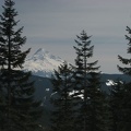
You can barely see Bonneville Dam from the clearing near Camp Smokey.

aah.jpg Near Camp Smokey is an open patch of ground with nice views of Mt. Hood. This is one of the few area on the Plateau where you can get a good GPS reading.ThumbnailsGoing down the Eagle-Benson Trail skirts a sharp dropoff that provides views to the north.Near Camp Smokey is an open patch of ground with nice views of Mt. Hood. This is one of the few area on the Plateau where you can get a good GPS reading.ThumbnailsGoing down the Eagle-Benson Trail skirts a sharp dropoff that provides views to the north.Near Camp Smokey is an open patch of ground with nice views of Mt. Hood. This is one of the few area on the Plateau where you can get a good GPS reading.ThumbnailsGoing down the Eagle-Benson Trail skirts a sharp dropoff that provides views to the north.Near Camp Smokey is an open patch of ground with nice views of Mt. Hood. This is one of the few area on the Plateau where you can get a good GPS reading.ThumbnailsGoing down the Eagle-Benson Trail skirts a sharp dropoff that provides views to the north.Near Camp Smokey is an open patch of ground with nice views of Mt. Hood. This is one of the few area on the Plateau where you can get a good GPS reading.ThumbnailsGoing down the Eagle-Benson Trail skirts a sharp dropoff that provides views to the north.Near Camp Smokey is an open patch of ground with nice views of Mt. Hood. This is one of the few area on the Plateau where you can get a good GPS reading.ThumbnailsGoing down the Eagle-Benson Trail skirts a sharp dropoff that provides views to the north.

aah

Author
Steve Jones
Visits
1328
Rating score
no rating
Rate this photo

EXIF Metadata

Make
Canon
Model
Canon PowerShot S3 IS
DateTimeOriginal
2009:04:18 14:01:24
ApertureFNumber
f/4.0