- LanguageAfrikaans Argentina Azərbaycanca
Bahasa Indonesia Brasil Brezhoneg
Català Česky Dansk
Deutsch Dhivehi English
English English Español
Esperanto Estonian Euskara
Finnish Français Français
Gaeilge Galego Hrvatski
Íslenska Italiano Latviešu
Lëtzebuergesch Lietuviu Magyar
Malay México Nederlands
Norsk bokmål Norwegian nynorsk Polski
Português Română Slovenšcina
Slovensky Srpski Svenska
Tiếng Việt Türkçe Wolof
Ελληνικά Български Македонски
Монгол Русский Српски
Українська עברית العربية (مصر)
العربية العربية پارسی
कोंकणी বাংলাગુજરાતી
தமிழ் ಕನ್ನಡ ภาษาไทย
ქართული ខ្មែរ 中文 (繁體)
中文 (香港) 日本語 简体中文
한국어
Home / Klickitat Trail Photos WA 12

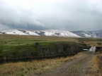 The Harms Road Trailhead is up on the prairies between Klickitat and Goldendale. The nearby hills catch the early fall snows and the windswept grasslands offer little shelter.
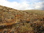 Starting down into Swale Canyon the rocks and reflective pools of water make a nice setting.
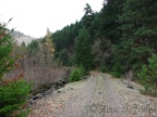
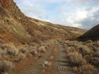 Midway through Swale Canyon the trail is mostly well packed with just a few 100-yard patches of loose gravel.
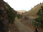 Looking down Swale Canyon you can see the gentle curves and easy downhill grade of the old railroad.
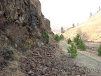 Loose rock tumbles down the canyon walls but seldom reaches the trail.
 IMG_5660 copy.jpg
 IMG_5661 copy.jpg
 IMG_5662 copy.jpg
 IMG_5663 copy.jpg
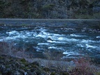 IMG_5664 copy.jpg
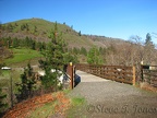 The Fisher Hill trestle has been redecked by Klickitat County and was opened on Jan. 6, 2011. This is about 2 miles from the Columbia River.
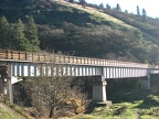 The Fisher Hill trestle showing the new railings along the trestle that were installed during the deck construction process.